|
|
|
|
|
|
|
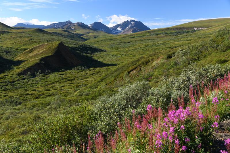
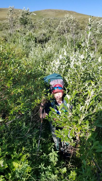
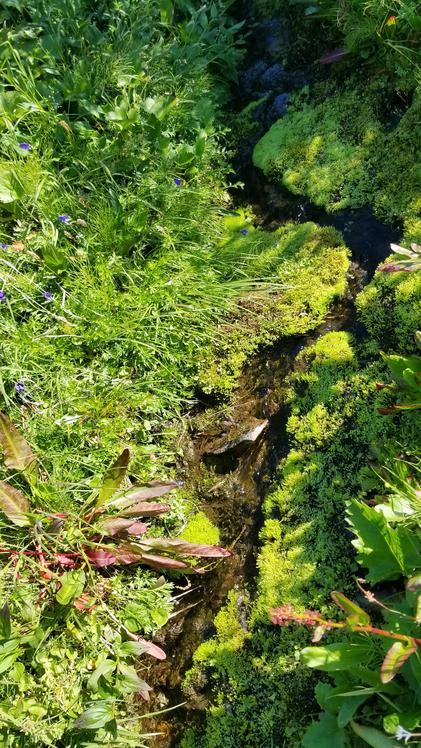
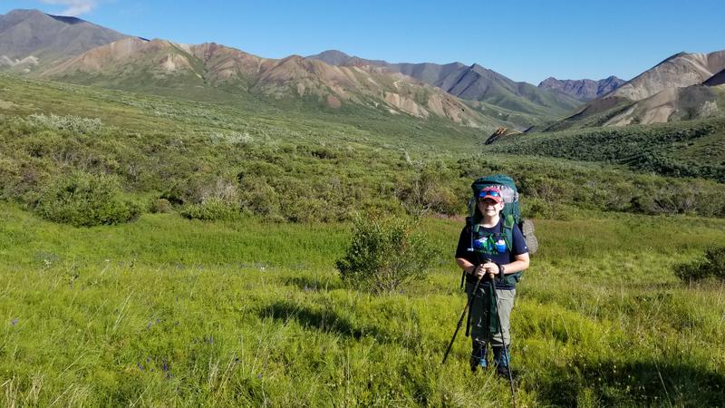
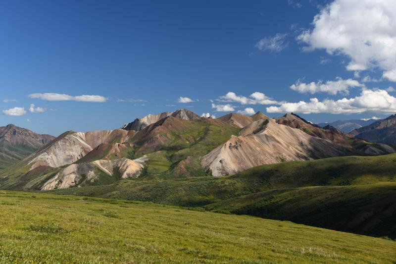
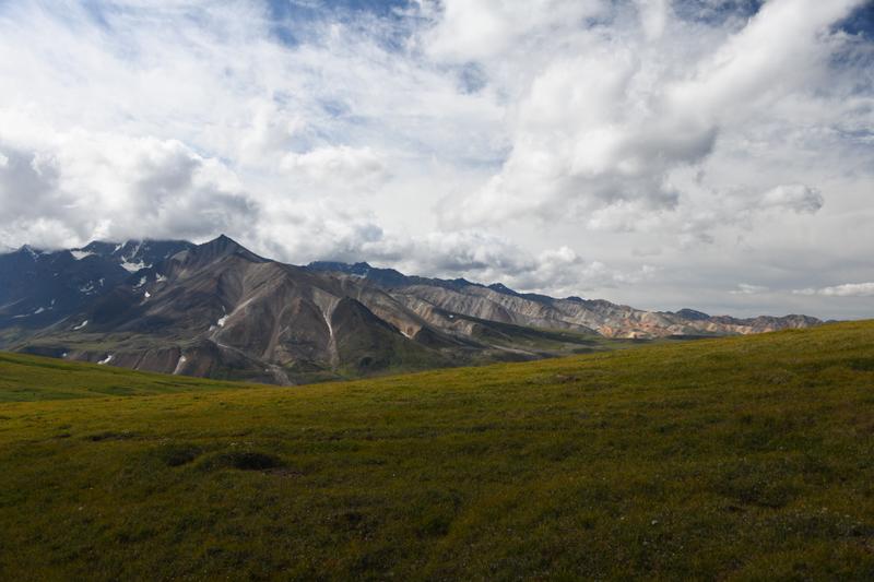
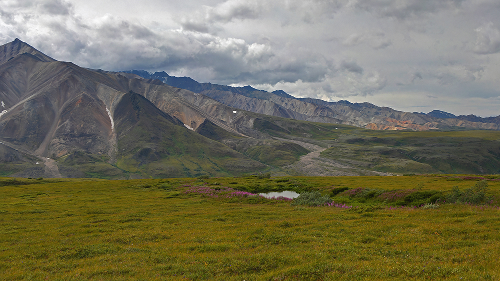
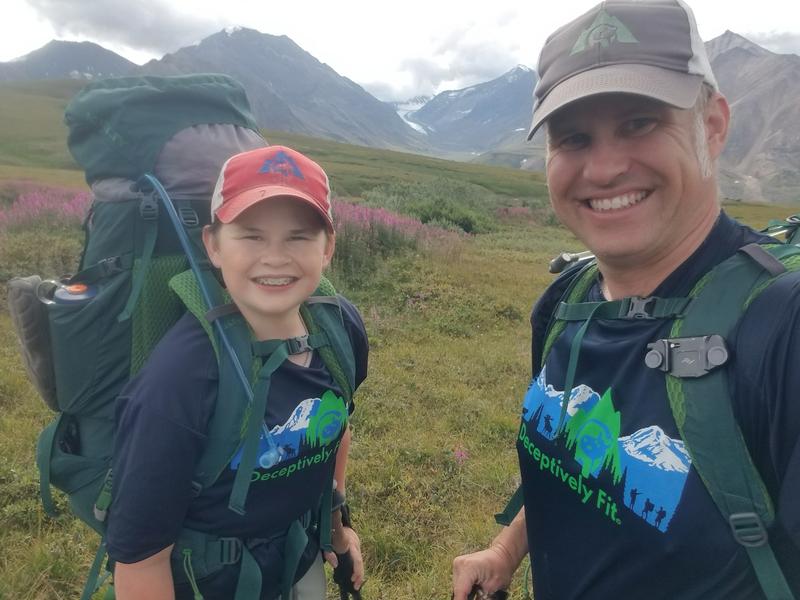
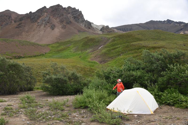
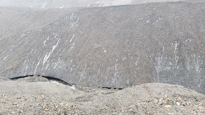
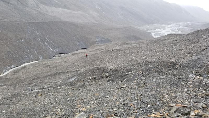
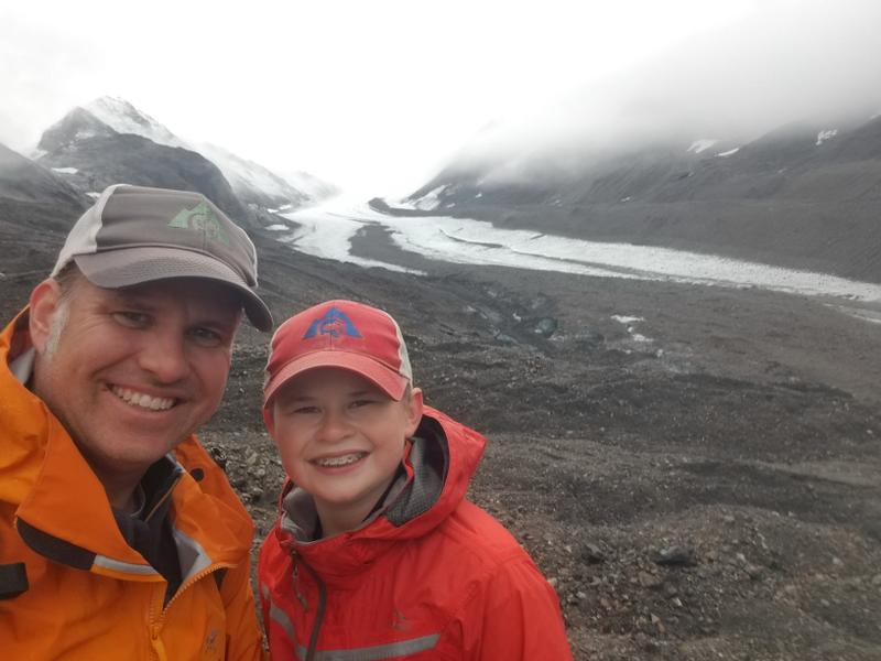
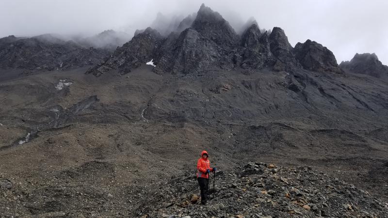
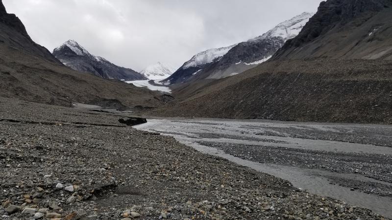
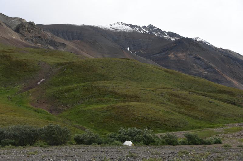
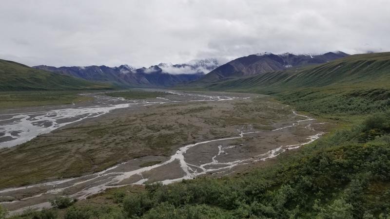
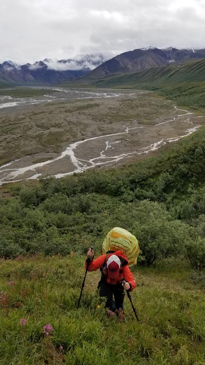
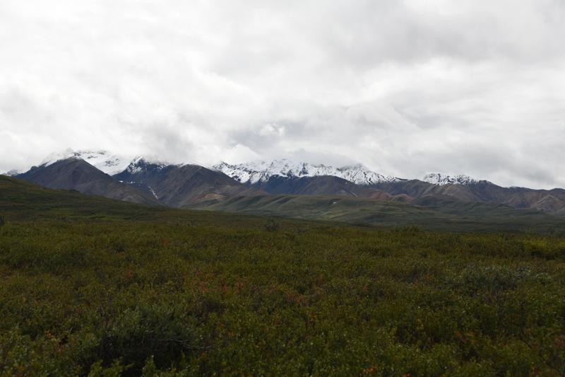
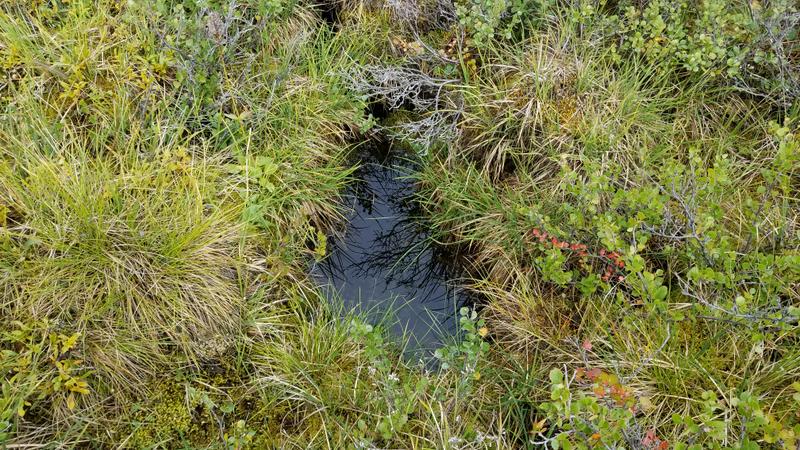
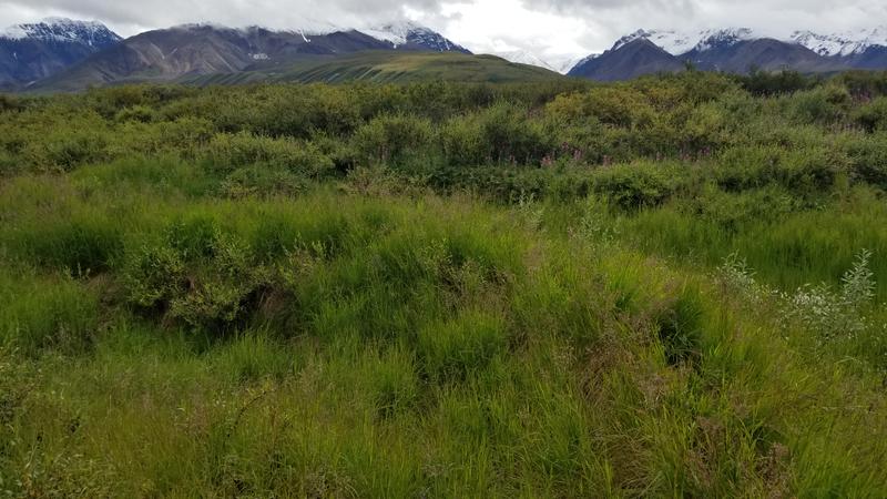
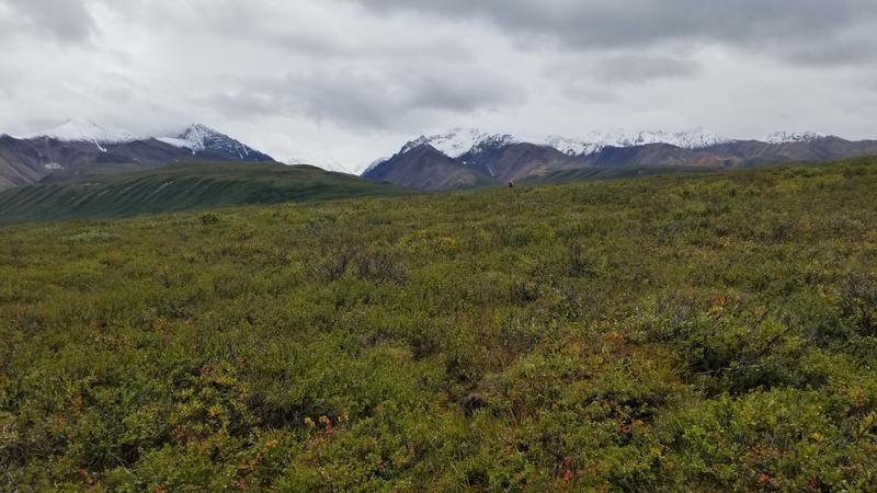
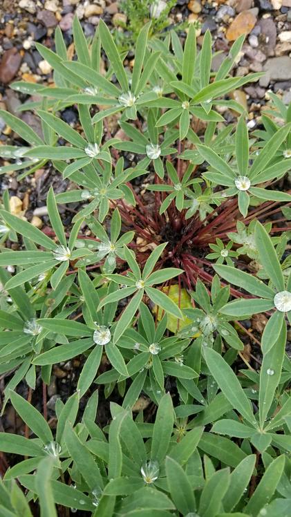
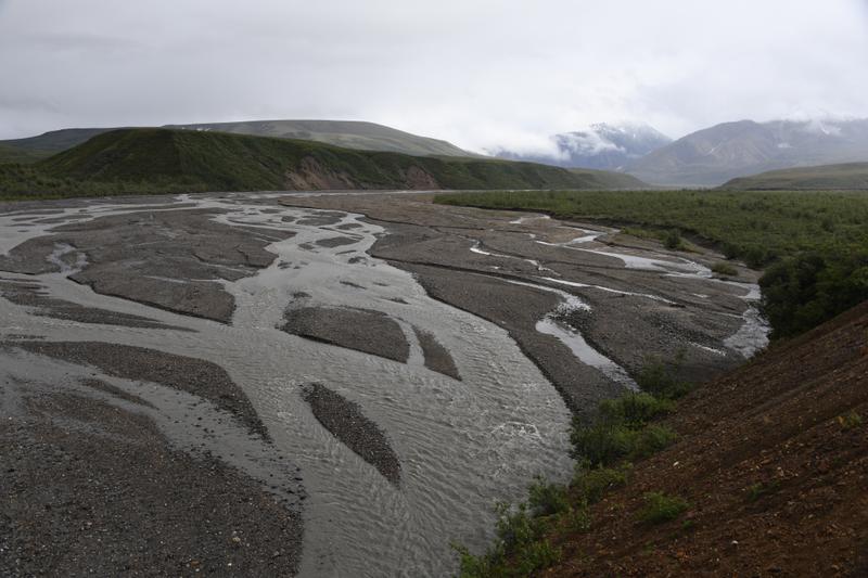
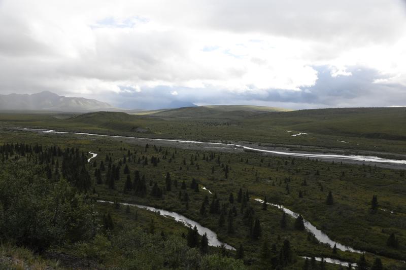
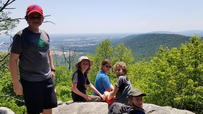
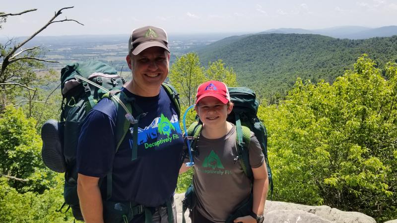
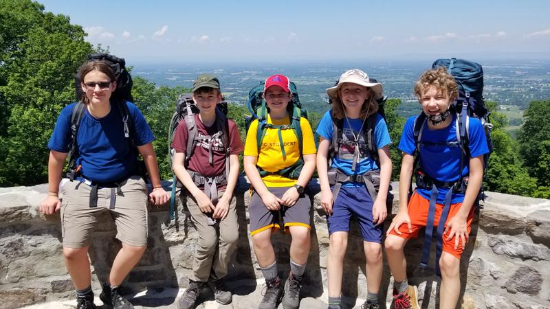
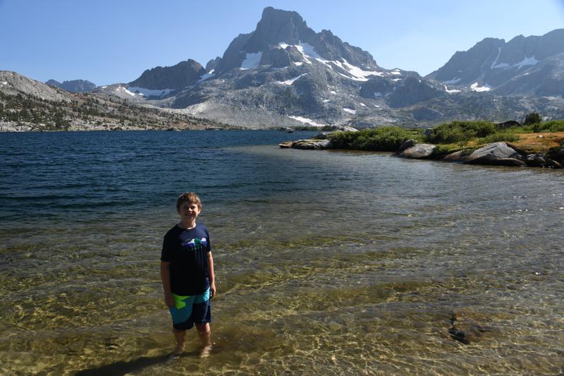
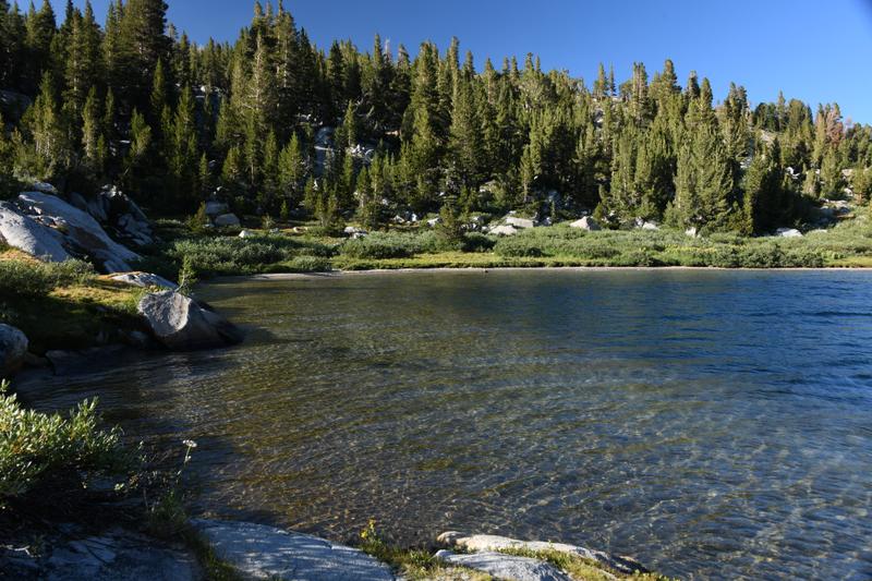
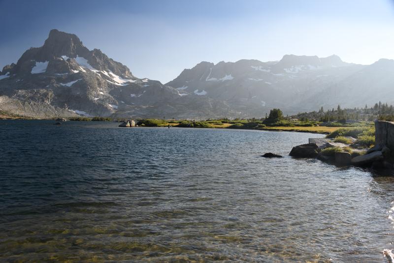
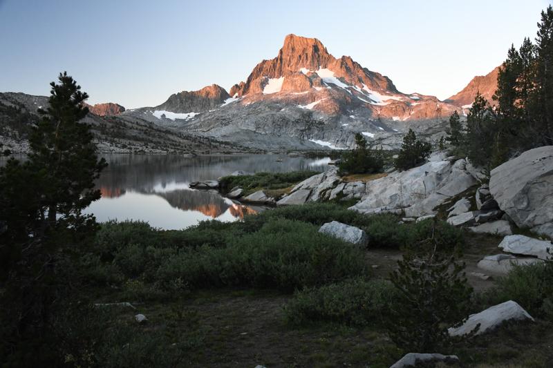
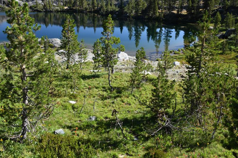
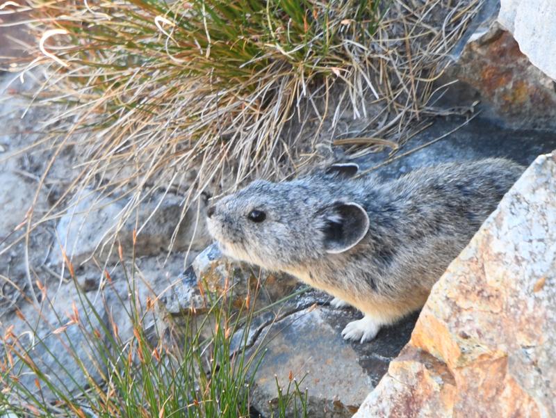
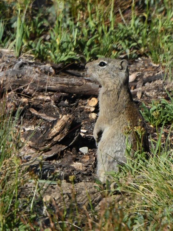
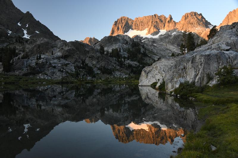
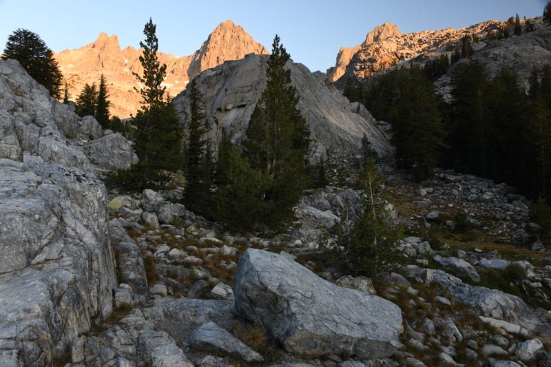
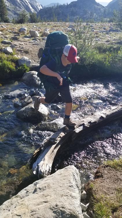
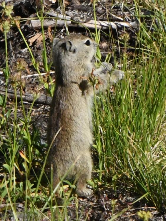
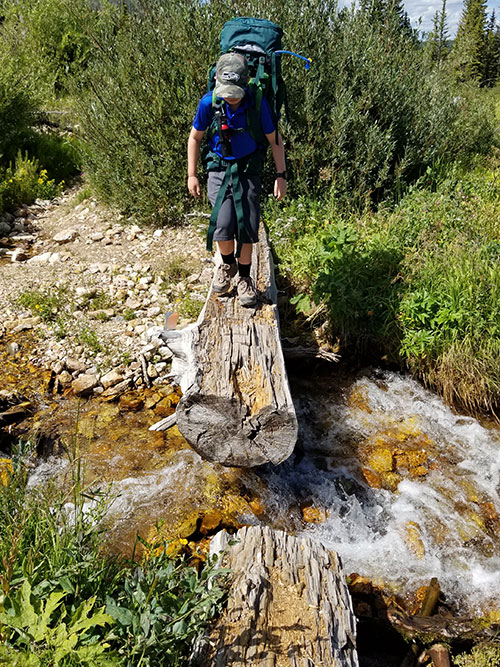
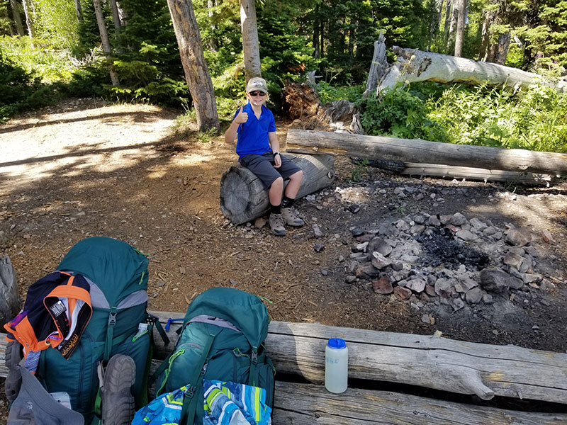
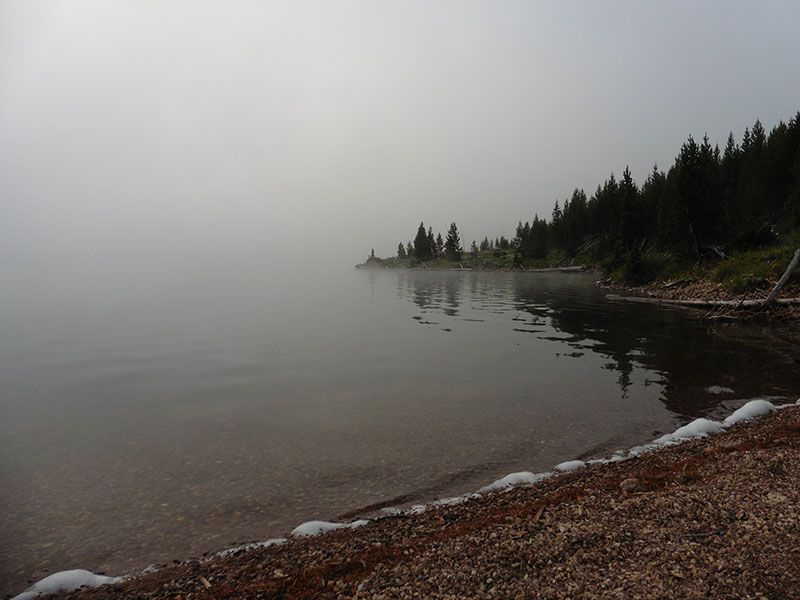
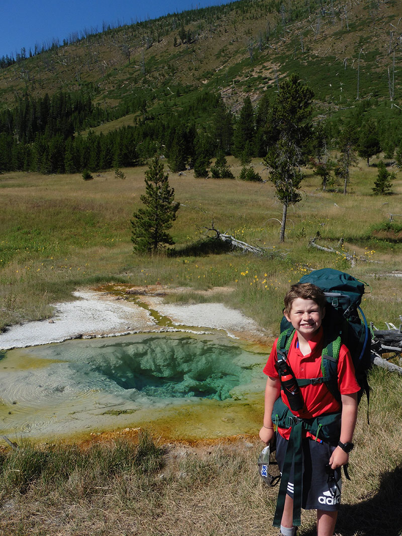
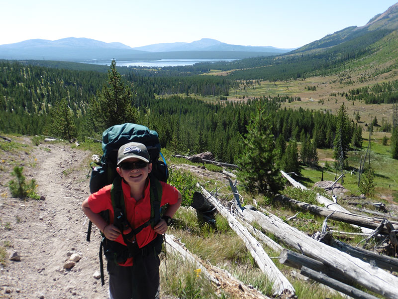
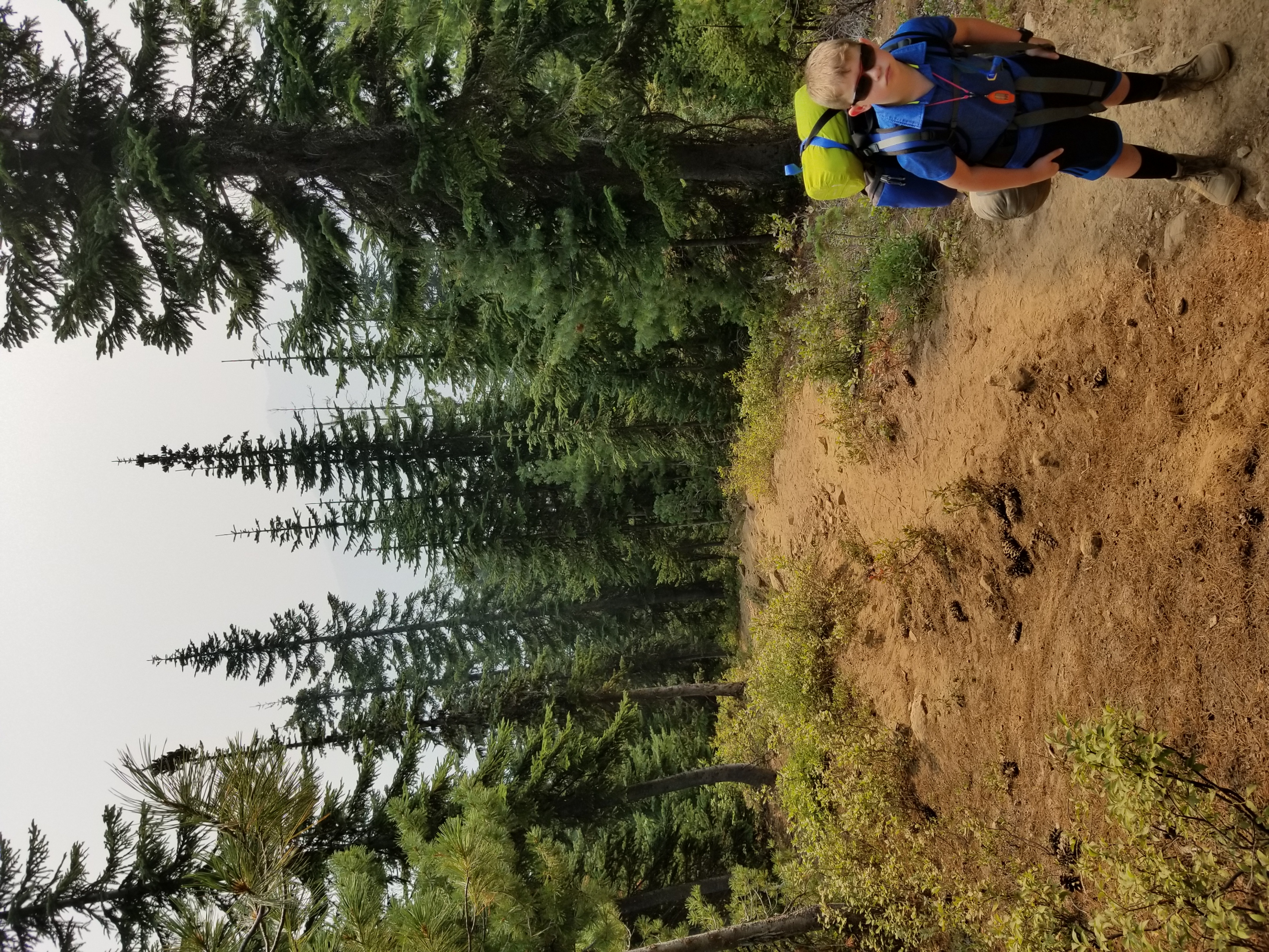
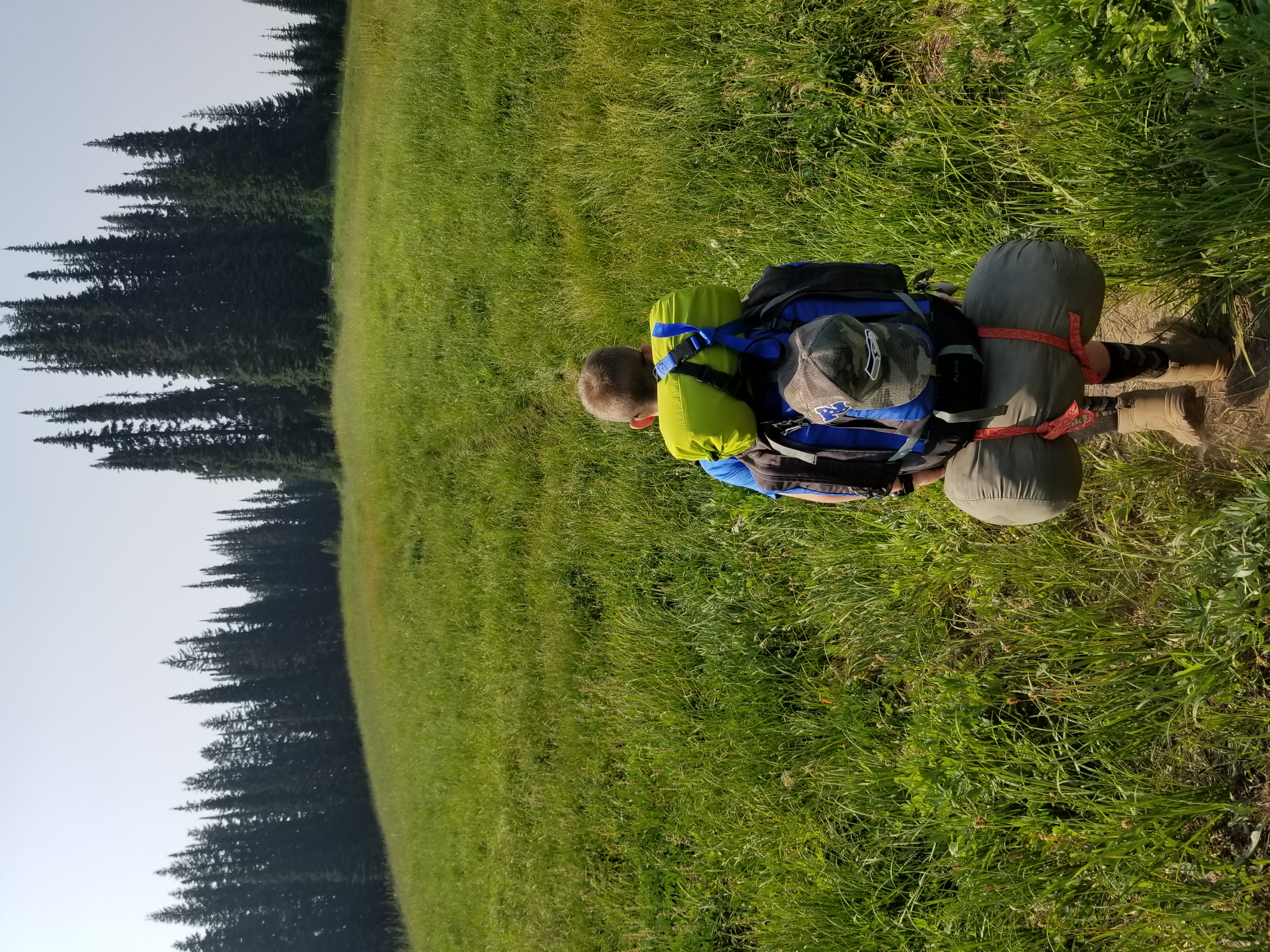
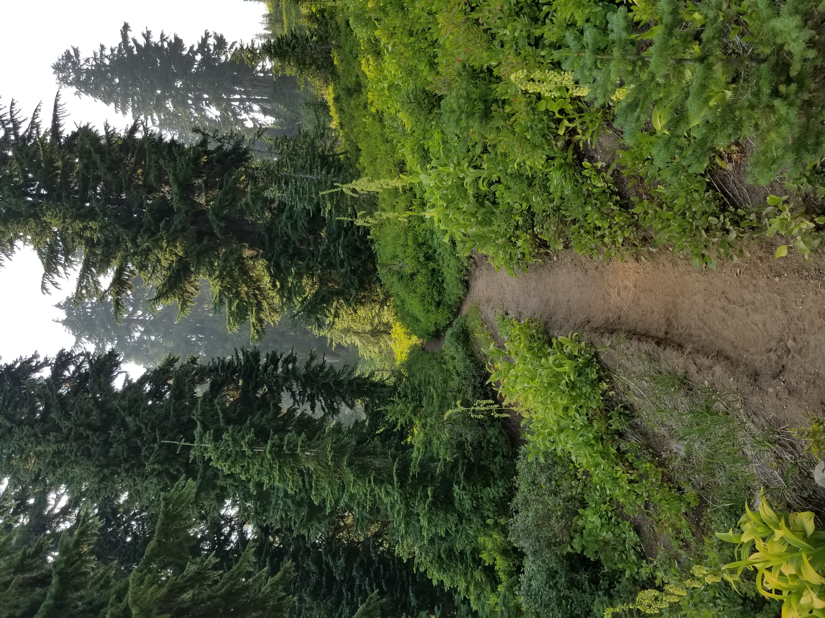
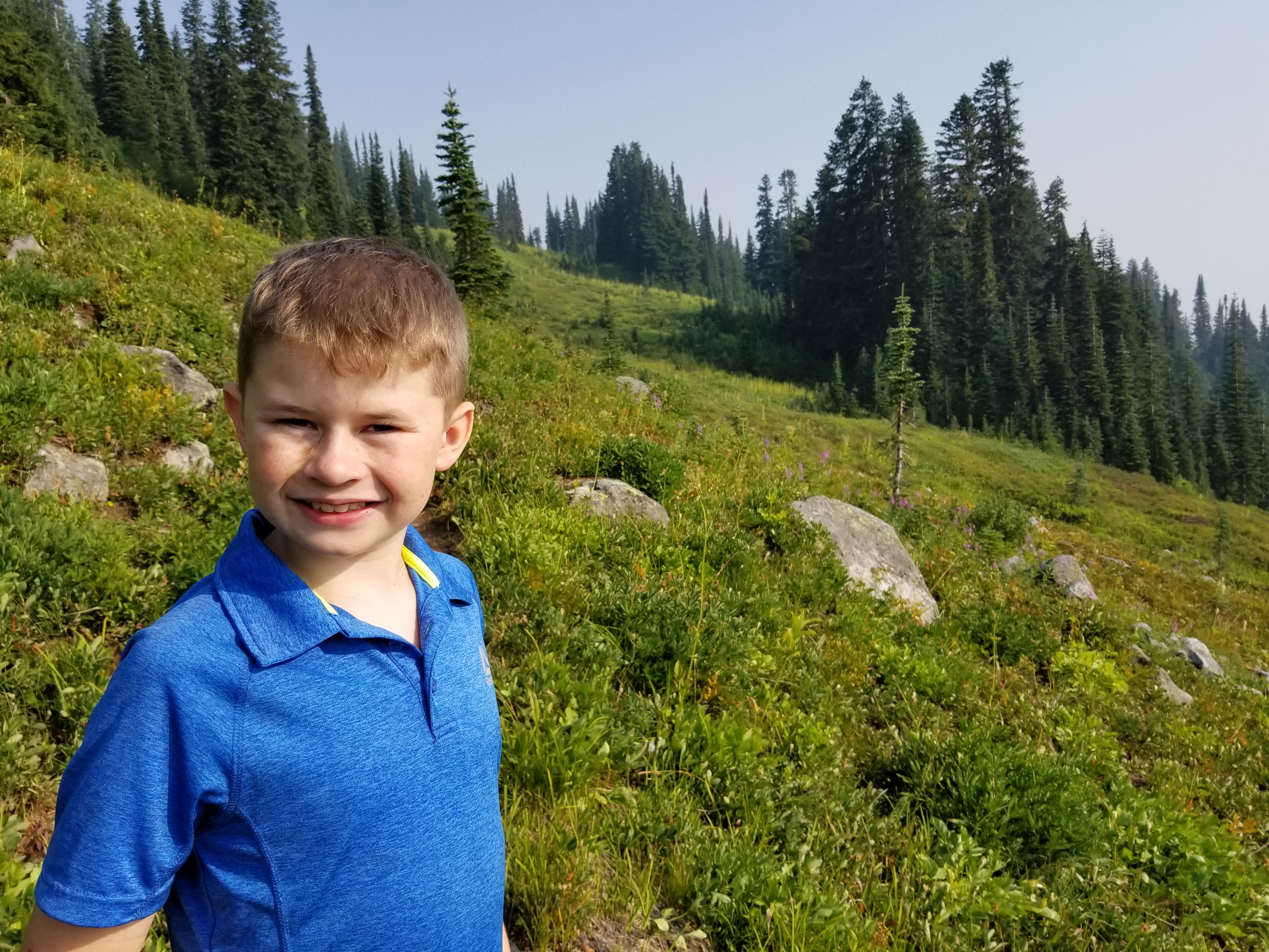
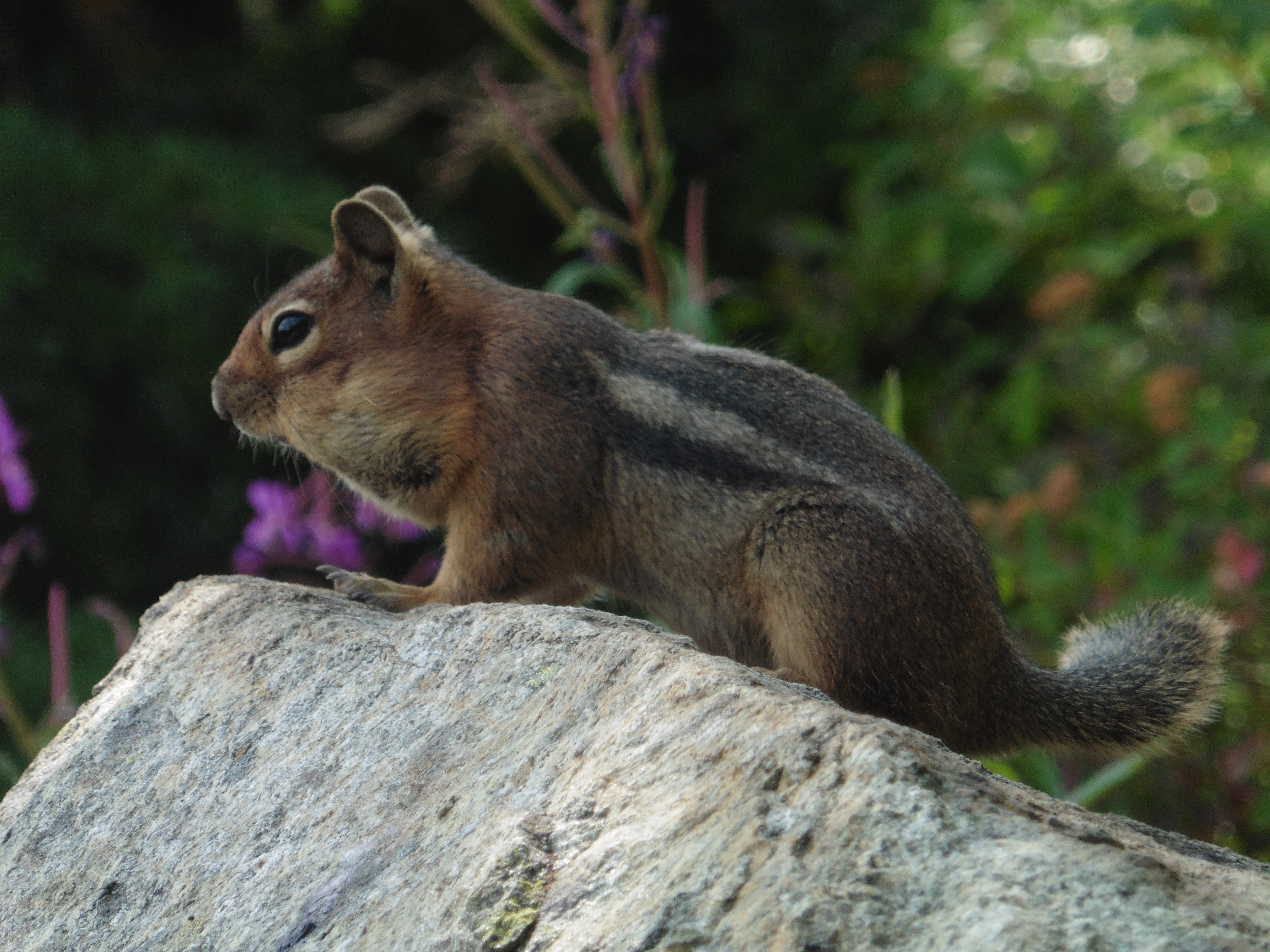
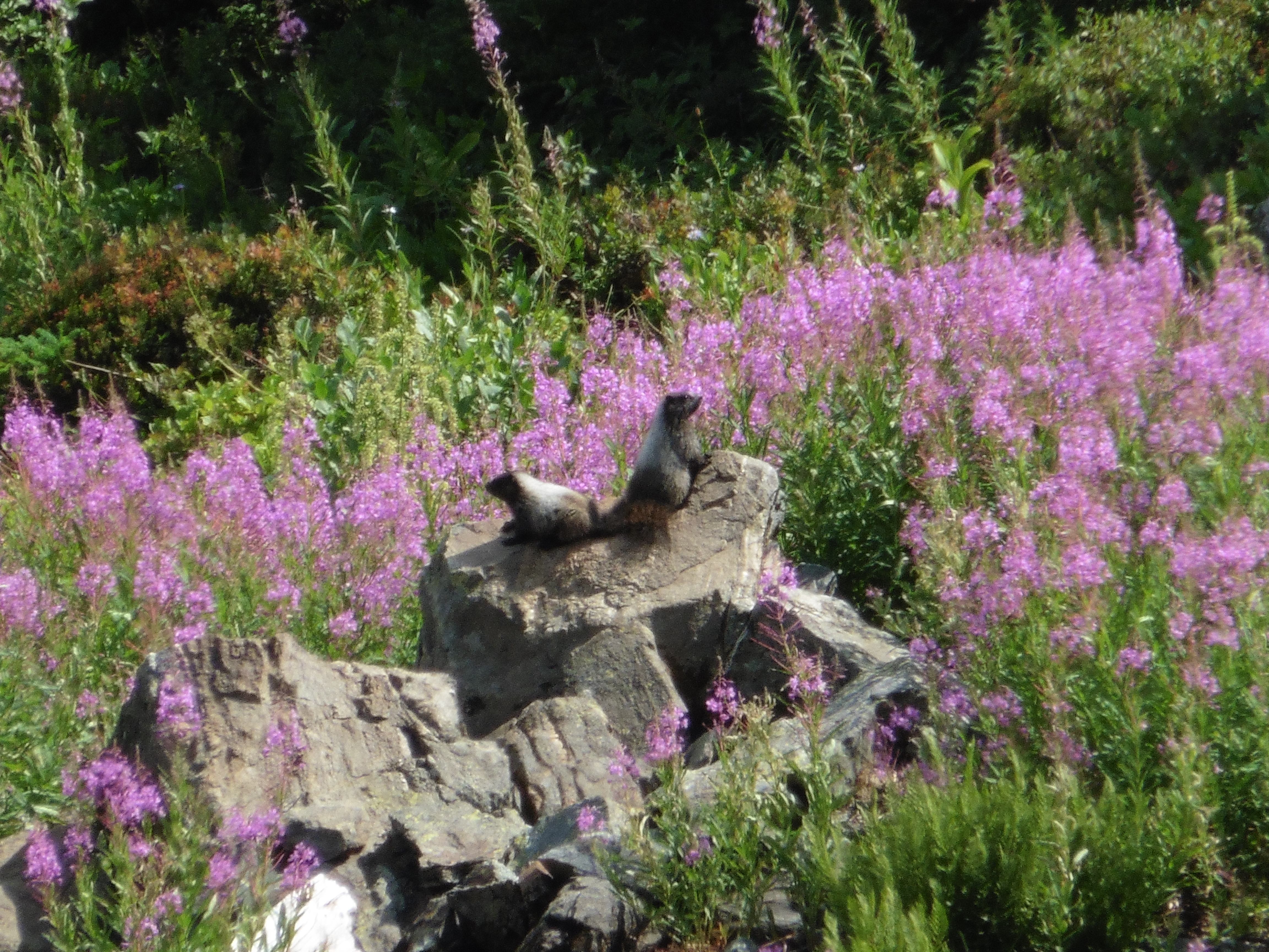
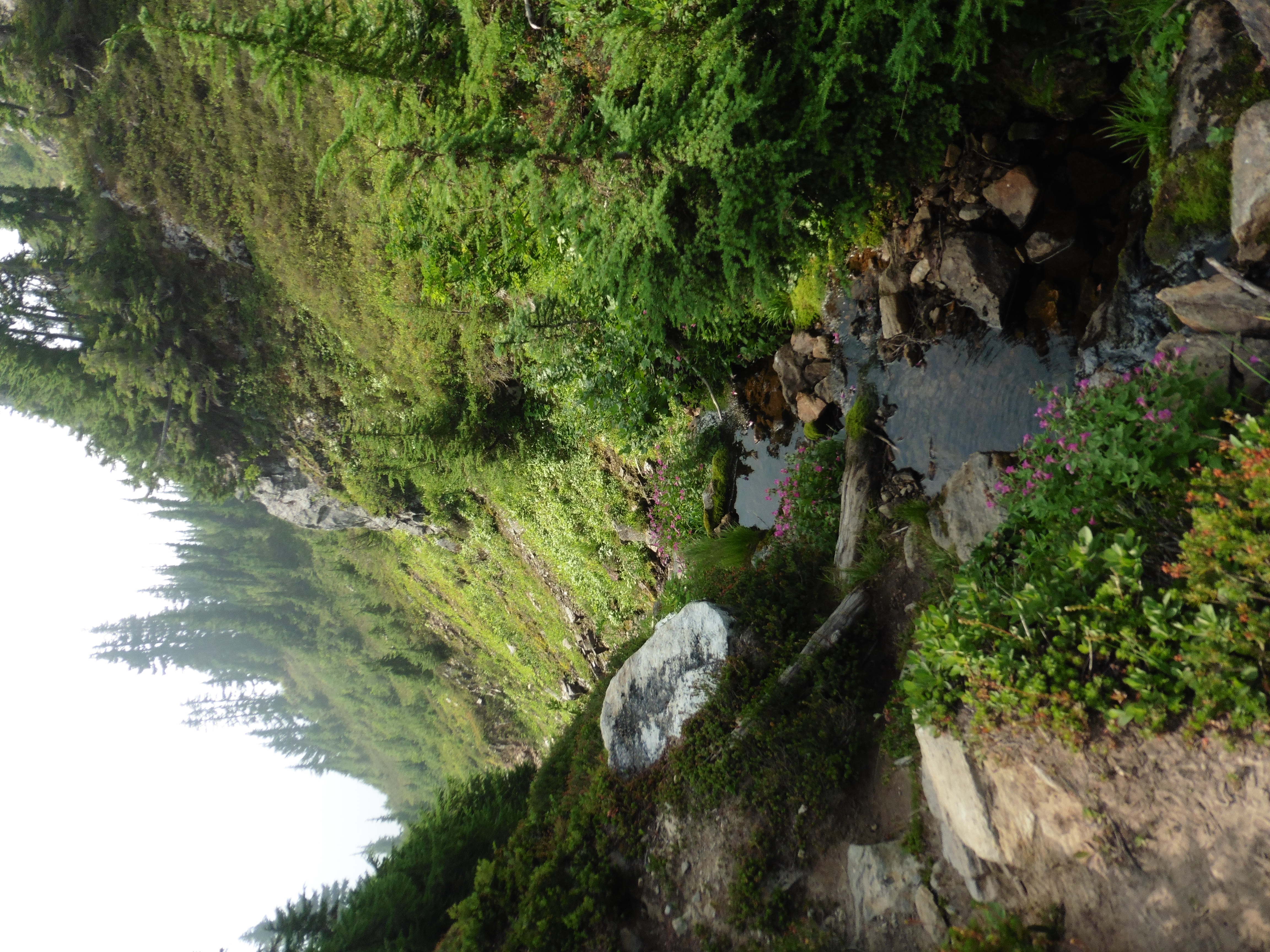
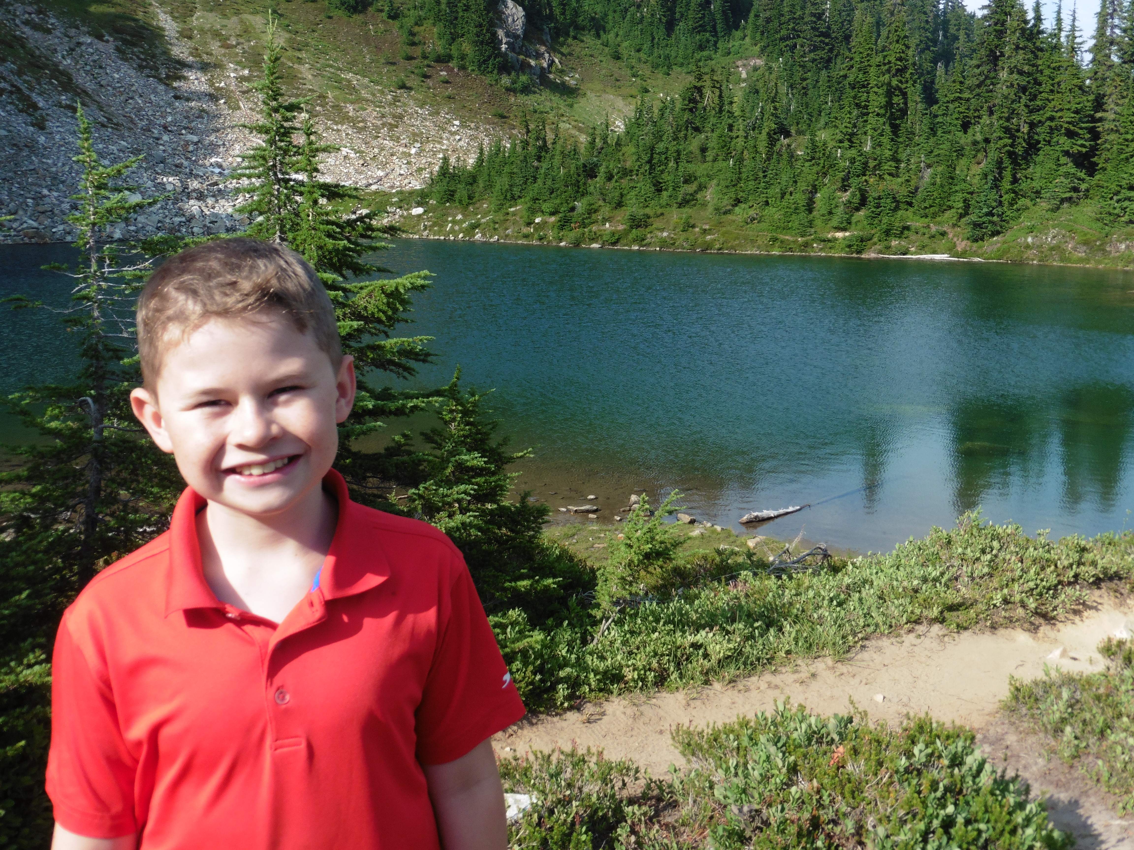
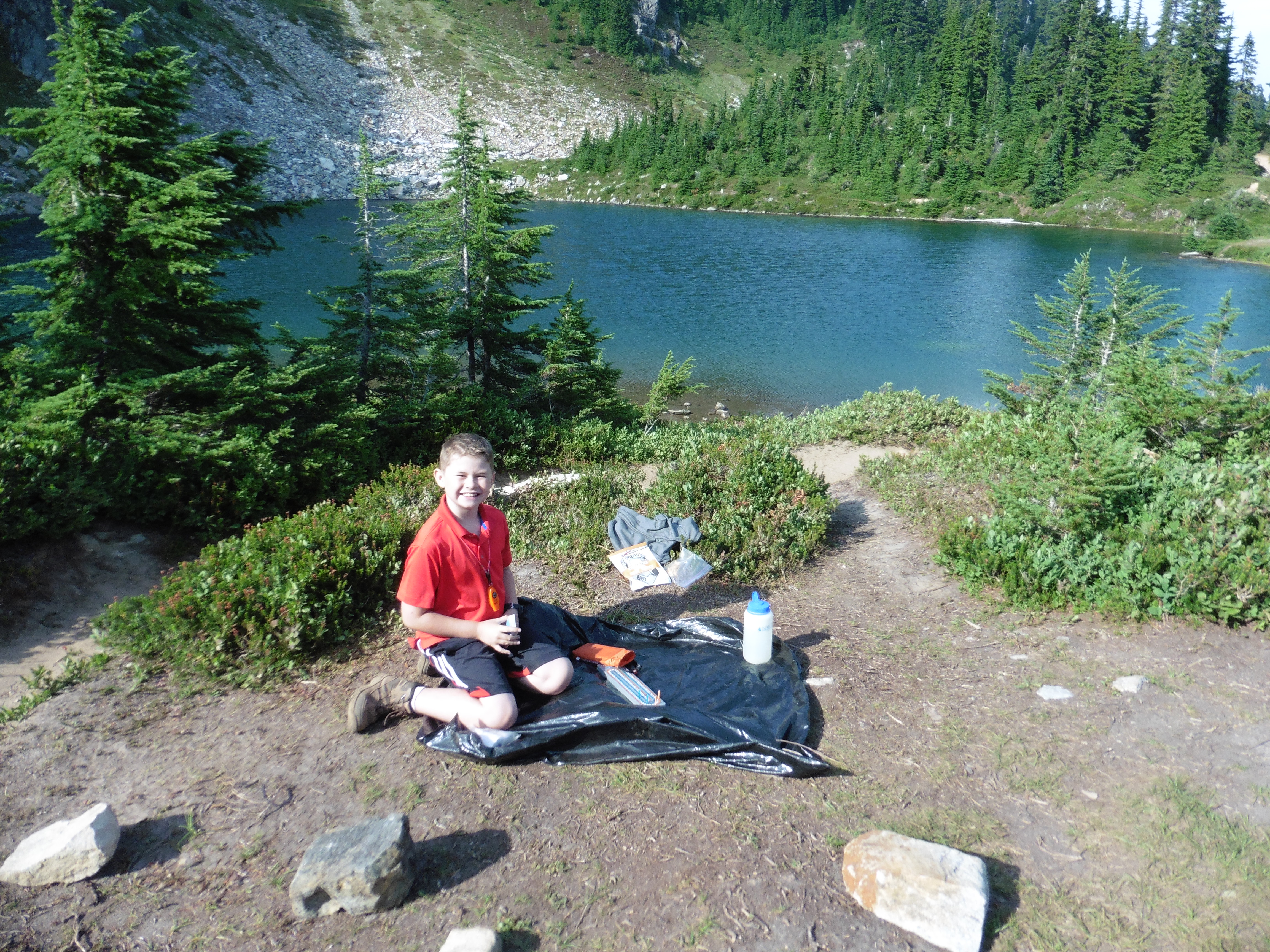
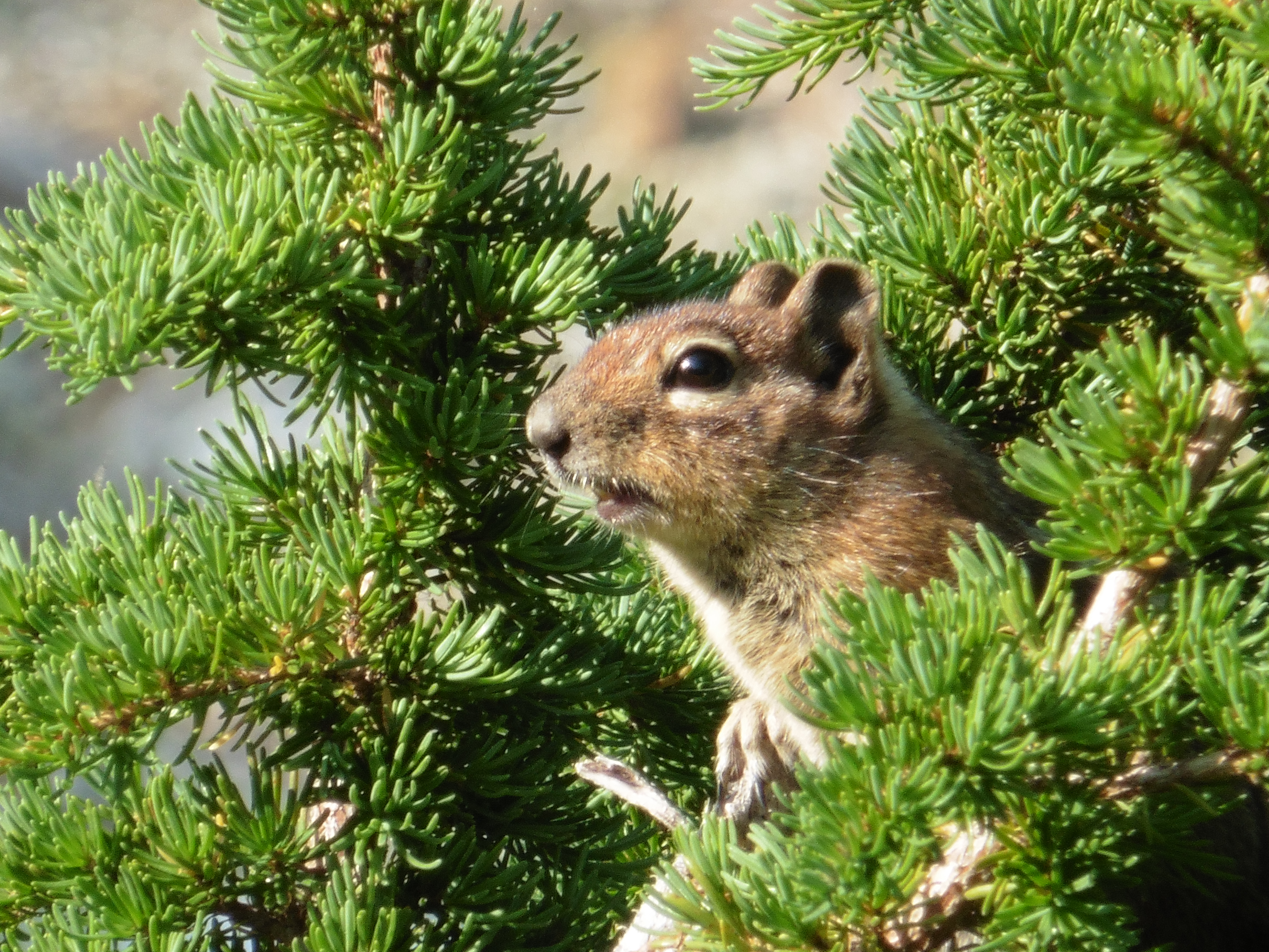
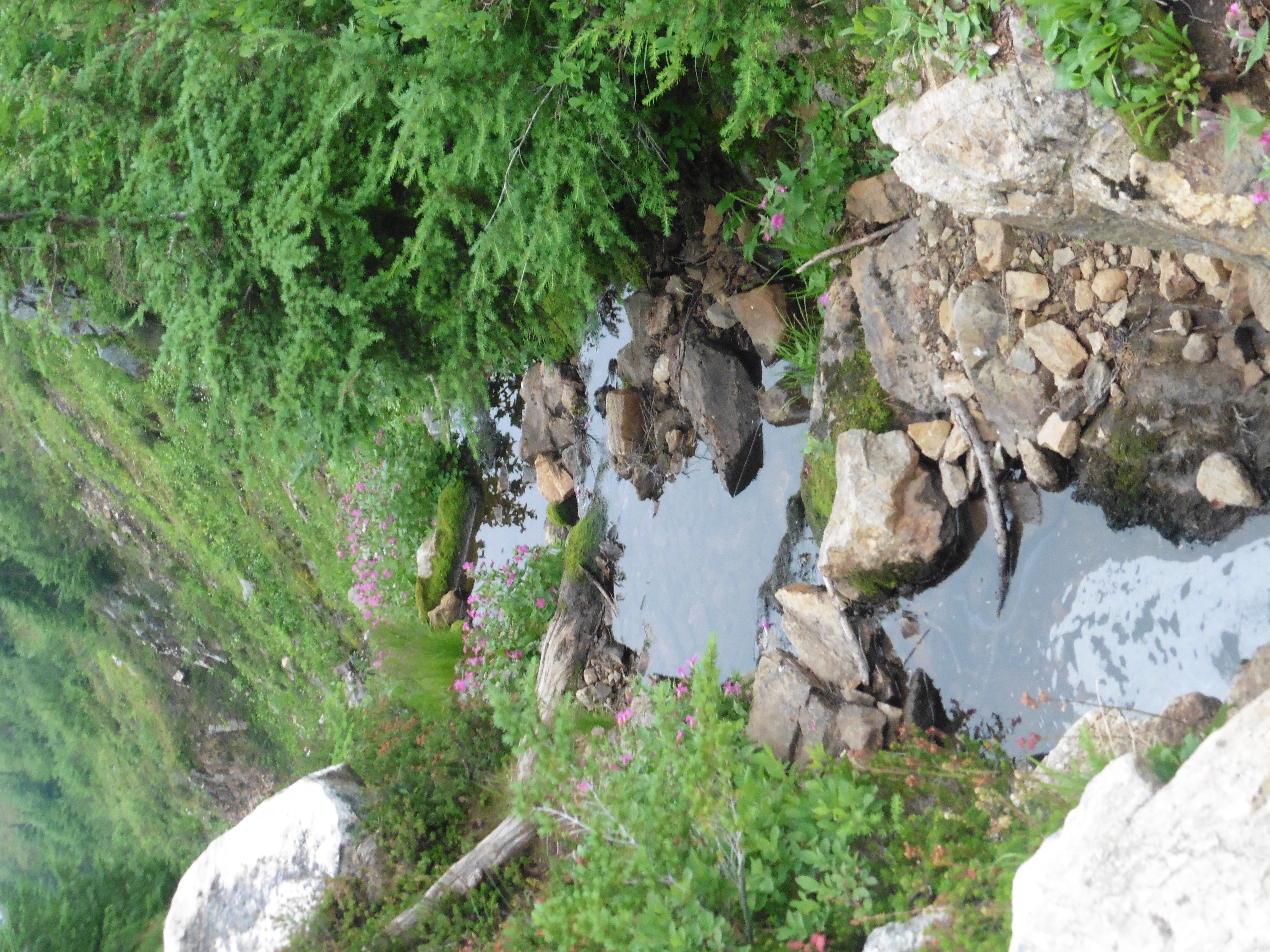
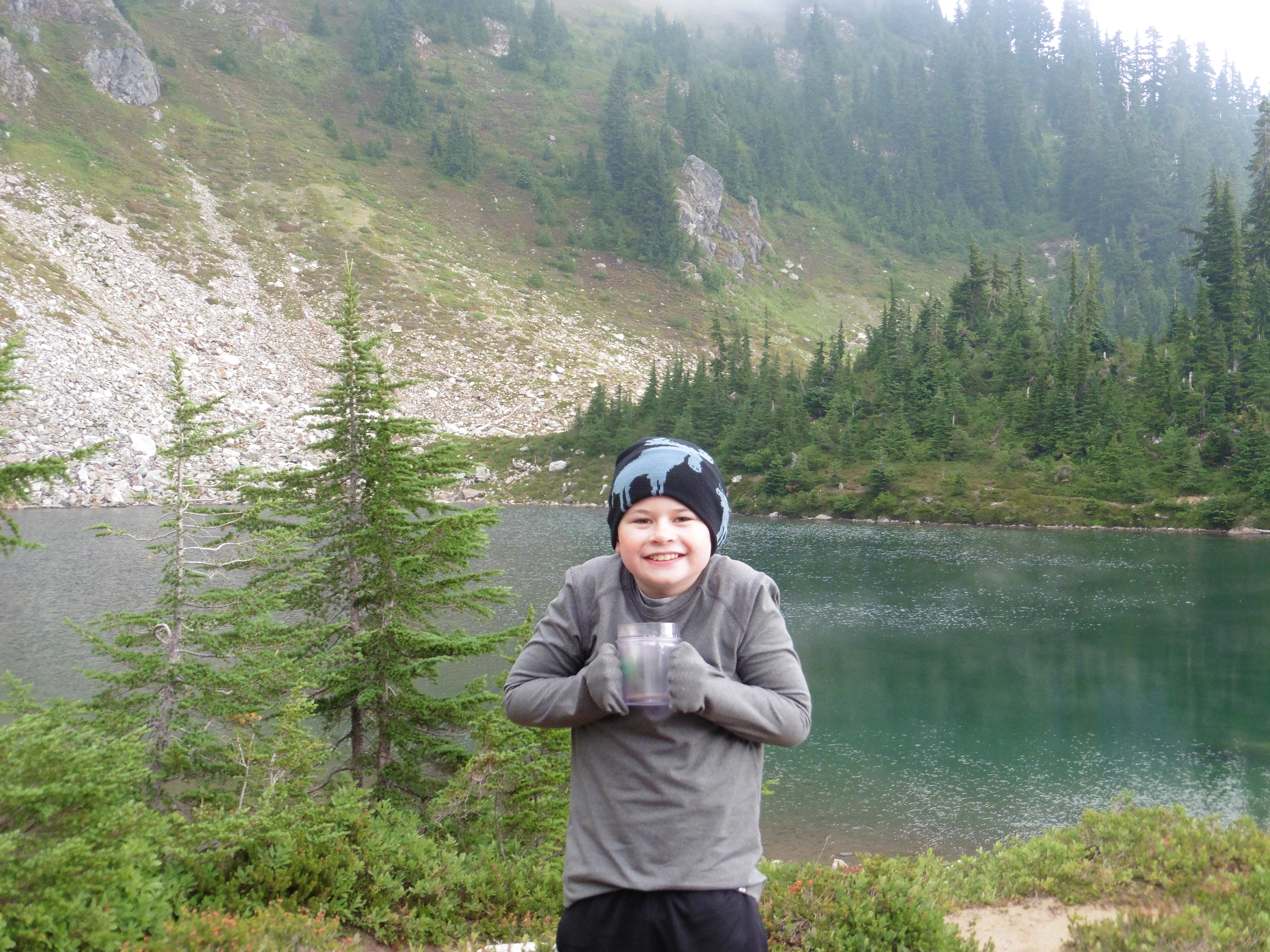
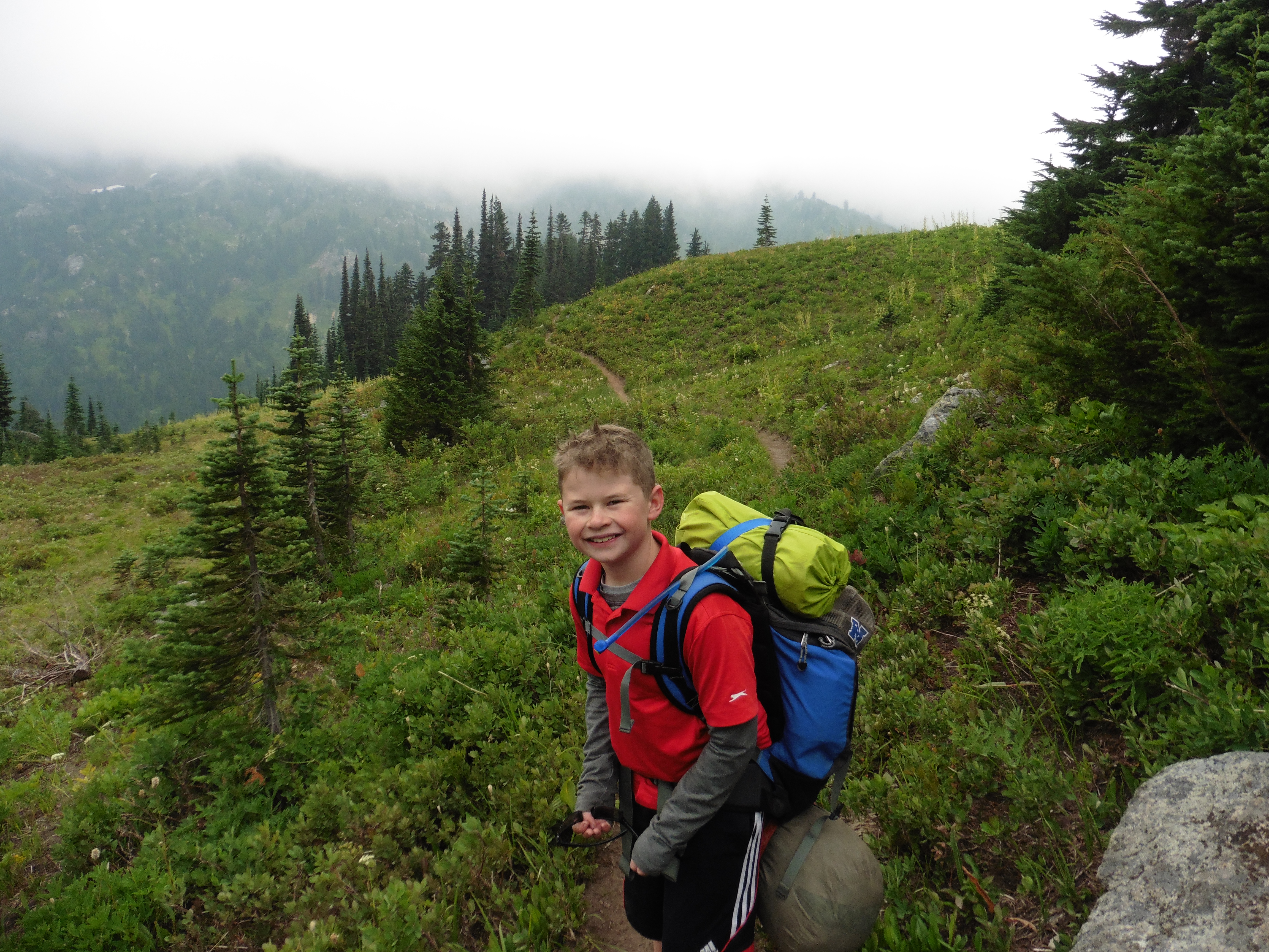
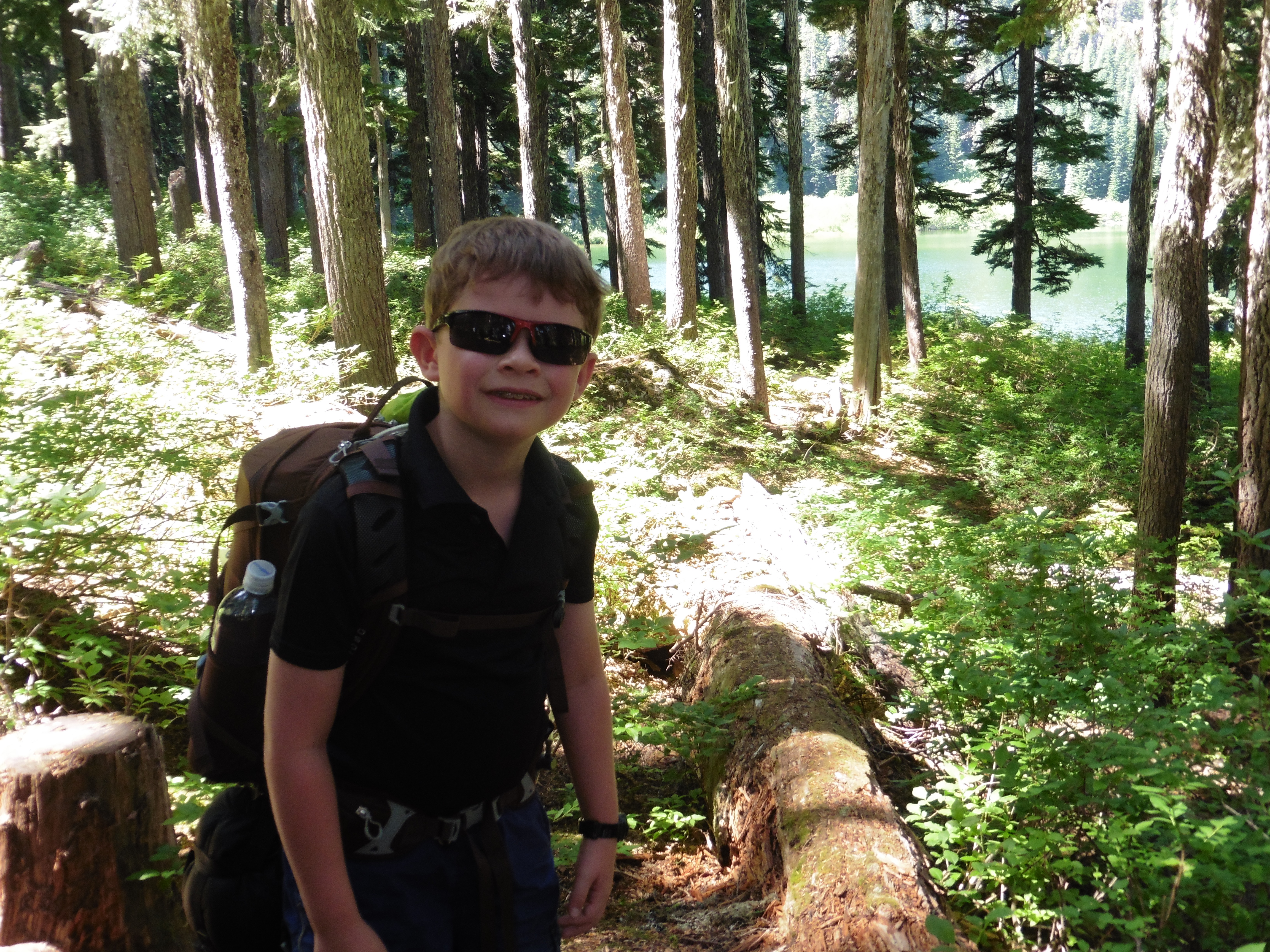
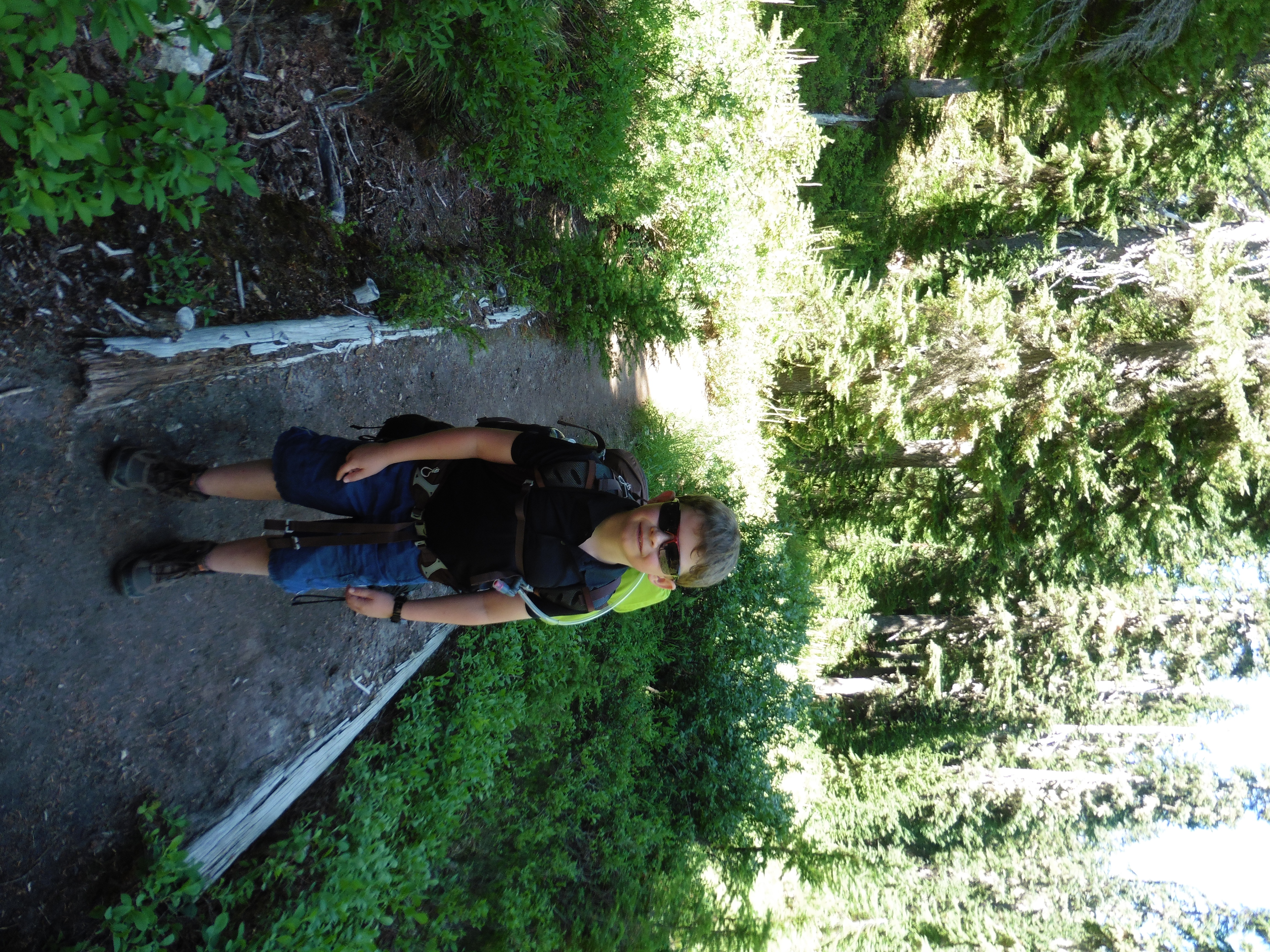
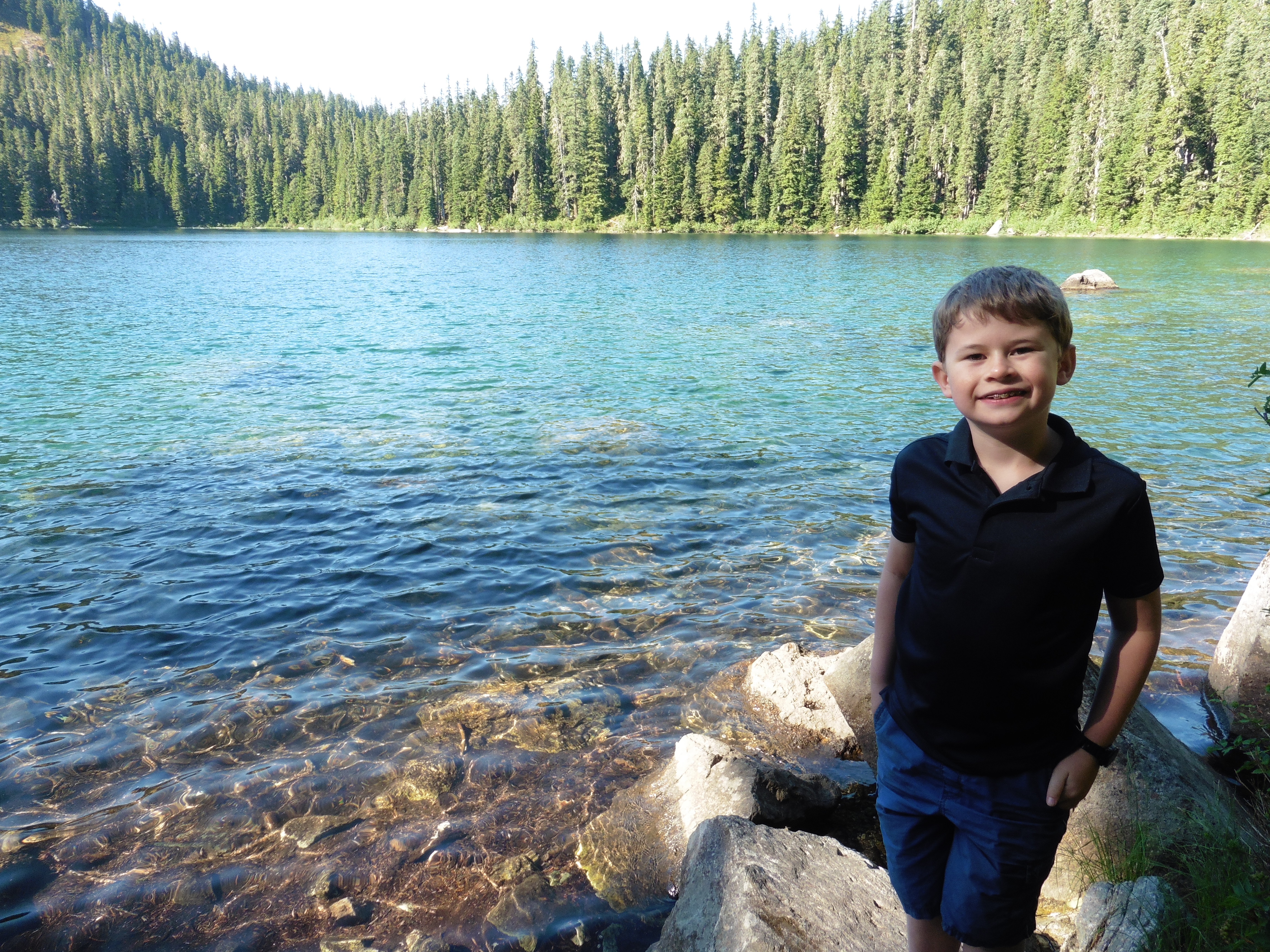
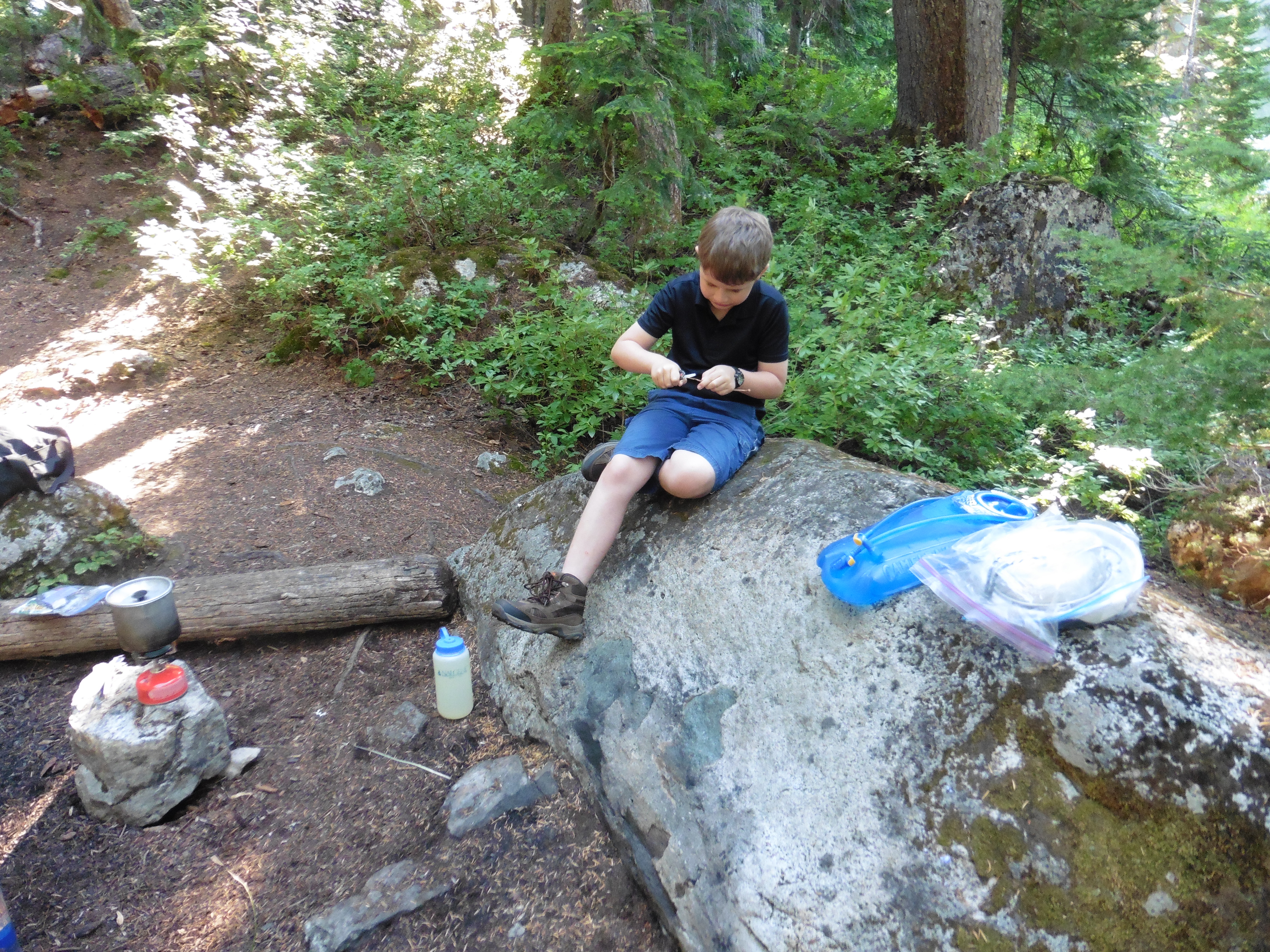
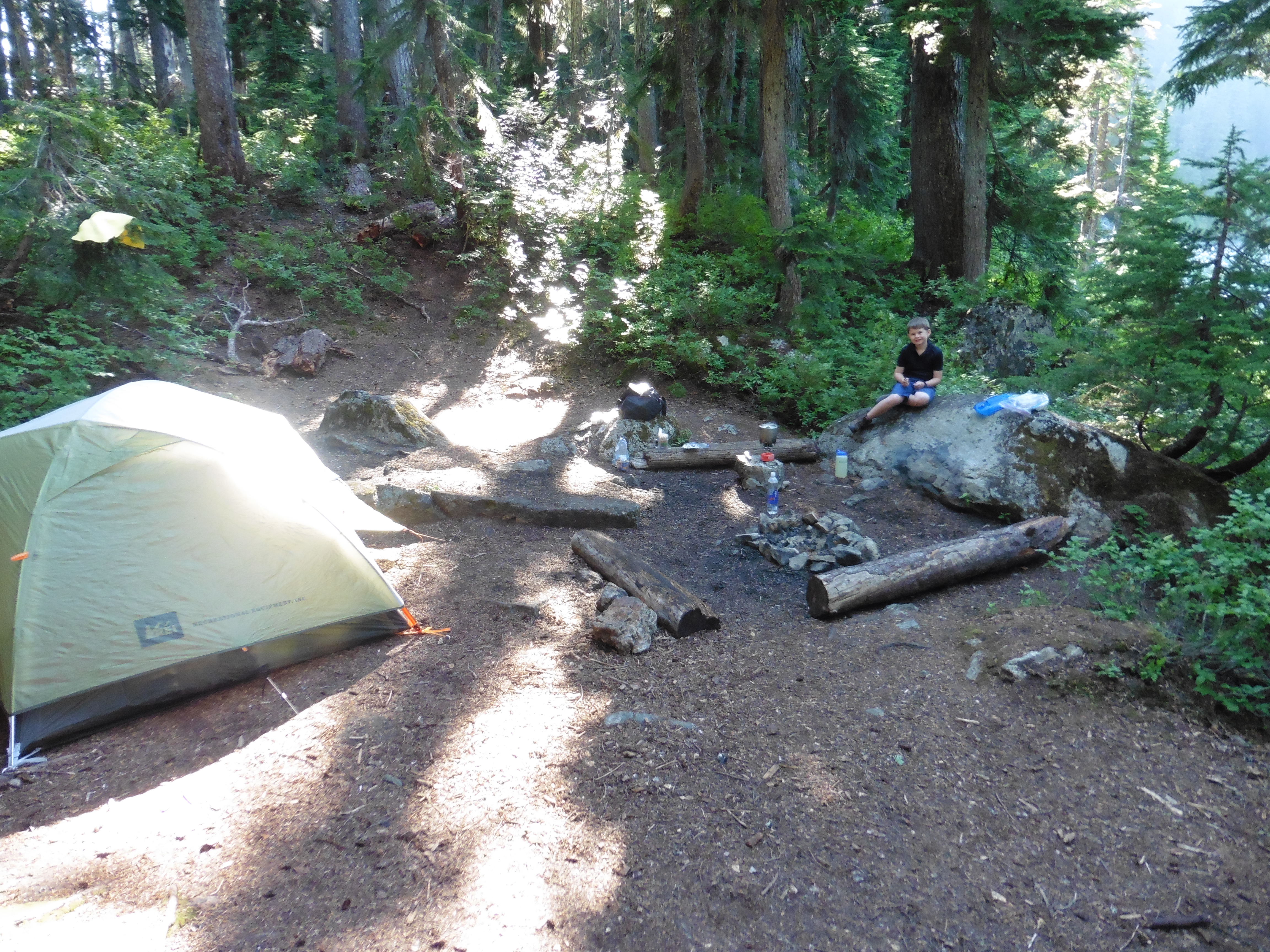
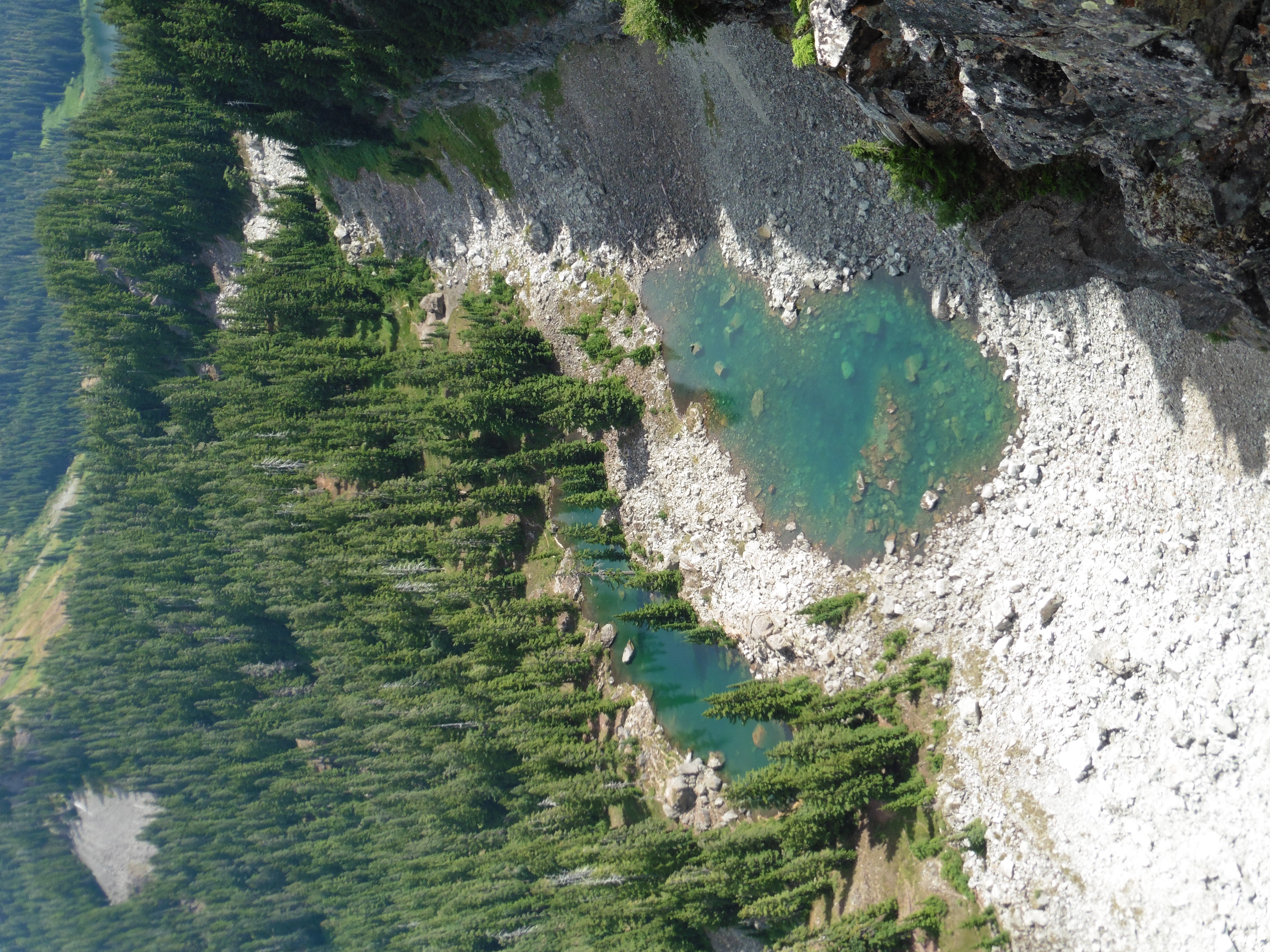
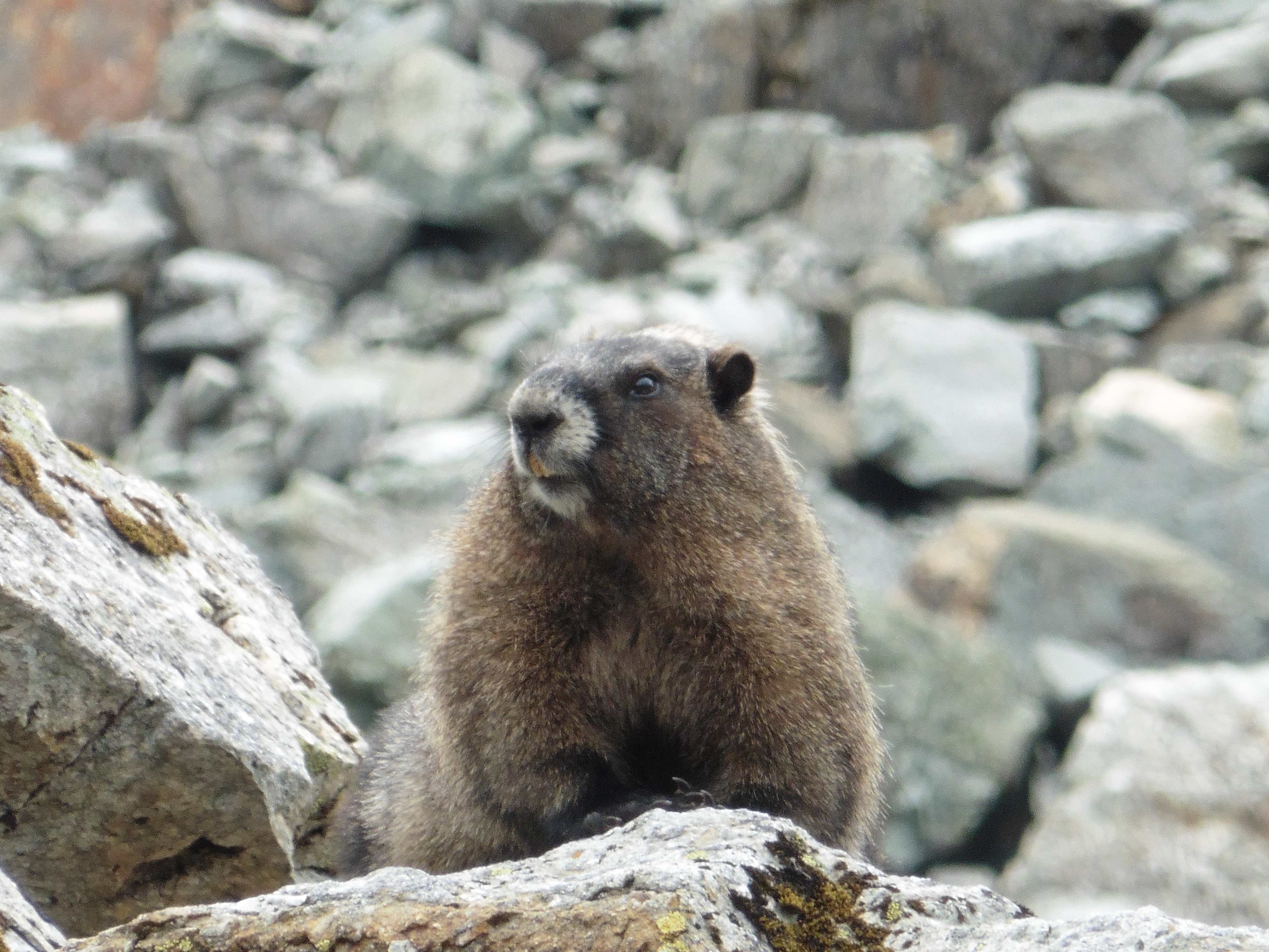
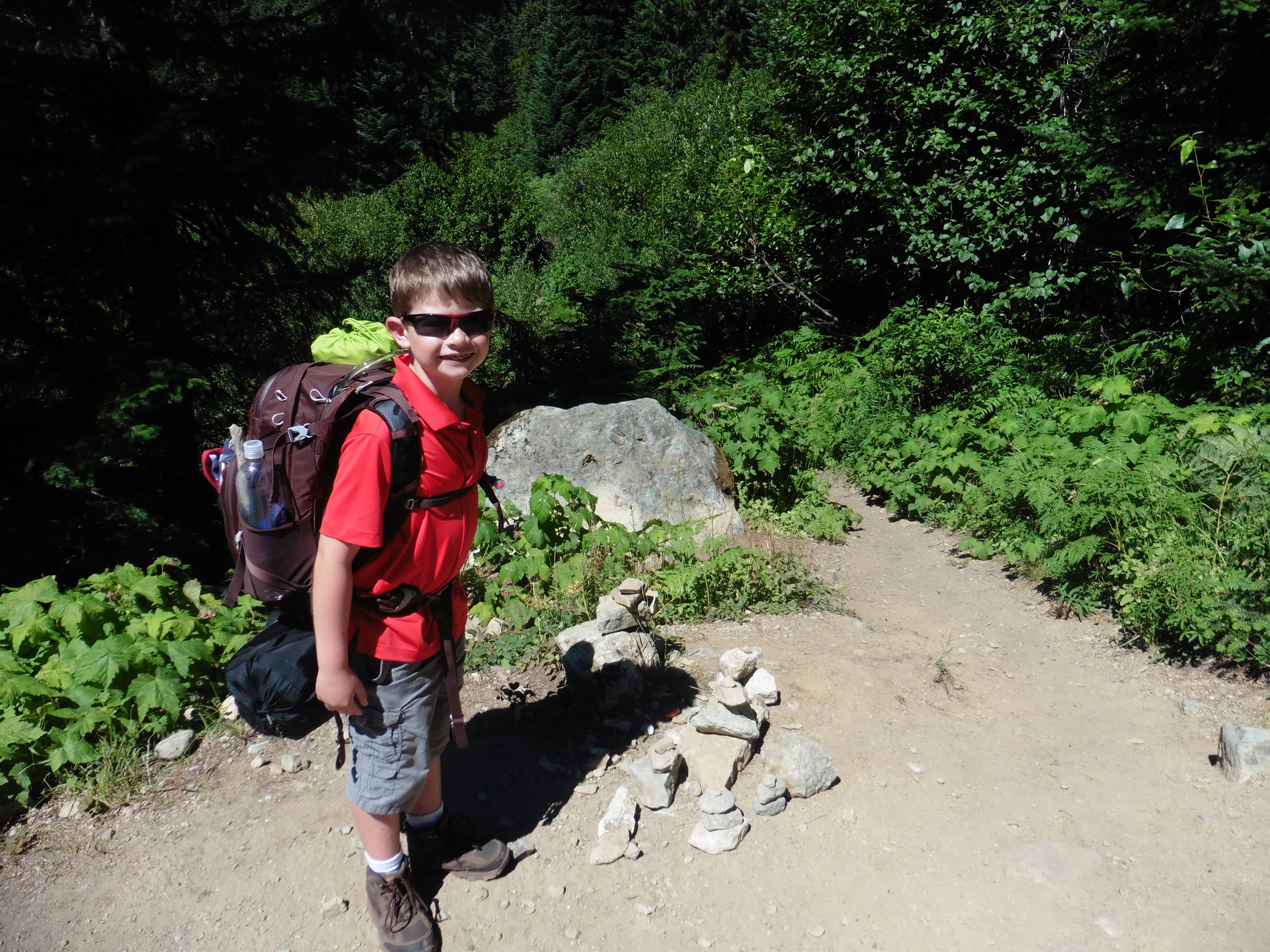
Day 20 (Aug. 4, 2022) We woke up early and caught our bus to the start of our backpack. The bus dropped us off on the side of the road at the edge of wildlife activity closure. We were alone as we gathered our gear and started the hike. Remember, there are no trails in Denali National Park, so we were going to blaze our own way. We dropped down to a large creek and followed it to skirt the boundary of the wildlife area. We found ourselves in tall bushes and marshy area around the creek. As we headed uphill, we came across more creek crossings and had to walk through thick brush and bushwhack our way through. We got to this super dense part where it took us forever to get through. Once we got through and we reached higher ground, there was soft boggy moss. It was very soft to walk on. Long strides worked best and it was like walking on the moon. We got to the top of a mountain and it was just clear enough to see Denali! We stopped for a lunch snack next to some fireweed at a creek and near a pond. We could see our glacier and Denali while we rested. Next, we had to find a way to descend to the river to continue up toward the glacier. One area was very steep, bushy, and sketchy, so I explored up a small hill to find a longer, but safer way down. Once we were down the hill, we came to a large creek running from a glacier to our East. We saw a wolf print while we went up and down the creek to find the safest place to cross. There was no other way, but to go through the water. We decided to go with the textbook method of keeping our boots on. We walked together and I held on to Papa's pack for stability, following in his wake. It was pretty deep and moving fast, our boots filled with water. After the crossing, it was about a mile to our target area to camp. The wind was strong and cold in our faces and it began to rain. The small creeks coming down the mountain that we were hoping to use for clear water were all dry. Fortunately, we found a small outcropping of large bushes that indicated there was more water in that area. We used the bushes for a wind break and there was a clear water creek next to us! As we arrived at the bushes, there was a very loud whistle. It scared us at first, and we wondered if there was a person around. Then we remembered that marmots whistle as an alarm. Sure enough, we saw a busy marmot running up the hill to his family on a mound. This seemed like the perfect spot for a marmot, a steep hill so the bears couldn't get him and fresh water. There was also a big mound full of holes and ground squirles / alpine prairie dogs. We set up camp and established a bearmuda triangle, cooking our food 100 yards from the tent, and storing our food on another 100-yard leg of the triangle. We also dug some catholes near the storage area. We made beef stroganoff for dinner, had desert, and jumped in the tent as it cold, windy, and raining more. I felt pretty good after carrying a 30 lb pack for 7.5 miles overland in tough terrain with no trail. Papa's pack was 55 lbs. We played some cribbage before falling asleep. |
 Route in to the valley to start the trek. |
 Ready to go. |
 These bushes are tall! |
 Moss by a small creek. |
 Making our way through the spongy open areas. |
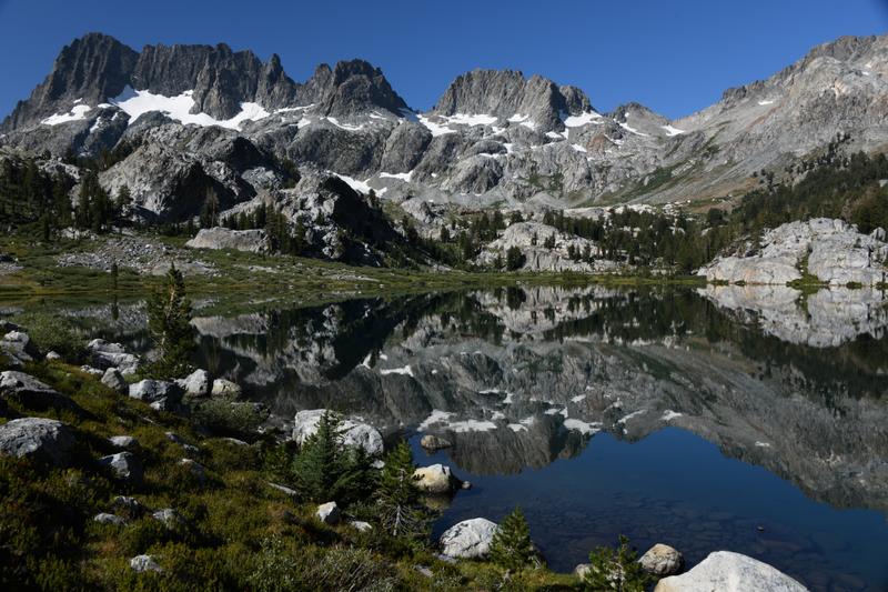
 Glacier high in the valley next to us. |
 View of the mountain near the start of the hike. |
 Vast, open area to cross. |
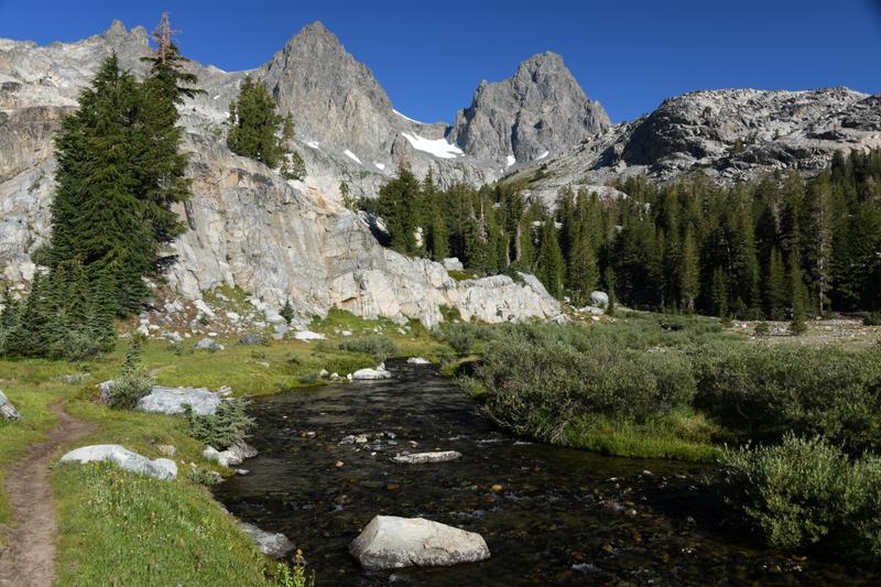
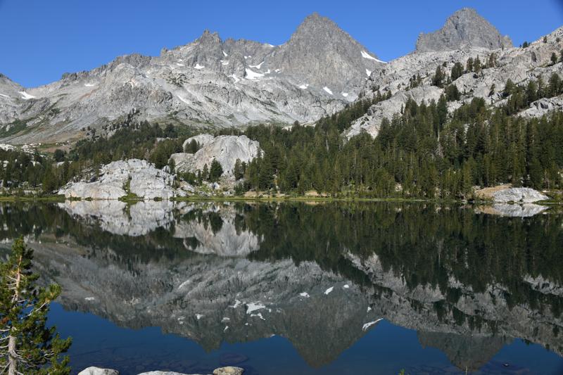
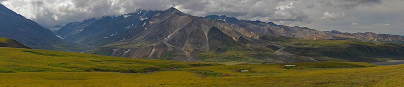 Panorama of the valley with our glacier and the Panchromatic Mountains. |
 Path ahead to our valley, river, and glacier. |
 Miri glacier over the valley. |
 The glacier will be our destination the next day. |
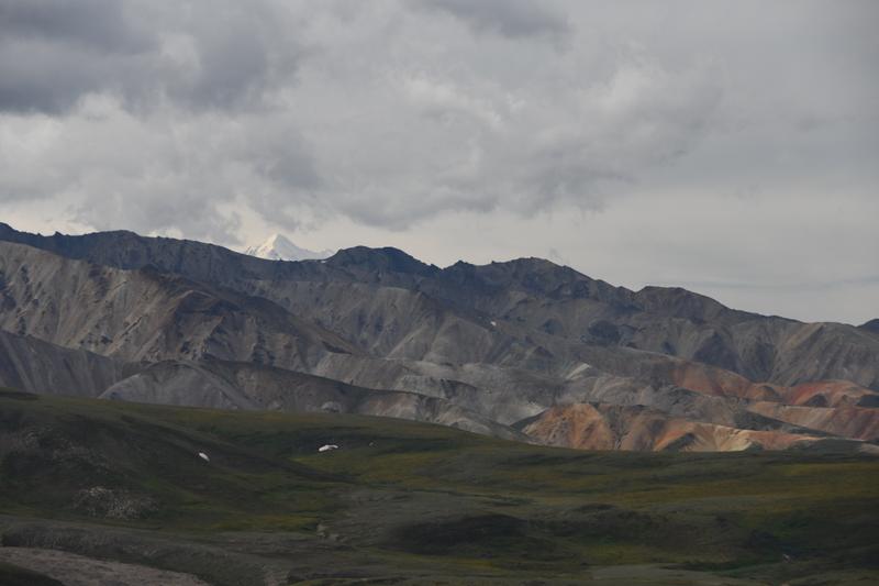
 Panorama of the Panchromatic Mountains. |
 Making good progress. |
 We catch a gimpse of the top of Denali as we make our way. |
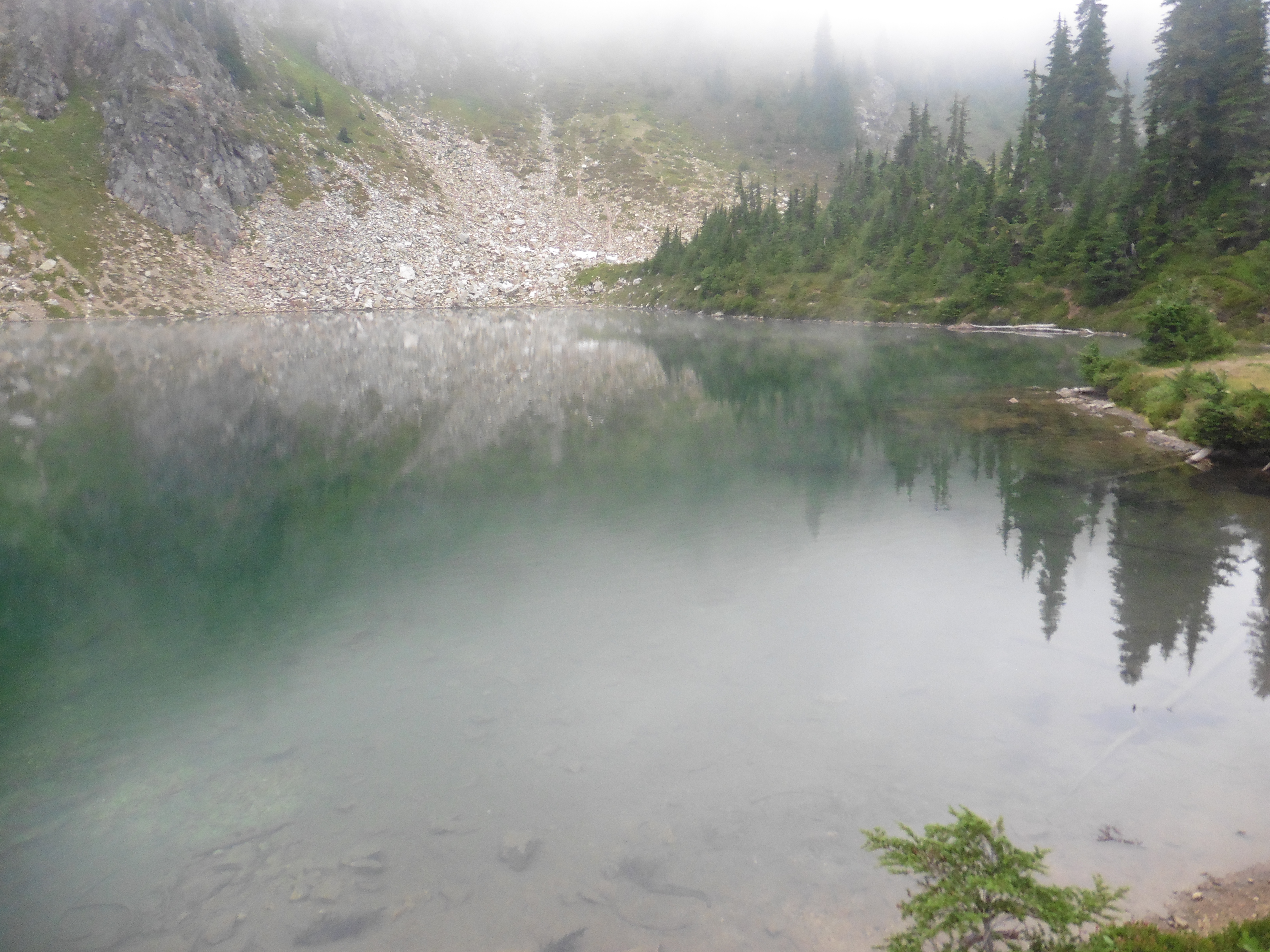
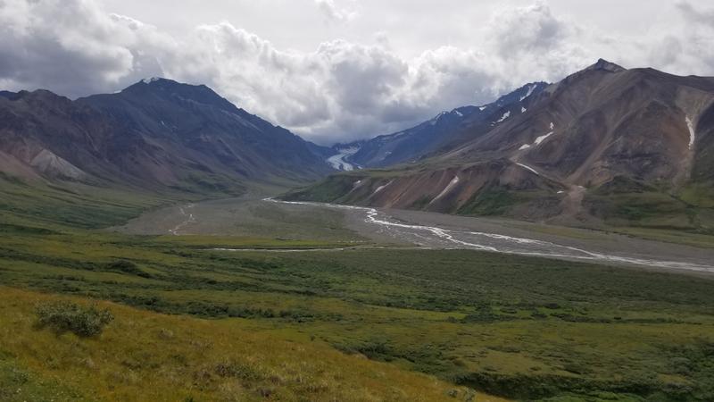 Our valley with river and glacier. We camp on the left side of the river, just before the bend. |
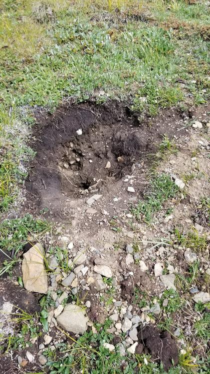 Oh, no! A bear trying to dig up our little buddies (ground squirrels). |
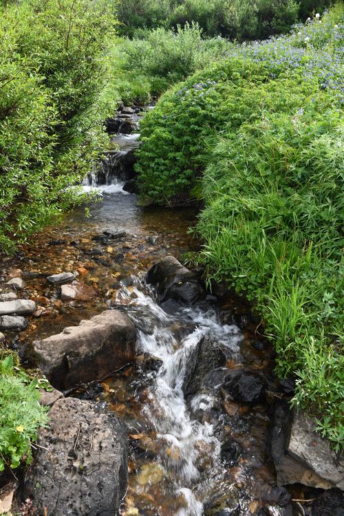 A stream feeds lush bushes. |
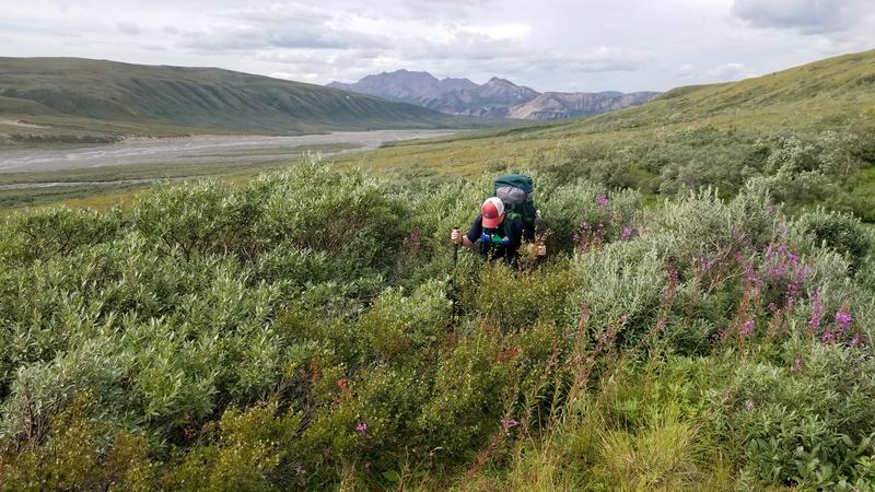 So much brush to go through! |
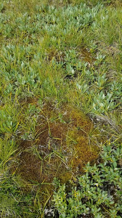 The spongy moss we were walking on. |
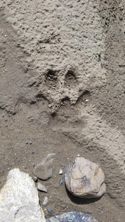 Wolf print! |
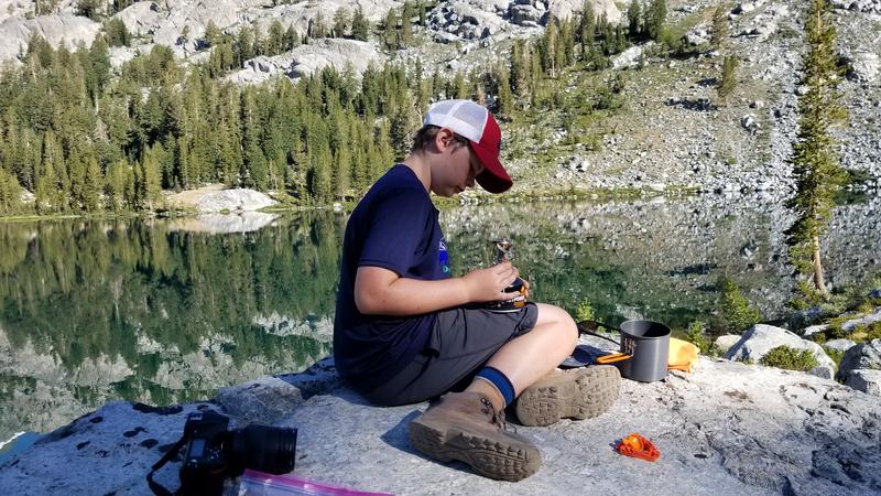
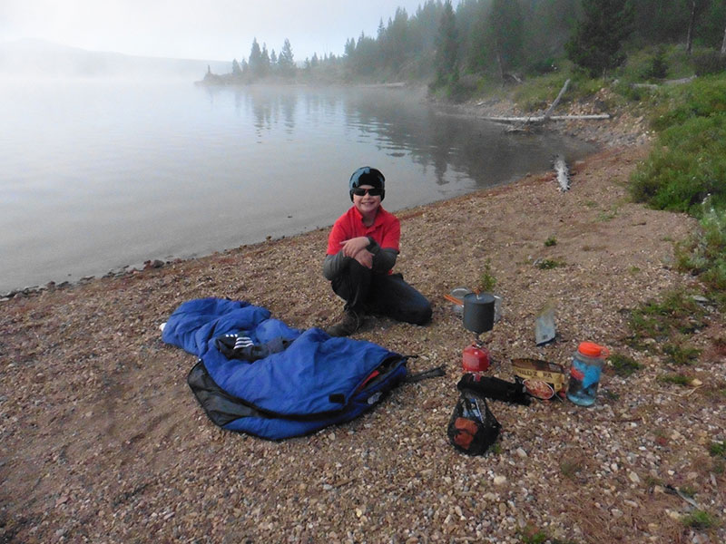
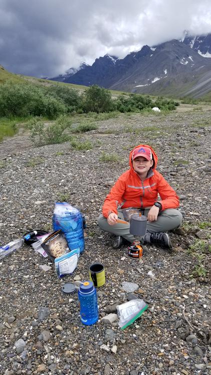 Cooking some dinner in camp, in one corner of the bearmuda triangle. |
 What was that whistle?! |
|
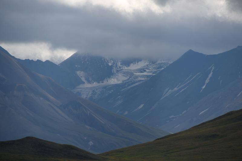
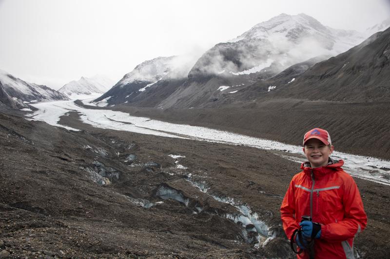
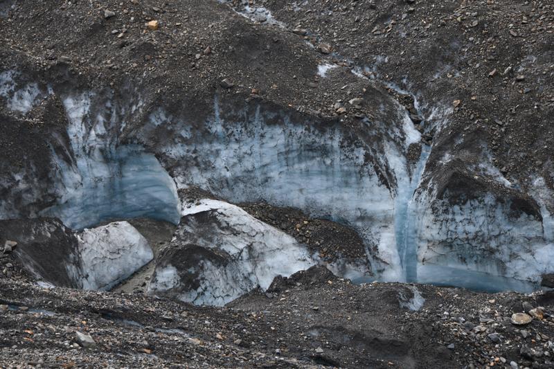
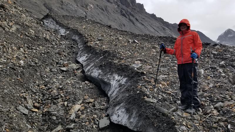
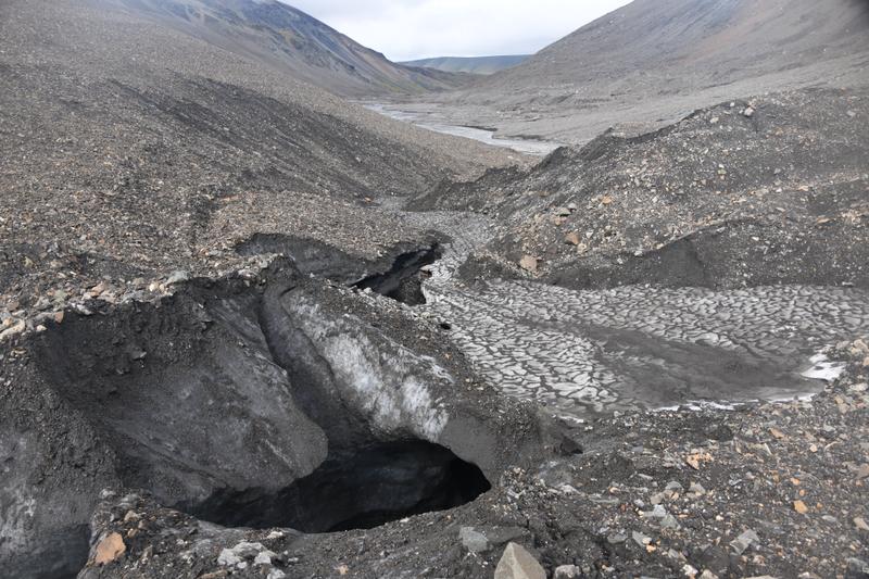
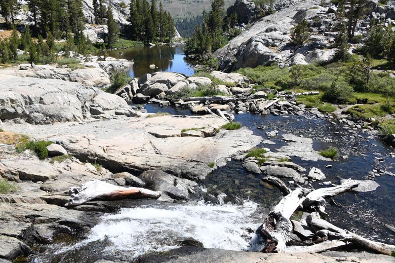
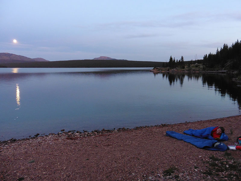
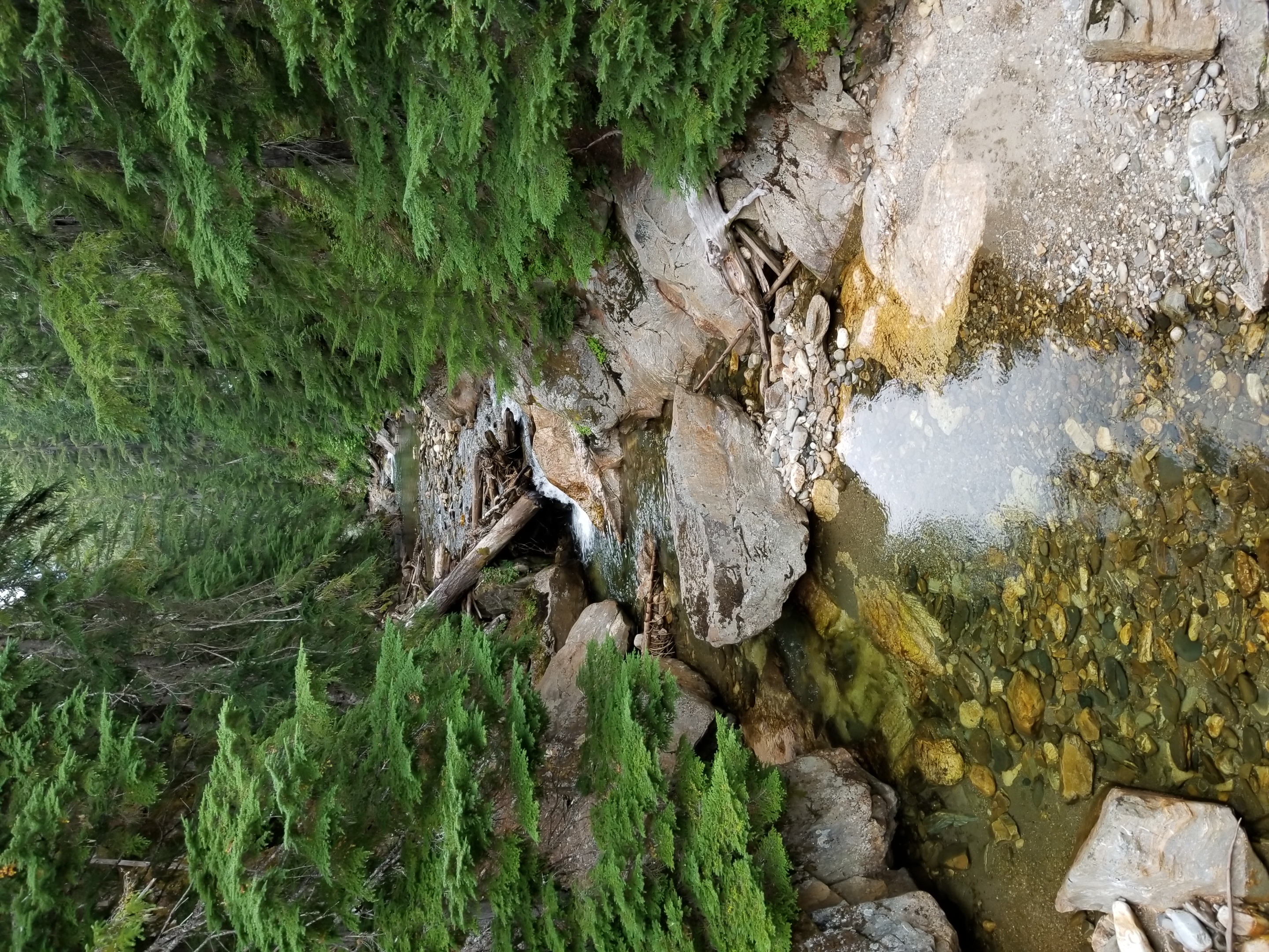
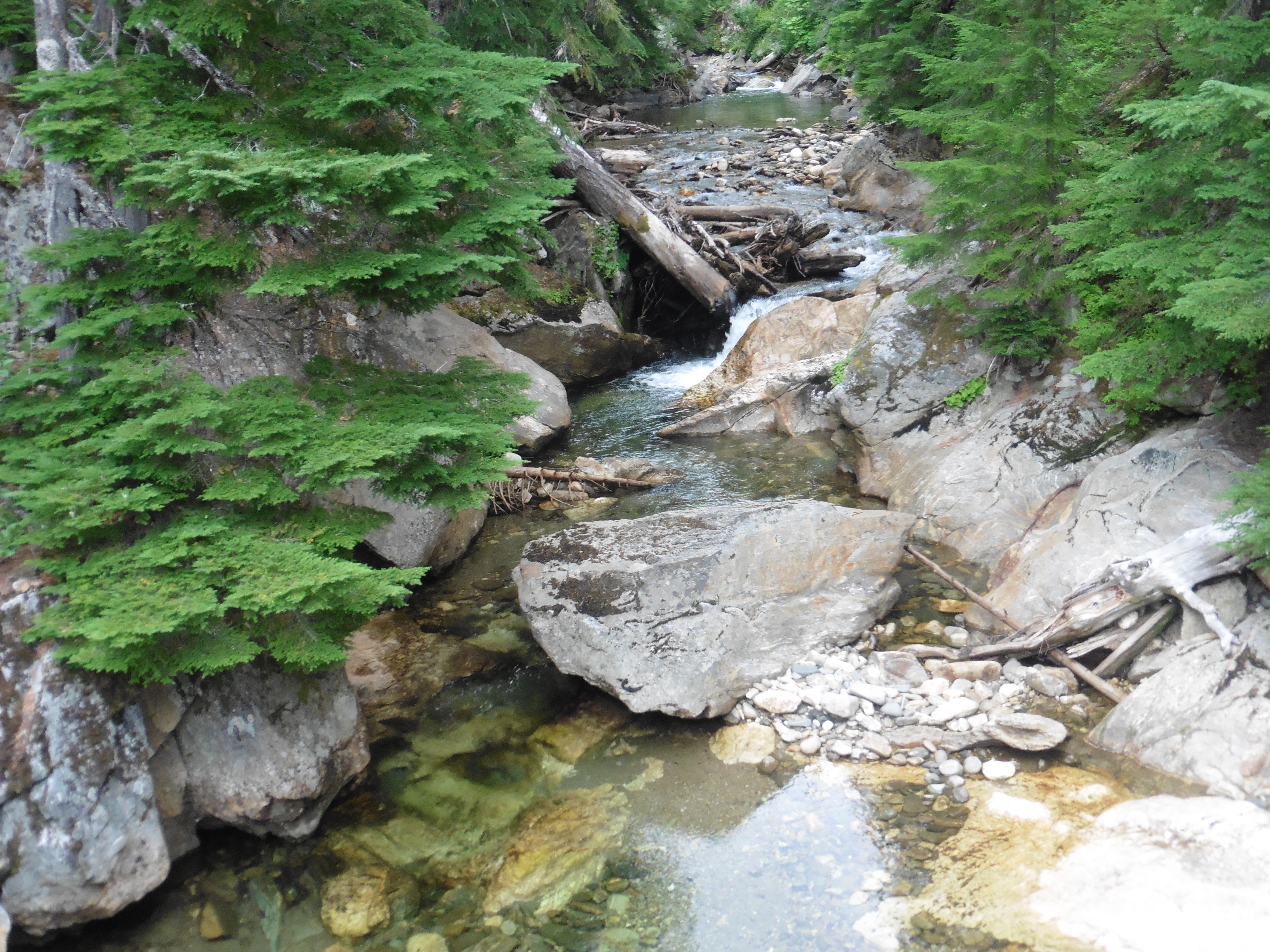
Day 21 (Aug. 5, 2022) It was raining when we woke up. Papa got out of the tent first and got wet while starting water for coffee and hot chocolate. I finally made it out of the tent and we ate our freeze dried eggs. We started our day hike to a glacier. We followed the river bed to the glacier. The river was very silty due to the heavy rain fall and day before and the silt in the glacier. We walked about 3 miles to the toe of the glacier. It was raining pretty hard and our raingear was soaked on the outside. The toe was very moraine and had a lot of rocks on top of it. We climbed up the glacier and checked out where the river was flowing on the ice We found that we werw walking on ice just below a thin layer of rock. On the steep faces, the rocks would slide when we stepped, exposing ice underneath. We learned to avoid these faces. On an ice shelf near the river, we could see and touch the blue ice. On the other side of the river, there was a massive trianglular extrusion pile of rocks that were covering blue ice that we could see in gaps. One could probably walk on this pile all the way up the glacier to the top. There was a well where water had drilled a hole down through the ice. I was tired, wet, and cold, but wanted to see more of the glacier. Papa explored ahead to see if it was safe to go farther. He signaled it was, and I gathered my strength to catch up to him. We climbed deeper in to the moraine, and it was safter to walk, rather than down by where the water was flowing. We climbed up and down rocky hills and crossed icy gluches with streams for another mile on the glacier for a gorgeous view of the rest of the glacier curving up the mountain. We were next to the first pathces of exposed ice and could possibly reach more exposed ice just up from our viewpoint. However, to walk on the exposed ice would be dangerous as there could be crevasses and the river had carved a gorge in the ice, making further exploration risky. The good news was that the sky had cleared, the rain had stopped, and we were starting to dry off. The blue ice exposed by the river was beautiful. On our way back, we saw a place where the river went under the piles of rocks. We could hear the glacier making noises. It was a periodic low sound, like we could hear it slowly ooching down the mountain. We headed down the glacier and Papa almost slipped down an icy face. Back at camp we had dinner. It felt good after 8.5 miles. It started to rain again, so we played cribbage in the tent and went to bed |
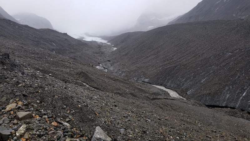 The glacier from the foot. Large amounts of moraine on top of ice! |
 Across the river is a huge ridge of ice that goes all the way up the glacier. |
 Look how small I am in this vast sea of rocks and ice! |
 We made it up the glacier. |
 It was great to have this view. |
 Melt water carving canyons in the ice. |
 The steamy peaks are scary. |
 Ridges of ice under the rocks. |
 Caverns created by the runoff. |
 River originating from the glacier. |
 Behind the trees behind our tent, we found this. One guess on who pooped this poop! |
 We are so tiny in this landscape. The snow on the peak was not there yesterday. |
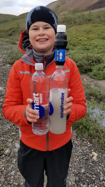 The rain made our stream run with silt, but our filter could handle it. |
|
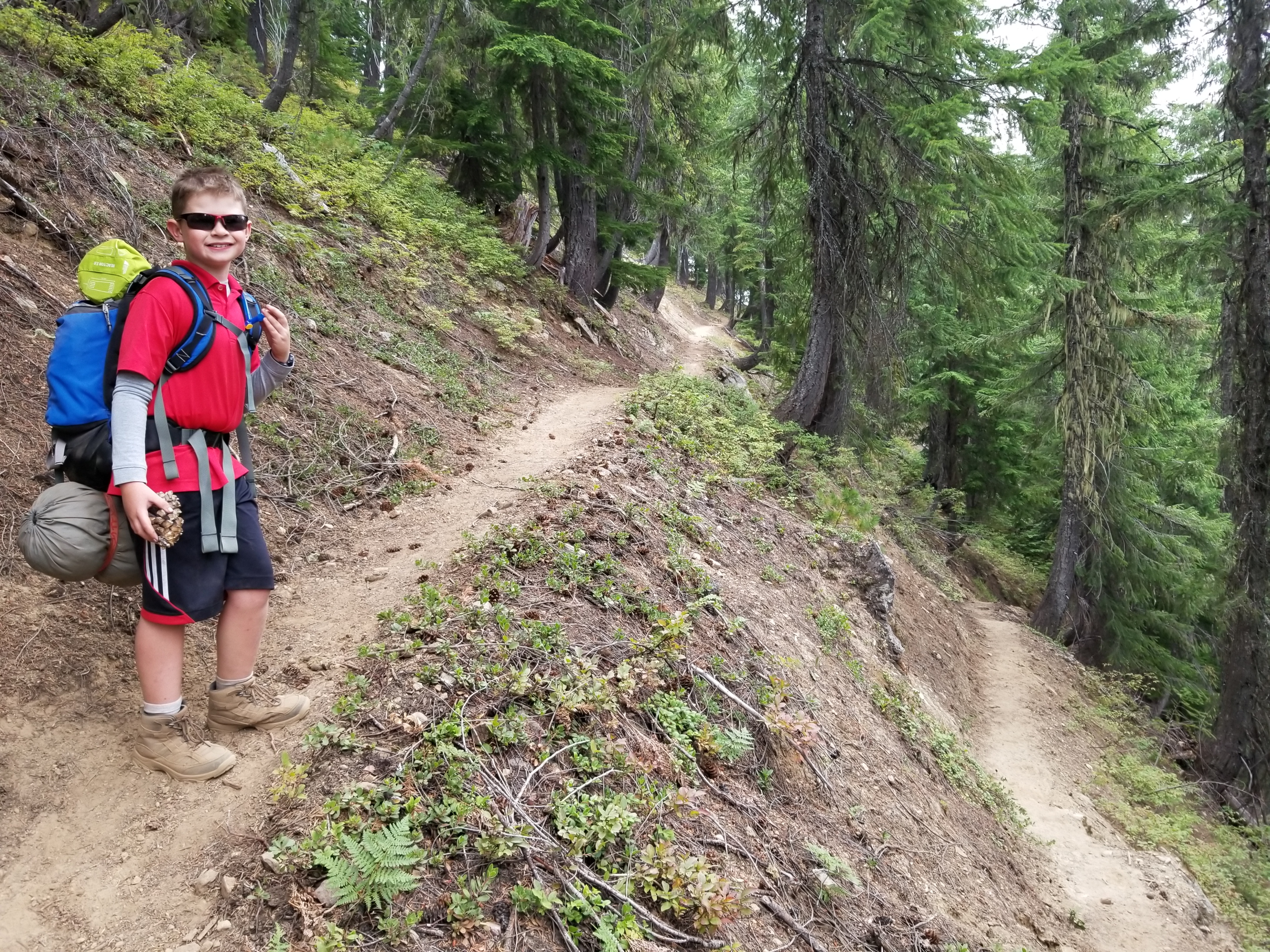
Day 22 (Aug. 6, 2022) It was raining, so we slept in a little. We enjoyed some hot breakfast, coffee, and hot chocolate, then broke camp. We had decided to take a different route home and hike back along the river to make a triangular route overall. We said goodbye to the marmot family and headed off. We knew we had to cross the large river that began with the outflow with the glacier we had visited. We found a spot were the river had many braids, but there was still a pretty deep main channel. Fortunately, we managed to keep our feet mostly dry. We continued down the river, scanning the hills for wildlife. Eventually, the rain moved off behind us and it began to clear. Clear water creeks entered the river from the mountains. We had to stay on the west side of the river due to an area closure for the caribou, but we reached a spot where the river ran right against a very steep hill where we could not pass without crossing. We could either make two possibly dangerous crossings through very deep water or hike up the ridge to cross back to where the river moved away from the hill. We hiked up the ridge and had to walk on super soft moss which was harder than we thought. I kept rolling my ankles. There were tufts of grass with moss surrounded by water and when I walked on the top of the tufts, they would try to tip over. At one point, there was a big lake with outlet stream and marshy area that we can to cross somehow. Before having to walk all around the lake, we found a miracle, narrow path of high ground that snaked across the stream and marsh. It seemed like it was an old beaver dam that had become overgrown with grass. I was hot, tired, and hangry, so it was a tough hike across the high ground, but we finally began to make our way down to the river. After bushwhacking our way down a very steep and bushy slope, we made it to the river. In this area, we found an illegal fire ring (no fires ever allowed in the Denali backcountry). We picked up the trash, dispersed left over wood and noted the location to tell the rangers. We also noticed many bear scat. As we neared the bridge and roadway, the end of our hike, we knew we had to cross another river coming from the west. It turned out to be much deeper and faster than we thought and there were no other good places to cross. I followed Papa in to the water, holding on to his pack. I had water over my waist and I almost got washed away. The water pushed me back from Papa. He took a few steps backward so I could grab on again. We managed to take a few big steps to cross the deepest part and finaly make it to the other side. We got to a little forest area where we saw a Ptartmigan. There was a ranger truck on the road with lights flashing. We kept our eyes out for wildlife. When we got to the end and made our way up on to the road, we saw a sign that said area closed due to bears. We talked to the rangers that were working to keep the tourists corralled on the bridge. There was a bear that had crossed the road and was eating berries not too far away. We finally got a seat on a bus and took the long ride out to the park enterance. We enjoyed the nice views along the way. We tried to hang up all of our wet gear, and headed out for our traditional victory steak diner. I had a steak which felt good after a big trip. We got back and went to bed, so tired. |
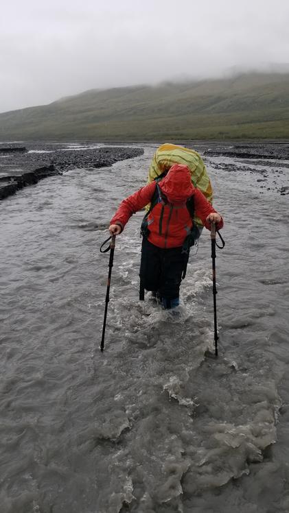 We had to cross the river on the way out. |
 The river braids its way. |
 We climbed a ridge to bypass an area where the river ran deep along a cliff, blocking our route |
 The vast, spongy marsh along our route |
 Water just beneath the surface. We had to talk on tall islands of moss and grass. |
 This old bever damn saved us from walking through a deep marsh or around a pond. |
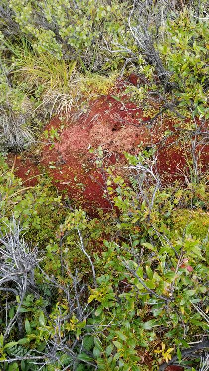 Some of the moss turns red for the fall. |
 I am making it! |
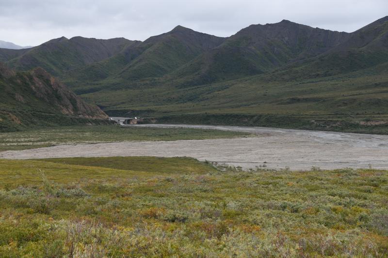 The end of the trek, the bridge at the end of the bus route. |
 Water collecting on a plant. |
 We made it. The river at the bridge. |
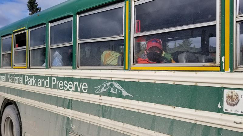 On the bus to head to the park entrance. |
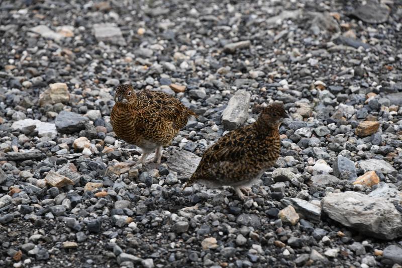 Alpine Chickens! (Ptarmigans) |
 Last views in the park |
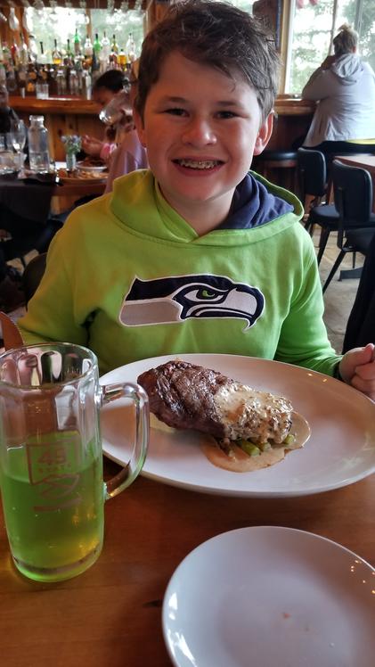 Traditional victory steak after a big backpack! (with spruce tip soda) |
|
|
|
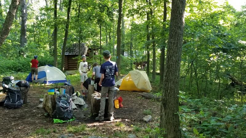
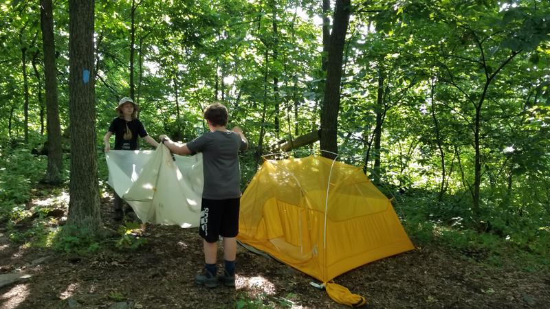
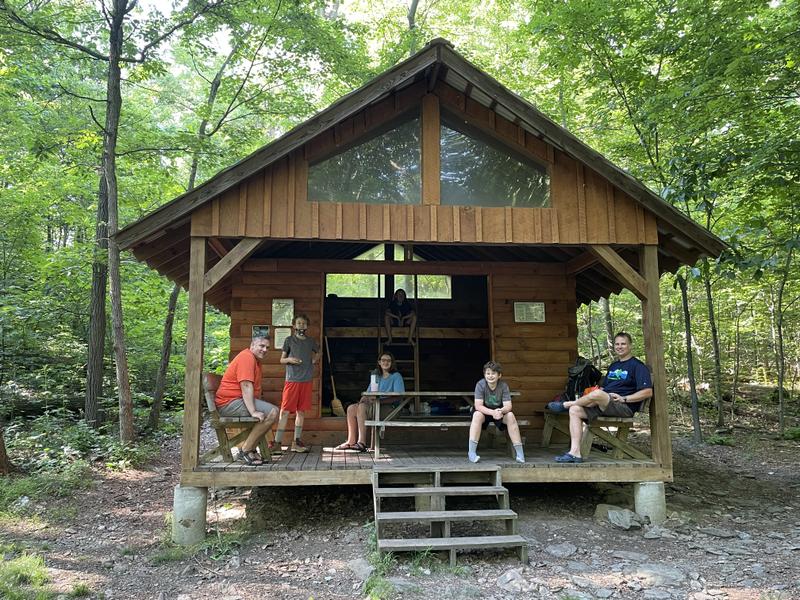
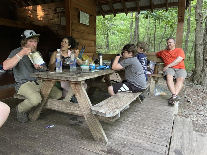
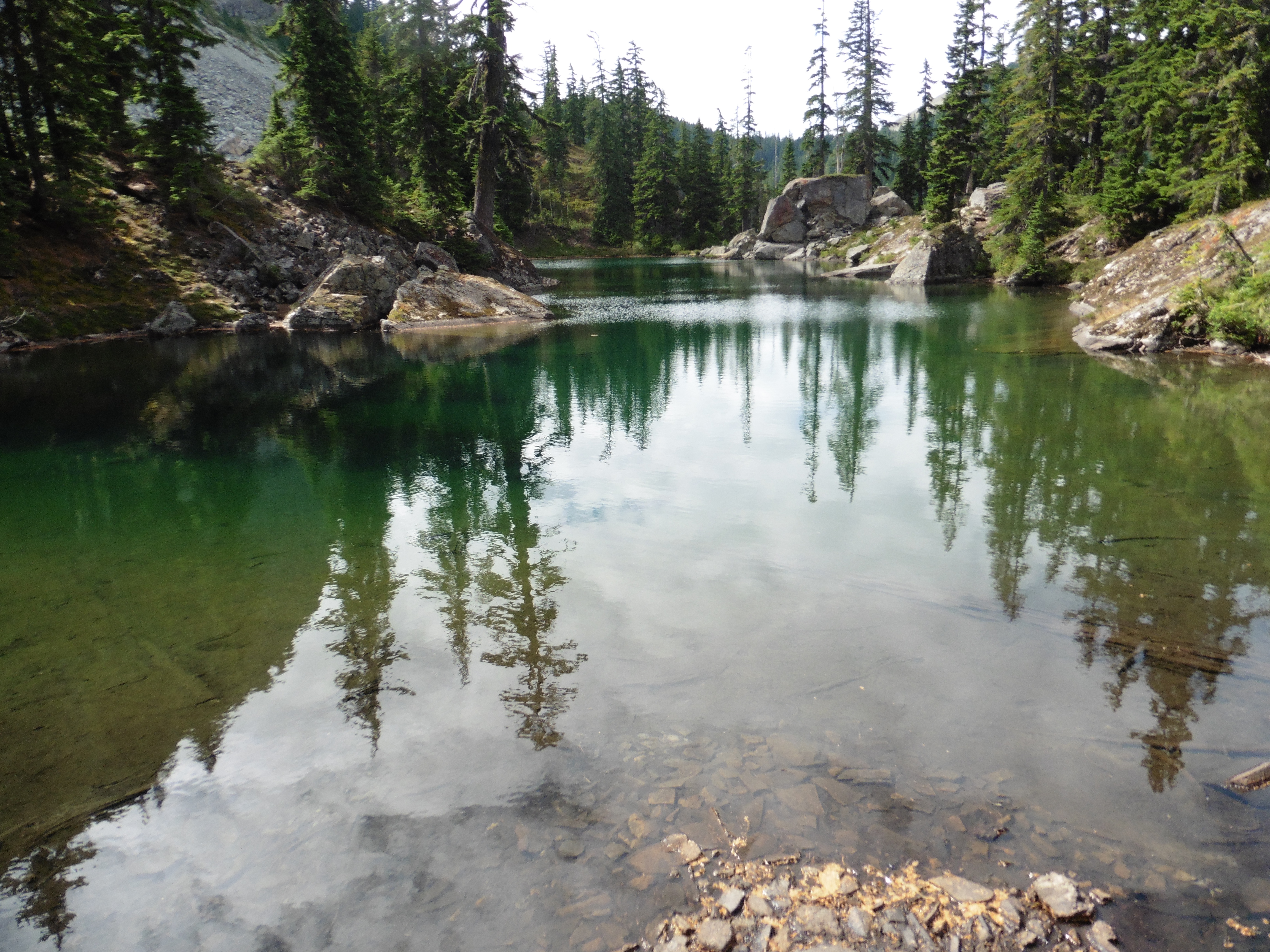
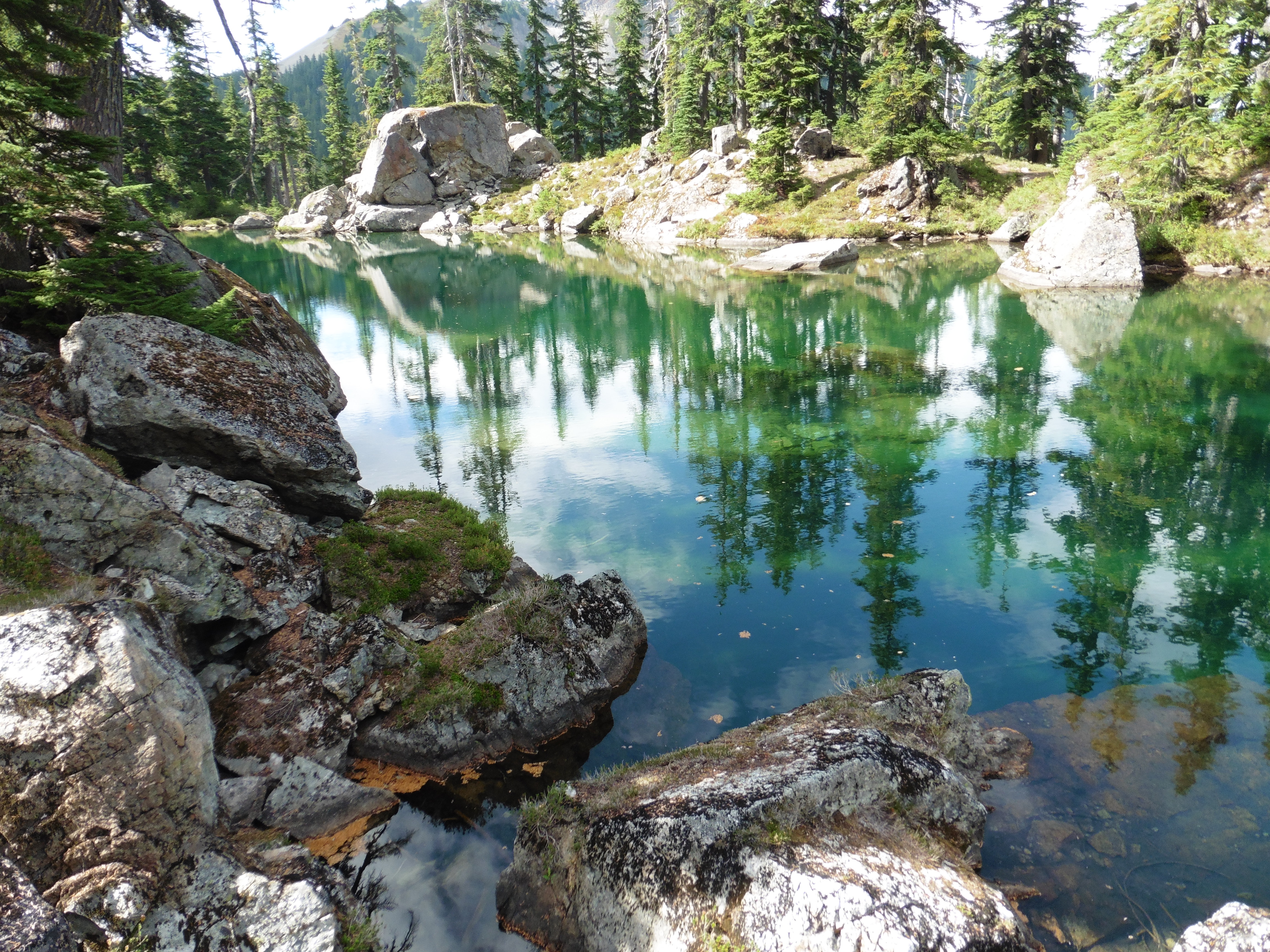
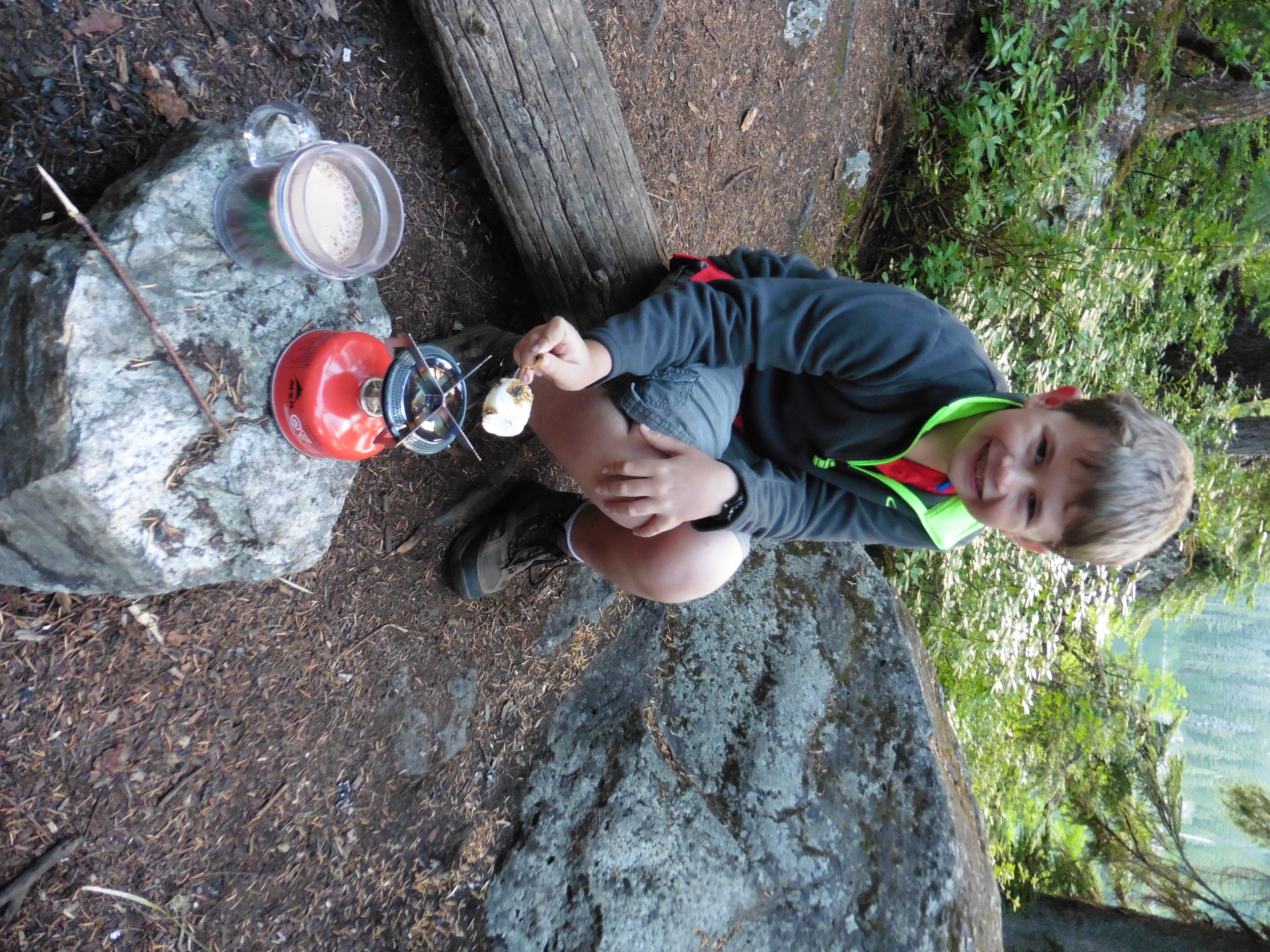
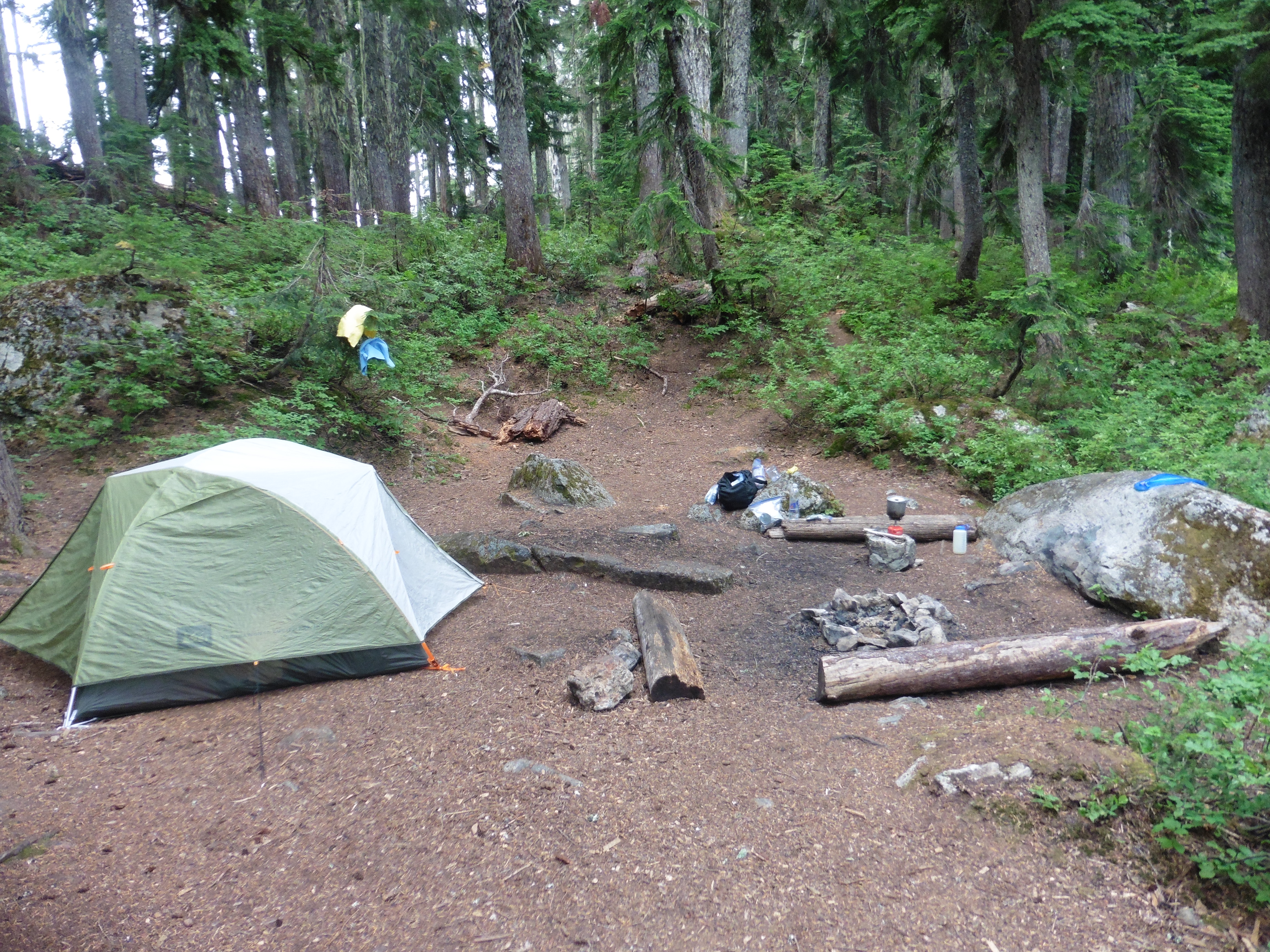
June 4-6, 2021 This backpack was primarily intended to be a training, or shakedown, backpack in preparation for the week-long trek at Lenhok'sin scout camp planned later in June. However, this turned out to be a great adventure and much fun! We started at Weverton Cliffs and hiked about 3 miles to the Ed Garvey shelter on the Appalachian Trail (AT). We stopped at the cliffs and enjoyed a nice view on a beautiful day. The shelter was busy, so we camped in a site near the shelter. We practiced tenting with our buddies, cooking and all of the other activities. The shelter also had a composting potty, so that make life good. The next day we hiked 9.5 miles to the Rocky Run shelter. On the way, we passed through Gathland State Park, where we learned some history and filled up on water. We hiked at record pace, covering 6 miles in 3.5 hours, including lunch. The shelter was not very busy, so we slept in it, which was a fun experience. There was a stream, so we could filter water, and even wash off. Some AT thru hikers stopped by for dinner and we had a chance to talk to them. They had already hiked 1,000 miles from Georgia and were about halfway. It sounded like a great thing to do one day. There was an interesting couple from WV at the shelter, but they were nice. The next day, we hiked on, another 7.5 miles, to finish just past Greenbrier State Park. It was a successful shakedown and a fun experience on the AT. |
 Weverton cliff view and snack spot. |
 The 'Boyz' on the trail. |
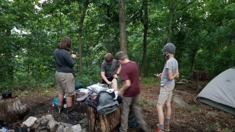 Preparing to cook near Ed Garvey shelter. |
 Setting up camp. |
 Breaking camp. |
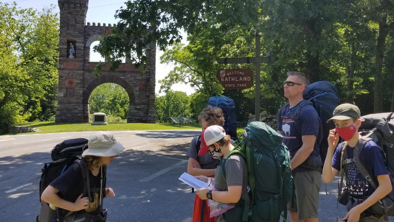 Navigating at Gathland SP. |
 View at rock on the trail. |
 Papa and I at the viewing rock. |
 The Rocky Run Shelter. |
 Talking to the thru hikers at the shelter. |
 The 'Boyz.' |
 Crew at Washington Monument. |
 Crossing the bridge over Highway 70, marking the end of the trek! |
 Customary Steak dinner after a tough trip! |
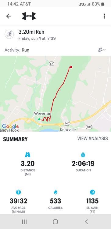 First day map. |
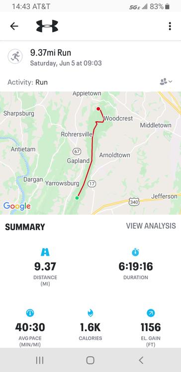 Second day map. |
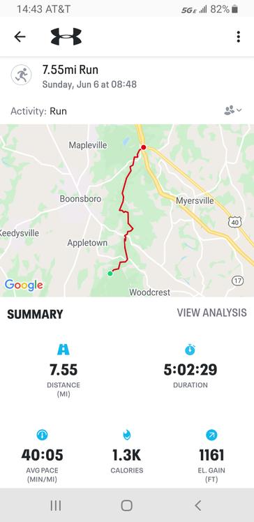 Third day map. |
|
|
|
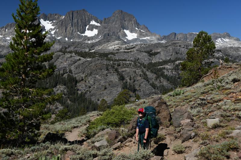
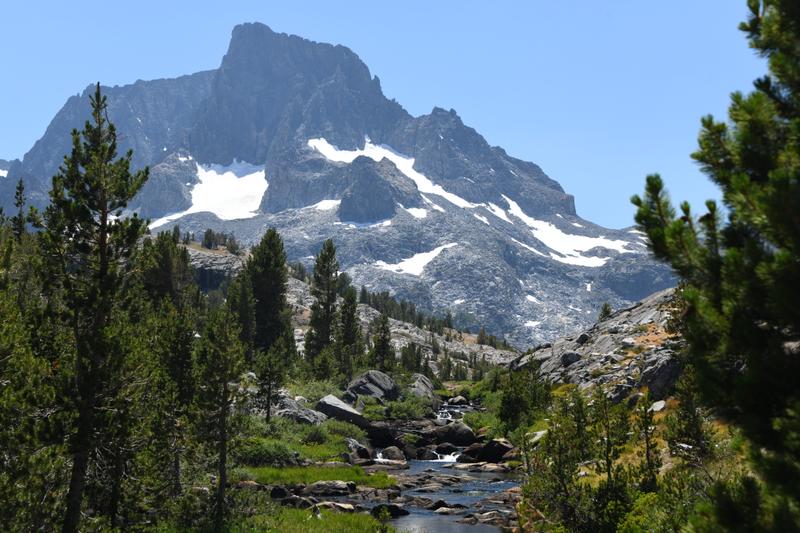
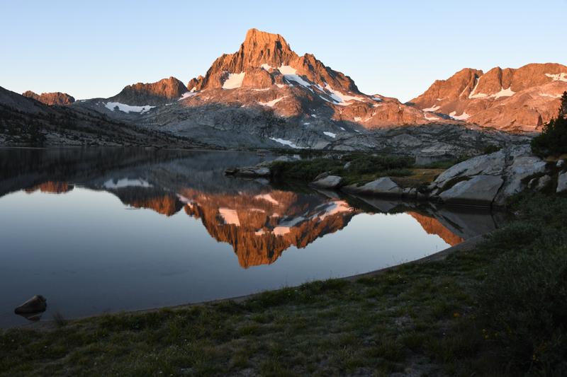
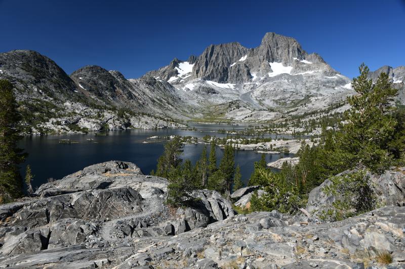
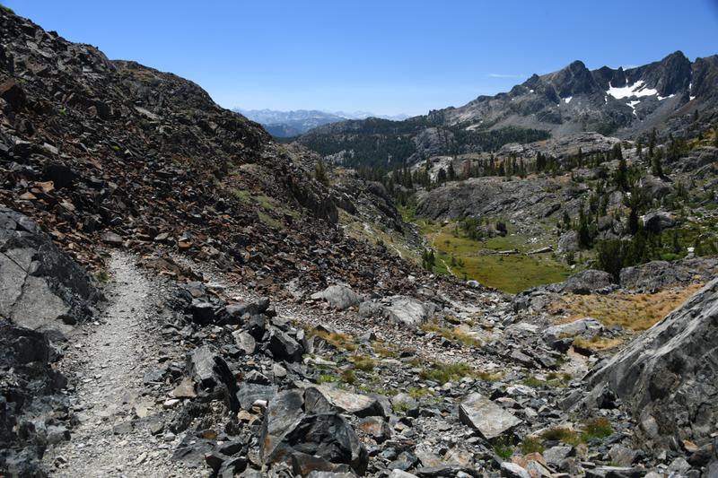
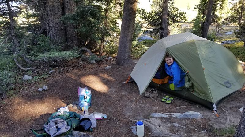
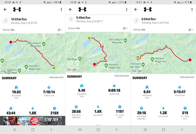
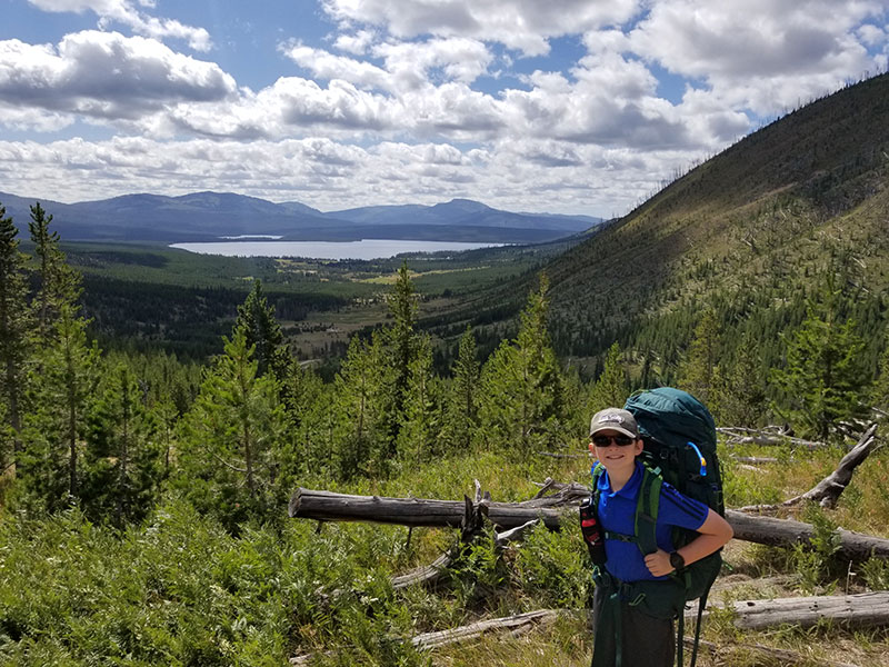
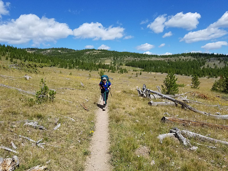
Day 13 (Aug 2, 2020) We woke up early to get to our trail because a lady at a store had told us to get there before 7 to get a parking spot. Juju helped us get out the door early and we had breakfast in the car. We started our backpack and the first 3 miles where very very hard on our legs as we had to climb about 1,500 ft. I had a 27 pound pack and Papa had 48 pounds. On this part of the trail, we had amazing views of Mt. Ritter and surrounding peaks, Shadow Lake, the valley below, and the rolling granite mountains. We had to stop every 3 miles because I needed to rest. We sat on a rock on the edge of a cliff to enjoy the great view while we ate lunch. The trail we were on was the actual Pacific Crest Trail. We hike it for about 10 miles. This marked that 3 out of 4 of our backpacks were on the PCT at some point. It followed a high route that meandered through meadows, forest, aspens, tall brush, and had a number of stream crossings as water came down from San Joaquin Mountain. The trail finally curved toward Mt. Ritter and 1,000 Island Lake, or destination. We had to hike up some tall steps and I was very tired. We reached an area of waterfalls and small lakes. Papa said it was the most beautiful set of lakes, river, and waterfall that he had ever seen. Finally, we made it to Thousand Islands Lake. The lake was at 9,800 ft. The hike was 10 miles with 2,200 feet of gain. Papa had me wait at a camp site while he looked for a better one. He came back without his pack and we went to the new site. It was a good campsite because it was set back from the lake with some trees for shade, there was an area to go to the bathroom behind the site and we had our own beach in front. We pitched our tent and filtered water from the lake to refill our camel backs. We played in the lake and then Papa took a shower using his solar shower. It started to get cold, so we put long clothes on. I used the backpacking stove to cook all of our food. For dinner, we had chicken and dumplings and beef stroganoff. It was so so yummy. We ate on 'coffee' rock, looking out over the lake, across to Mt. Ritter above. We had raspberry crumble for dessert, which was also super yummy. We hid our super fat bear container so a bear would not move it too much. We went to bed and played cribbage. The moon was so bright it woke me up many times. |
 Just starting the hike and the climb. |
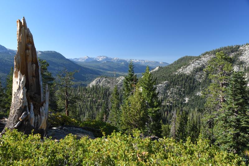 A view south of the Sierras. |
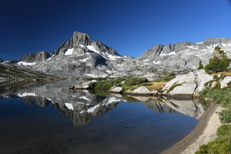
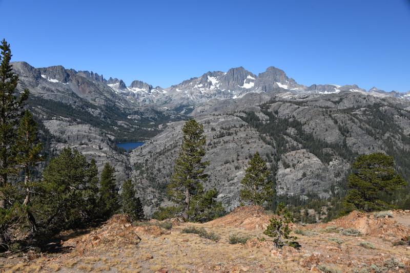 The wilderness we will explore. Shadow lake with Lake Ediza hidden in the hills behind. Mt. Ritter is the peak to the right. Hidden behind the rolling. granite hills to the far right is Thousand Island Lake. Garnet lake is hidden in between. |
 Making our way along the High Trail. |
 The layers of the mountains had many colors. |
 Thousand Island Lake outlet waterfalls and ponds, with Mt. Ritter above. |
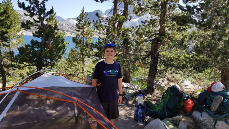 Our Camp at Thousand Islands Lake. |
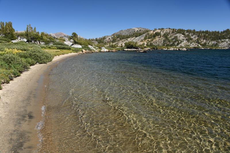 Our little beach. |
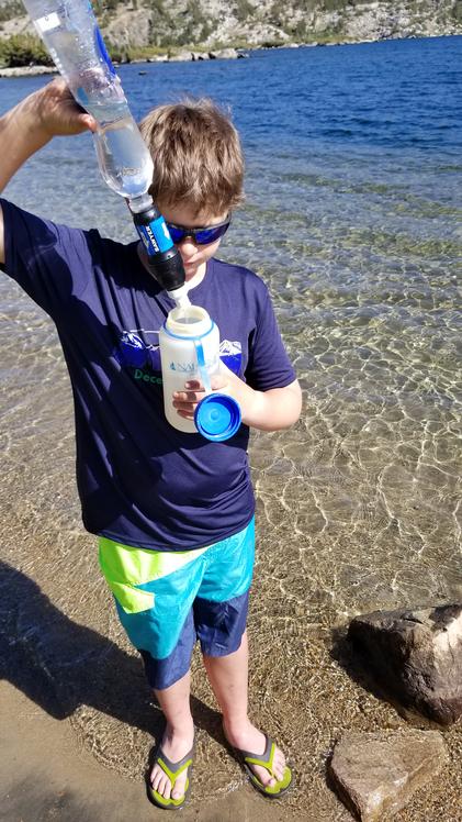 Filtering water. |
 Wading in the lake. |
 The cove with our camp in the trees. |
 Nearing sunset on our first night. |
|
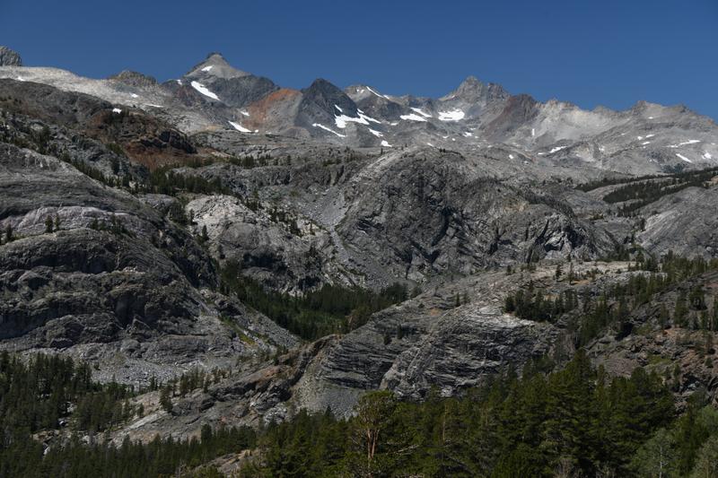
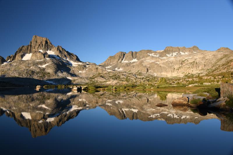
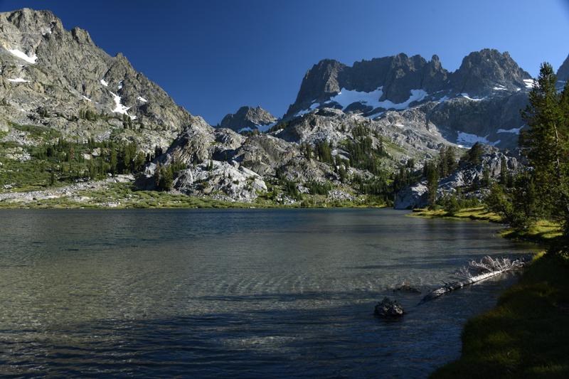
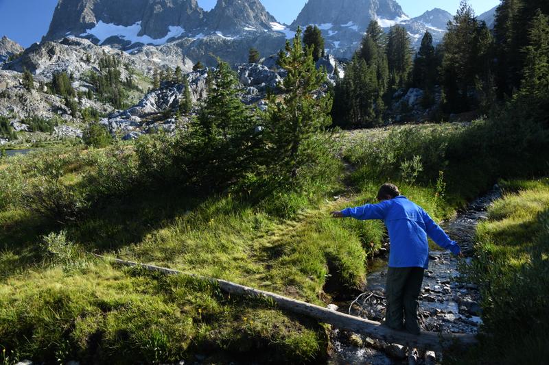
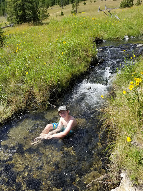
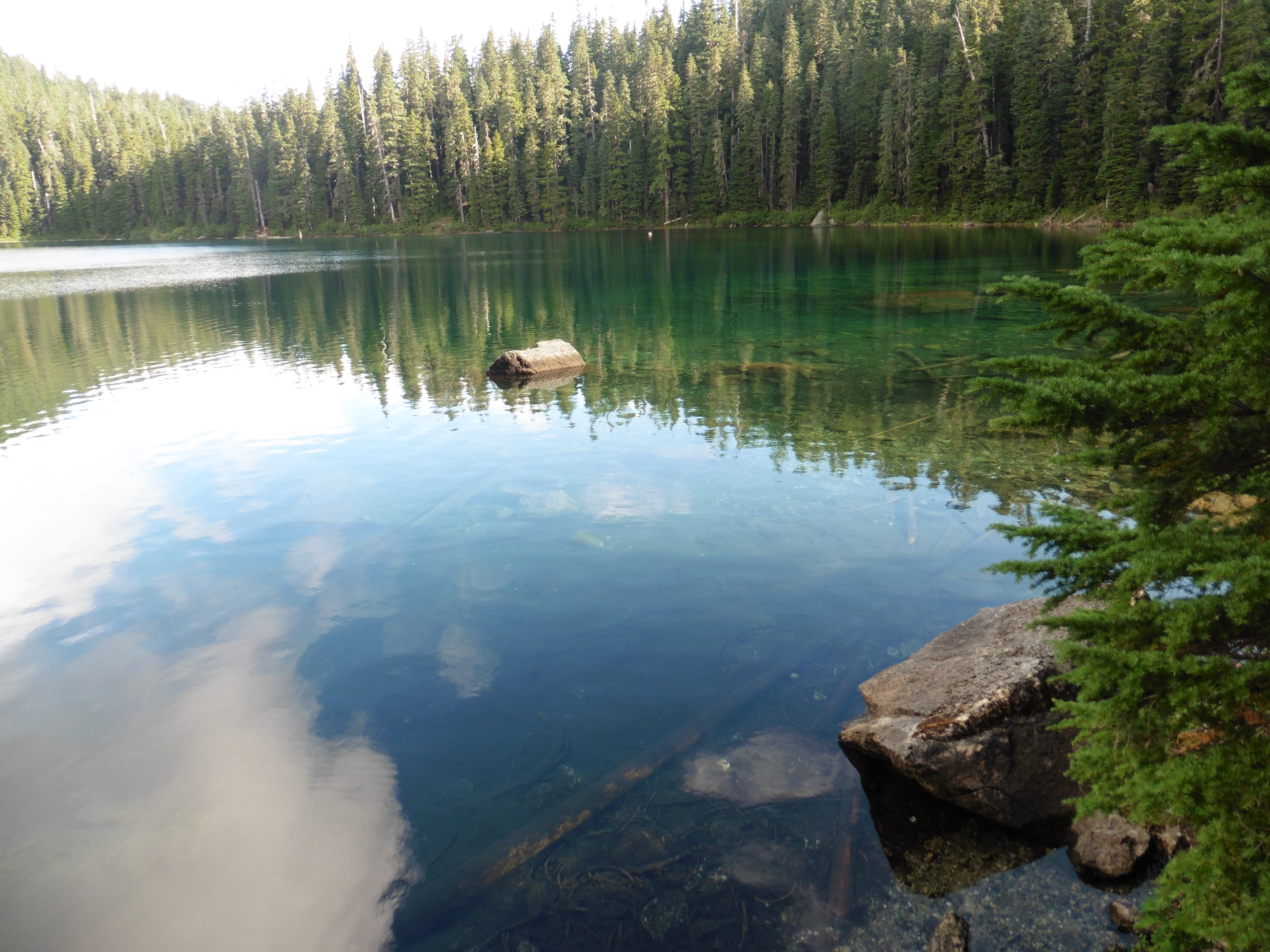
Day 14 (Aug 3, 2020) We woke up at 5:30 am and packed up our stuff. Then we make breakfast, which was eggs and bacon, oatmeal, and some leftover raspberry crumble. We ate on coffee rock and enjoyed breakfast with hot chocolate and coffee. The lake was glassy smooth and we could easily see the reflection of the mountains. As the sun rose, the colors on Mt. Ritter changed from orange to bright yellow. In the cool morning, we felt relaxed and lucky to be there. We were in the middle of California, in the High Sierra's! We started our hike and we had to go up over a pass above 10,000 ft. To start the morning, my spirits were high. We saw some Pika building a nest and we got to watch one eat for a while. He was unusually comfortable being close to us. His friend made some calls and he called back, using his whole body to go 'squeak!' We passed Ruby Lake, a small alpine lake in a bowl at the base of two steep ridges, and finished the climb over the pass. We stopped at Garnet lake and had lunch on a nice rock overlooking the lake. After going around the outlet to Garnet lake, we went up again, over a second pass above 10,000 feet. We descended down an area of rocky rubble, then across a meadow, and down in to a forest. On this part of the trail, we were on the John Muir Trail that goes from Yosemite to Mt. Whitney. We went down and down and it seemed like forever before got to the trail junction with the trail to lake Ediza. On the way up to Ediza, we had to go up some steep rocky areas with steps that only the donkeys could climb. We even had to go through a donkey poop canyon. We were passed by a few people going to the same lake and I was nervous we would not find a good campsite. I asked Papa to go ahead and find us a good one. He told me where to go on the map and said there was a river crossing that might be scary. He told me to wait at the river if I was not comfortable crossing. A large group of people passed me and then we arrived at the river crossing. Little did I know, Papa was just on the other side, waiting for me, but when he saw the large group of people, he went on to stay ahead of them. Some of the large group took off their boots to cross the river, but some jumped across on some rocks. They showed me the way and I went ahead and did it myself. I was walking along the edge of the lake and then I saw Papa wave as he was coming back down the trail. He was very happy that I had made it across the river on my own, as it saved him from going back another mile to get me. He showed me to the campsite he found, it was a long way around the lake, but it was another good one. We had a spot in the trees, with a path to our own beach and some rocks to use as 'coffee' rock. We pitched the tent, filtered water and had a snack. We waded in the water. Papa took a shower and I took a little nap. We explored around the lake and found a group of some kind of 'alpine' prairie dogs. They stood up and barked warnings as we arrived. They ate the grass and there seemed to be some younger ones around, too. They were so cute! We cooked dinner up on the rocks by the lake. We had chicken and mashed potatoes and chicken and dumplings. We made some chocolate cheesecake for dessert, but saved most of it to have with breakfast, as we did not have much food left. When we went to bed, we played cribbage and I won this time. Papa went out of the tent to try to take some night photos before the moon came up. |
 Sun just starts to rise. |
 Sun warming the tops of the peaks. |
 Warm sun reaches us on the lake. |
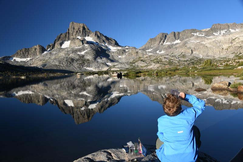 Breakfast on 'Coffee' rock. |
 Reflection in our cove. |
 Meadow and lake as we climb up from Thousand Islands Lake. |
 Pika squeaking back to his friend. |
|
So Cute! (Video) |
 Garnet lake with our lunch spot below Mt. Ritter. |
 Outlet creek at the bottom of Garnet lake. |
 Pass summit at 10,000+ ft with the rocky area, meadow, and forest below. |
 Our camp at Lake Ediza. |
 Lake Ediza near our camping area. |
 Playing around by the lake. |
 Alpine Prairie Dog! |
 Sun setting behind Mt. Ritter. |
 Cooking dinner. |
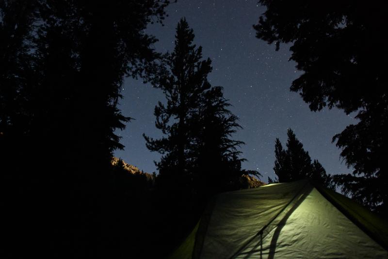 Stars over our tent. |
|
Day 15 (Aug 4, 2020) We woke up at 5:30 am and packed up our stuff. I cooked all of the breakfast, which was eggs and bacon and the leftover chocolate cheesecake. We ate on coffee rock. Papa's coffee wasn't the best as I spilled some when opening the packet. We watched the top of the peaks start to glow with the rising sun. The sun came up and warmed us up on the rocks. Since we had to hike to the back side of the lake to camp, the sun was in our eyes. We decided to finish packing up and hike to the other side of the lake. We found a nice rock in the shade to sit on. With the sun behind us, we had a very nice view of the mountains and the reflection in the smooth lake. We got out the stove and I made Papa another coffee. We sat on the rock and enjoyed the view and talked for about an hour. It was very relaxing, with the cool rock in the cool morning. We talked to some of the hikers that passed on the trail nearby. We finally hit the trail and made our way down pretty quickly in the beginning. We were talking all along the way. We made it across the river crossing without incident, then, we made it down all of the steep sections I hated the day before. We made it to Shadow lake and stopped for lunch. It was also a nice lake. I had to go potty, so I hiked up the hill away from the lake and dug my hole. The trail down from Shadow lake was very steep, so I took my time. A hiking wiener dog came up the trail. The owners said he liked hiking and could make it up the steep rocks and steps. It seemed to be a very hard hike for a wiener dog! We had nice views of the big water falls coming out of Shadow lake. We also saw a number of twisty bristle cone pines. They could have been very old as the oldest tree in the U.S. is a bristle cone somewhere in CA. My feet started to hurt on the steep downhill. Finally, we made it to the bottom of the valley and to the main creek. We followed the creek on the way out and made better time. I was ready to finish the hike! We had a final climb up to Agnew Meadow. While climbing up the hill, at around mile 25 for the trip, I told Papa that all of the hiking was worth it as I really liked the lake views and the camping. It had been a great trip. I felt guilty about being happy to be making it home as I had had fun on the backpack. We finally made it to the parking lot! As we arrived to where the car was parked, a crew was putting up 'no parking' signs all along the road, including where we parked. We drove to Mammoth Lakes to find some lunch. Not many places were open, so we got burgers at Carl's Jr. and started driving to South Lake Tahoe. We had a scenic drive up and down the mountains to Tahoe. We finally made it and met Juju at the RV! We had sheppard's pie that she had made for us. I took a nap in the hammock. We cleaned up and had a nice fire. Then, we were very ready for bed! |
 Sun starts to rise. |
 Mt. Ritter aglow. |
 Our cove begins to warm up. |
 Sunrise at the lake. |
 View toward the outlet with the rising sun. |
 Easy creek crossing (not the hard one) on the way around the lake. |
 Mt. Ritter above Ediza. |
 Alpine prairie dog eating some greens. |
 Making Papa some coffee on the cool side of the lake. |
 Beautiful view. |
 Awesome reflection. |
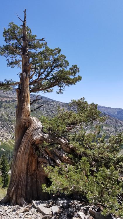 Bristle Cone Pine on the way down from Shadow Lake. |
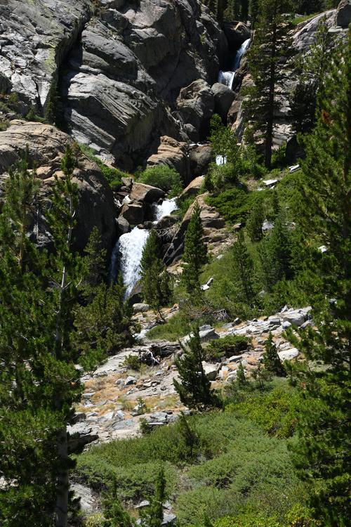 Waterfalls coming down from Shadow and the lakes above. |
 We made it! Our trip stats. |
|
|
|
We woke up at 6:30 and we got ready for the backpack. I was so nervous that I had to go potty 3 times before starting on our
hike we saw some hot thermal features, they were breathtaking. Some of them were boiling. We went in a river
that was heated by a thermal feature. It felt so so good. The downside was there were some little red worms on
us when we got out. We had to check to make sure there were all off. On the last 2.5 miles my foot hurt so much that every
time I put weight on it. I went, "OW OW OW." We got to camp and I had hiked 9.5 miles with a 30 pound backpack. At camp
we set up our bear bag, then our tent. We ate a snack at the lake, the lake is super pretty. We saw a tiny toad by the lake. We took a shower and
the ate dinner. On the menu was freeze dried chicken and dumplings (Mm mm). For dessert we had a raspberry crumble,
so delish. We saw two chipmunks playing around a stump, they were so cute. We also watched a mommy birdie feed
a little baby birdie. The lake was pretty at sunset. Then, we went to bed in the tent. The water filter worked well
to make us very tasty water. We woke up at 6:30 and made some breakfast, scrambled eggs with bacon (my favorite) and leftover desert. We did a 7 mile hike. We saw 2 skulls with antlers on them. The hike took us through some old growth forest that had not been burned in the fires. I had to wear a brace because I had sprained my ankle and the brace clip scraped my skin. Papa was good at wrapping the brace that he carried in his first aid kit. After the hike, we sat at the beach and we saw a weasel and it looked at papa and I funny. We took a nap on the beach. We ate dinner and then we slept on the beach. Papa and I herd a growling sound. I woke him up and Papa asked if it was him snoring. Later, he heard it too, it was super adrenalin rushing. Sleeping on the beach in the open was a very cool experience. The moon was so bright, we could see it through our sleeping bags. We woke at 5:50 and packed up. We had another nice breakfast on the beach. We left at 8:50 and our first 2 miles were 20 minute miles. I did great on the first half of the hike, up the hill. My foot was hurting at the end. I said during the trip, "this was the best backpacking trip ever." If my ankle did not hurt, it would have been even better. |
 Hiked through the forest to get the first view of the lake. |
 Trail through the exposed valley area. |
 Soaking in the warm water. |
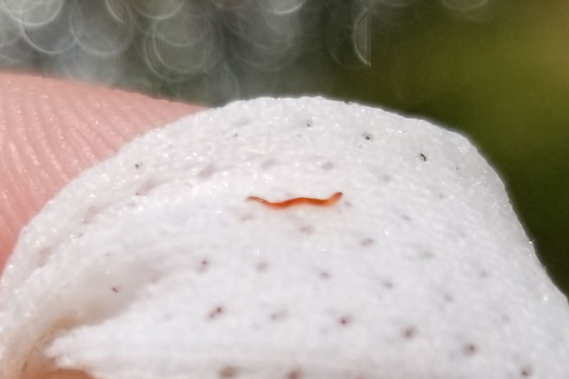 Little red worms on us. |
 I had to jump to cross the stream. |
 Made it to camp! |
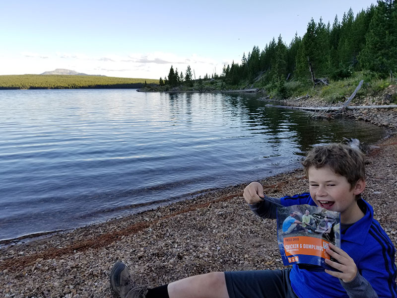 Chicken and dumplings are my favorite! |
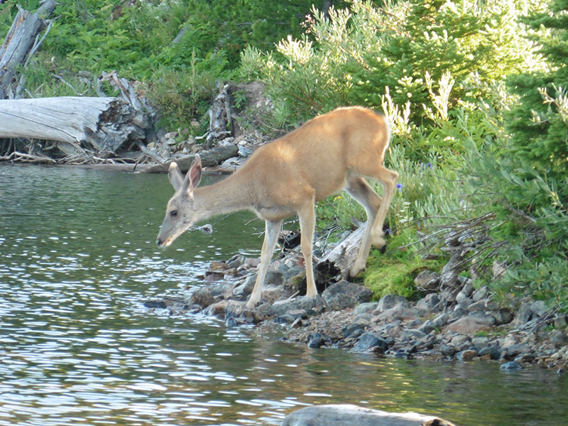 A deer came down for a drink. |
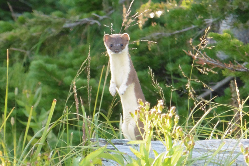 Cute weasel! |
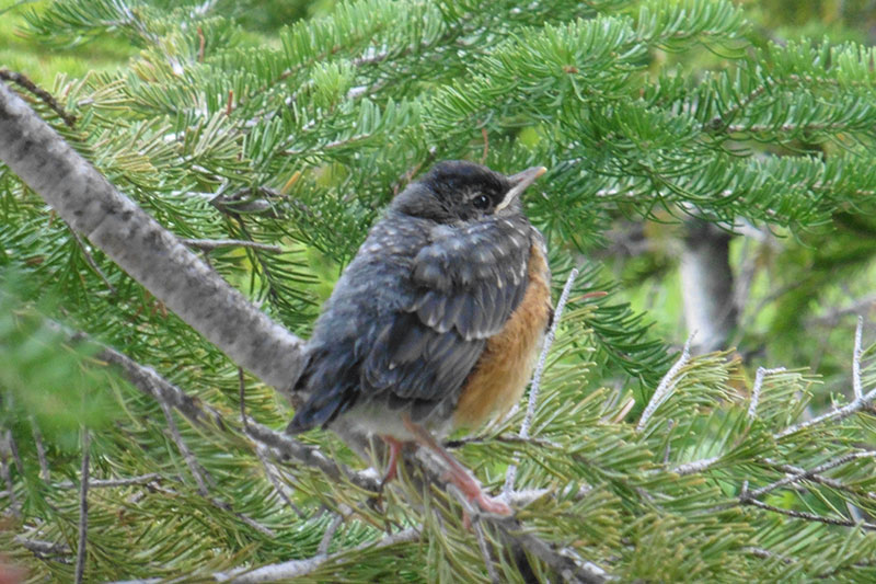 Baby robin in the alpine. |
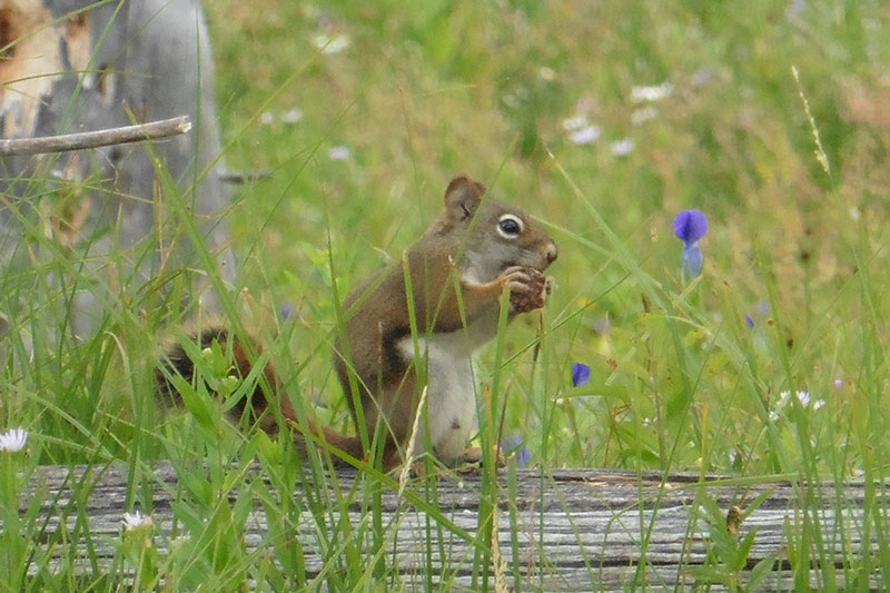 Yum, yum, nut! |
 Foggy morning since the lake is warmer than the air. |
 My ankle wrap. |
 There are bears here! We saw scat, too! |
 Elk antlers. |
 Sleeping in the open on the beach. |
 Making our meals. |
 Thermal feature. |
 Hiking out. |
|
|
|
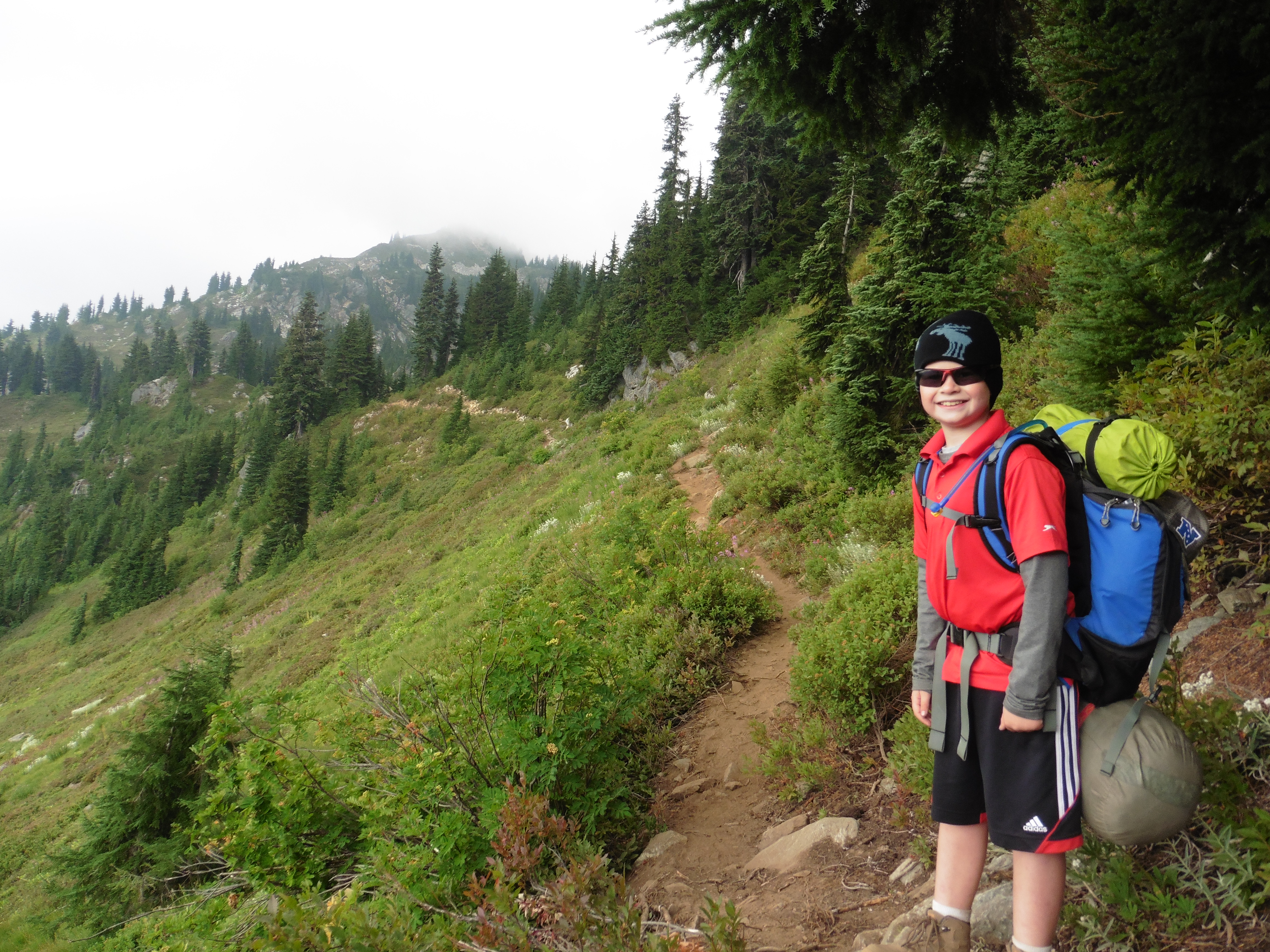
We woke up early and drove up through Steven's Pass from Grandma and Grandpa's house. The planned route was to hike up Cady Ridge Trail from the Little Wenatchee Trailhead to get to the
Pacific Crest Trail and camp at Jane Lake. Papa thought it was 6 miles. I had a 23 pound pack, and Papa's was 45. We started hiking and there was a beautiful river to cross. The hike started
in a nice forest, but the trail was already going up. In the forest, there was a lot of moss hanging from the trees. Then, the trail turned out of the
forest and really started going up. I started to complain. Then, I really started to complain. I didn't think I could make it. As we went further,
I didn't think I could make it up or back home. This part of the hike was 2,000 feet of gain over 2.5 miles. The trail was loose dirt and slippery.
Papa carried my pack for a while, and encouraged me to keep going. We saw some huge pine cones along the way. Finally, we made it up the steep part of
the hill! Papa carried my pack for a while longer, then gave it back to me as we hiked the flat part of the ridge. We came across some nice meadows. As Papa tracked
our progress on the map, due to various trail junctions, it seemed the hike was closer to 7.5 miles! At one point, while hiking the flat part in the trees
on the ridge, I started talking to Papa about taking my kids backpacking one day. The trail climbed again through some meadows.
Unfortunately, our views were obscured by smoke from nearby wildfires. We could not even see the next ridge across the narrow valley. Finally, we
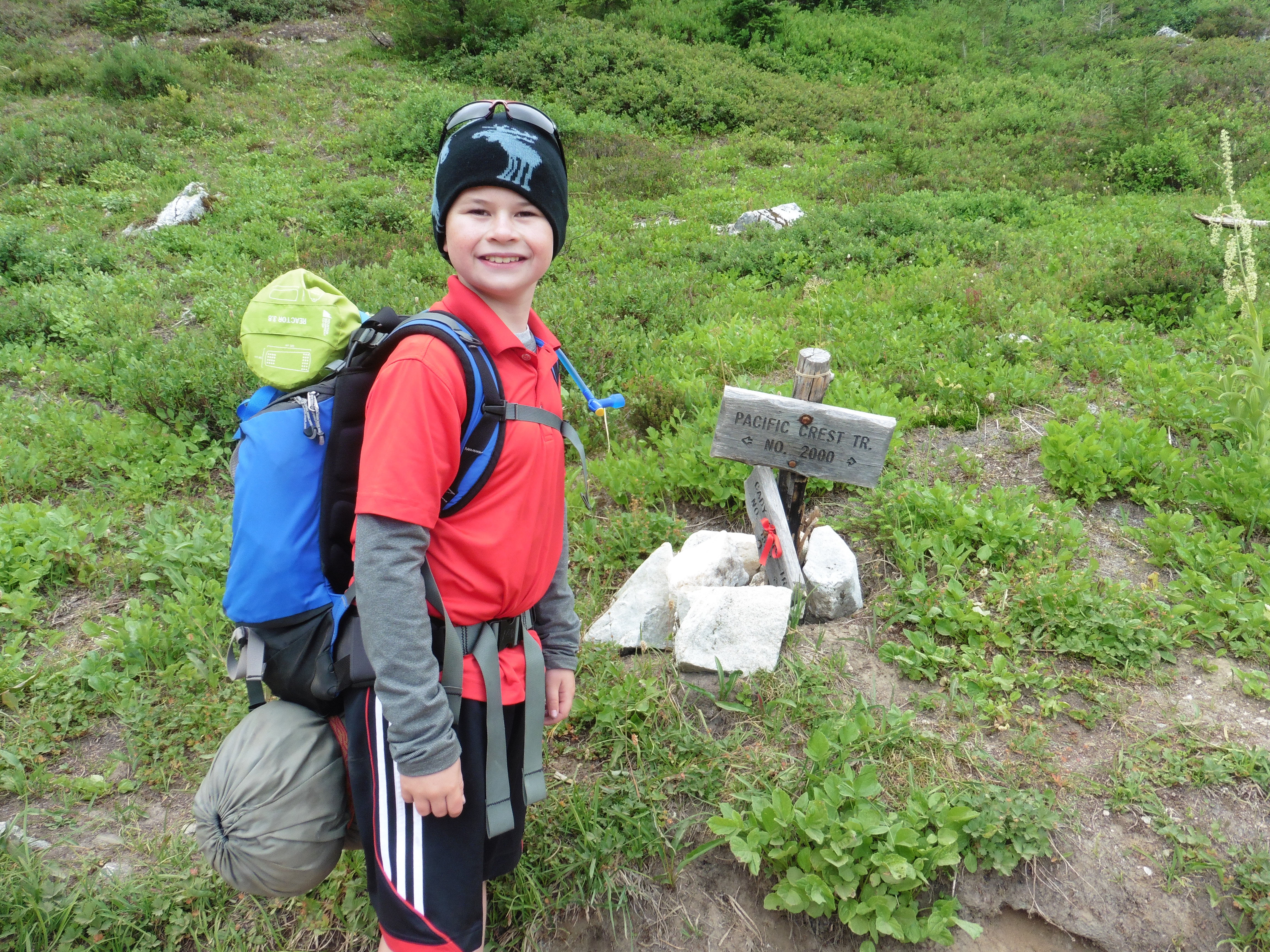
made it to the junction with the Pacific Crest Trail! We hiked the PCT south for less than a mile to get to Jane lake. There was no-one there, so we chose
a nice campsite. It was nice to take off our packs! We set up camp, then explored around the lake. We found a rock that would be our 'coffee rock' for this trip
with a nice view over meadows. We made dinner and boiled water to re-fill our water bottles. We had learned from our last trip, so we shared two full rehydrated
meals. The Chicken and Dumplings was the best. After taking off our boots, Papa had a big blister
from hiking up the hill. I had a rub spot, but not too bad. We used our camp shower to take a shower by standing on some grass. It felt good to get the sweat
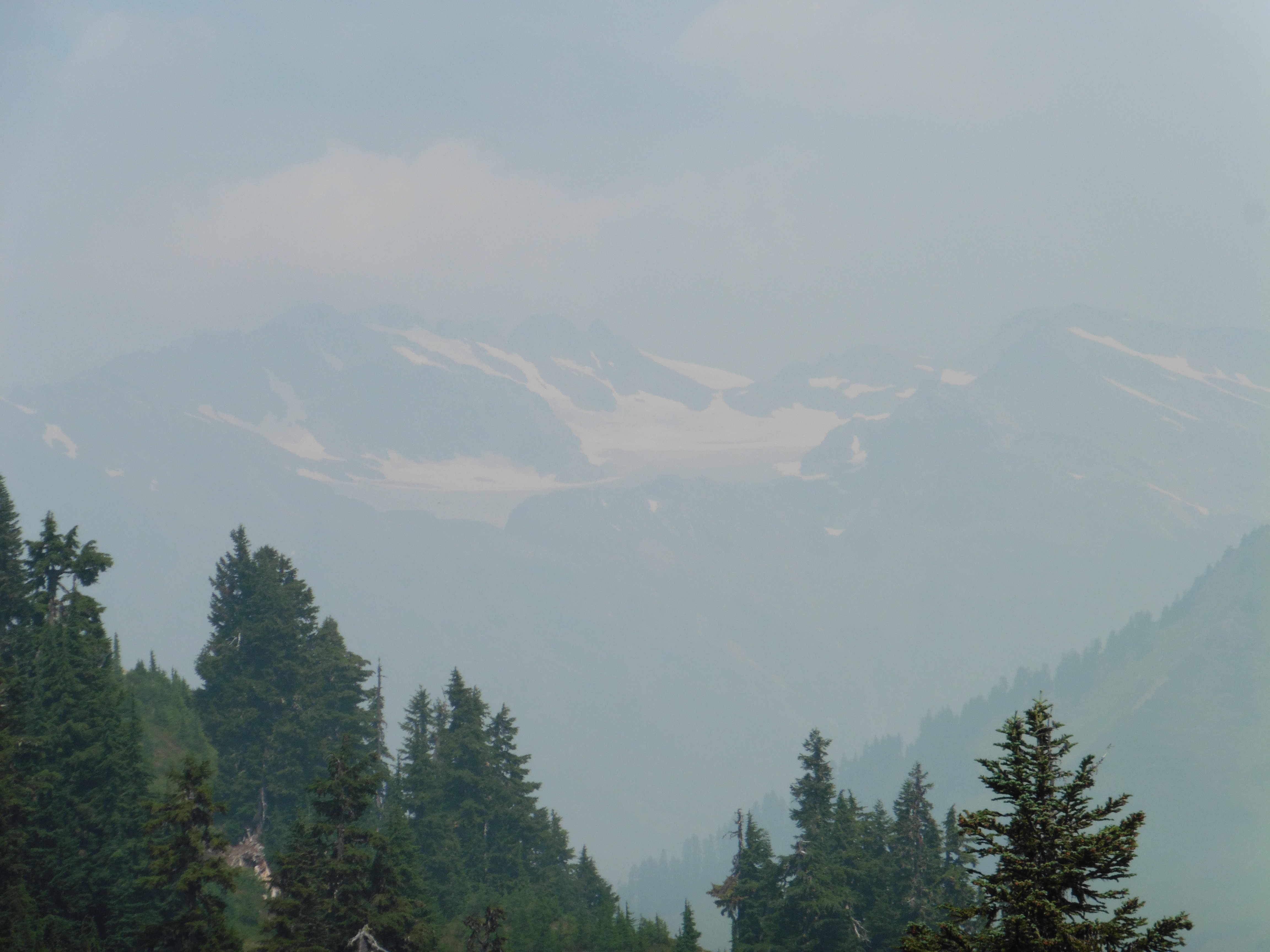
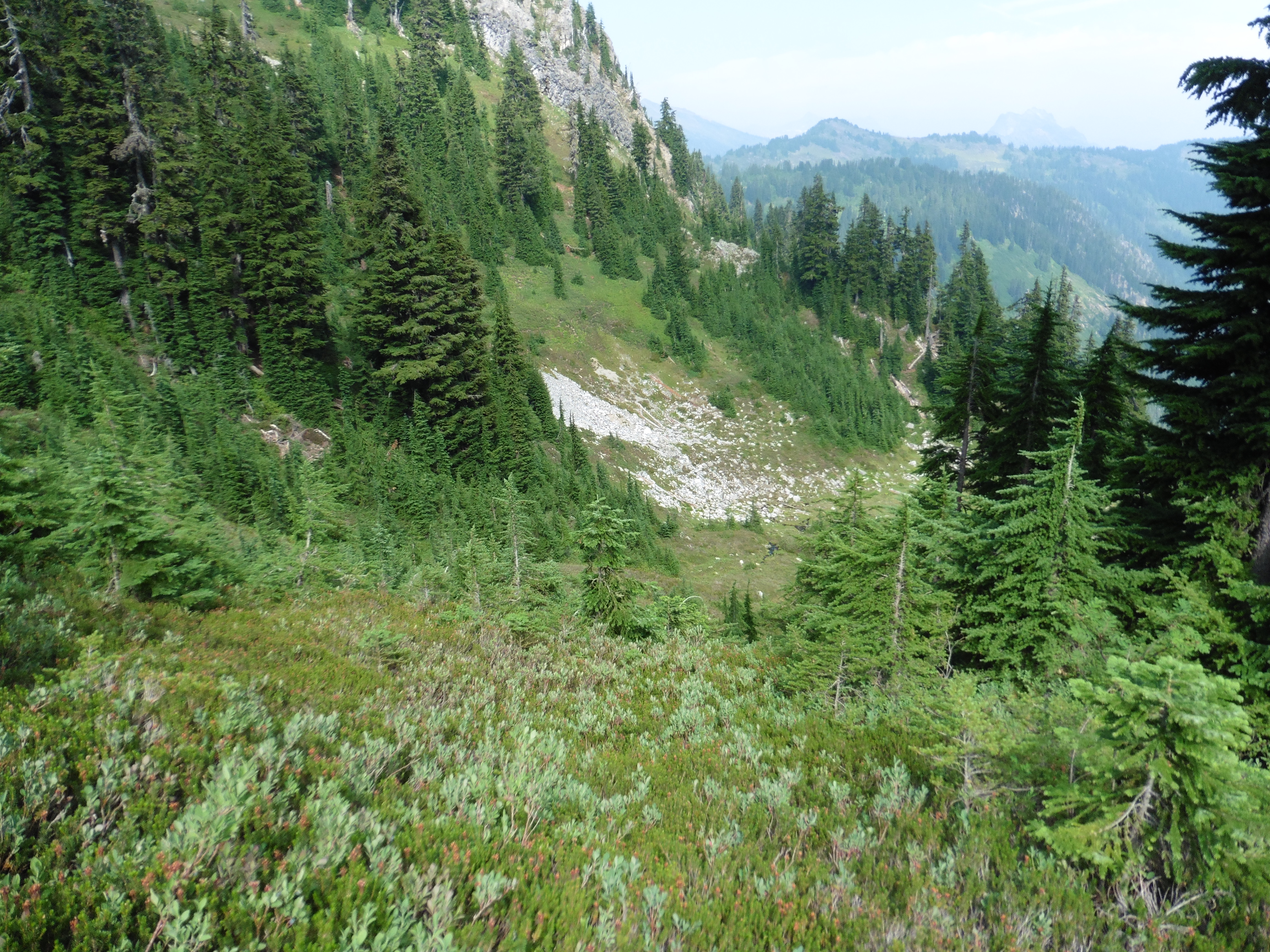
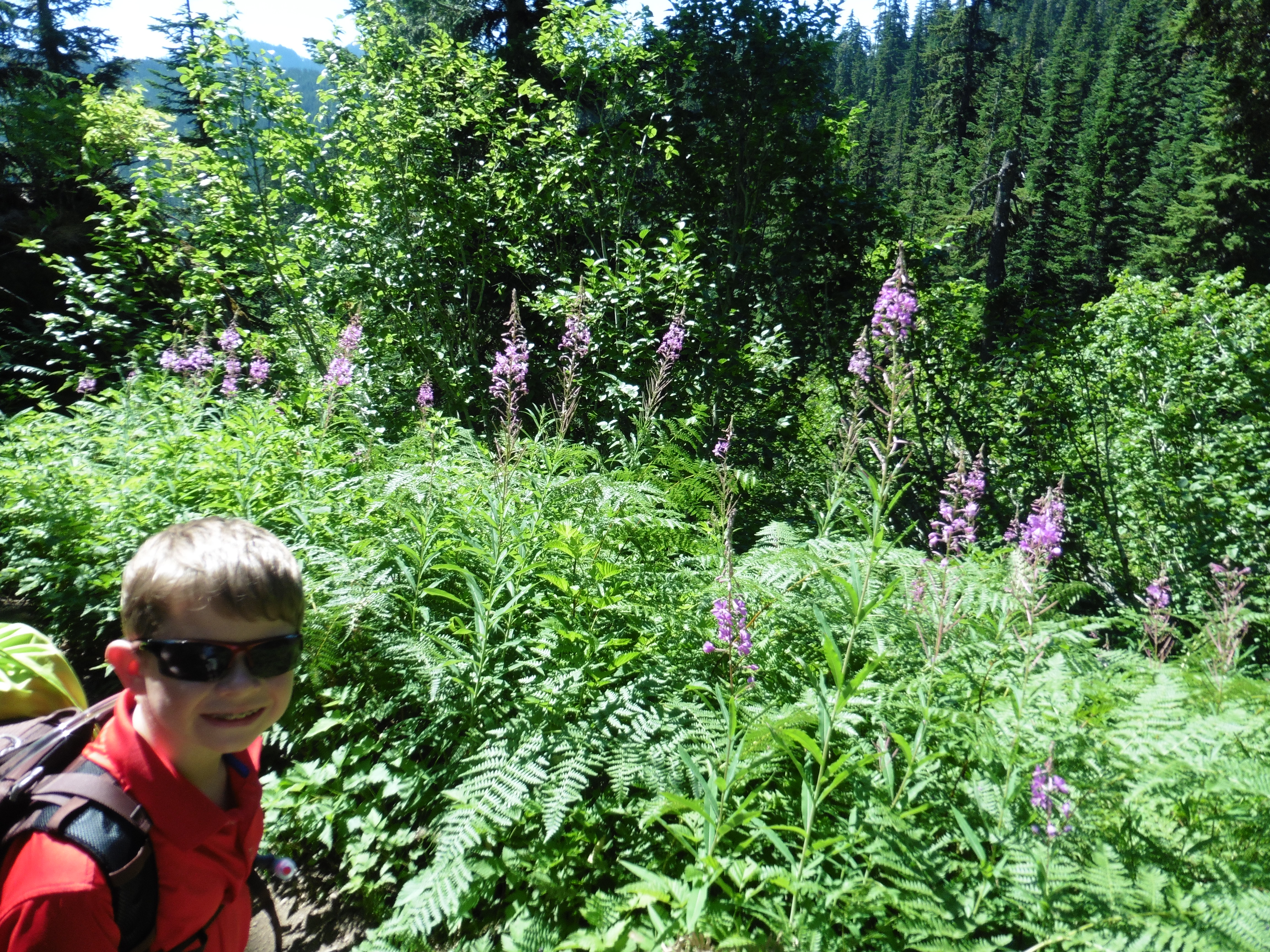
and dust off. We hung our food in a bear bag and went to bed. The next morning, we woke up and made hot chocolate and coffee and enjoyed it on coffee rock with the nice view. Then we made breakfast and ate it on the rock, too. As the water for breakfast finished boiling, the gas for the stove ran out, which was very early in the trip for this to happen. Papa said it was because we had boiled water the day before. Fortunately, we had another gas canister for the rest of our meals. However, we had to go to our back-up water purification method (Papa is a Boy Scout after all), which was tablets, to purify enough water to re-fill our camel backs. Papa said it was not a good thing to have to rely on the back-up method, so we needed a better plan next time. We grabbed our day packs and set off on a day hike going north on the PCT for about 5 miles. We were going to hike to a ridge to get a good view of Glacier Peak. As we started out, we ran in to a bear hunter that was set up not too far from the campground. We talked to him for a minute. He was watching for bears across the valley in the meadow that we hiked in from. Hiking on the PCT was fun. It was relatively flat, and there were many nice meadows and some views. There was still a lot of smoke, so we could not see very far. We reached the turn-around point, and, as per tradition, I had to go potty really badly. Papa helped me dig the hole. Just before turning around, we found some snow! While hiking back, we saw some ground squirrels that were gathering food and running on the trail. We also found a rocky area where we thought we heard a pika, but never saw it. There were a lot of blueberries on the side of the trail and we stopped to pick some, partially filling up a water bottle with berries. Almost back to camp, we saw a bunch of marmots sunning themselves on rocks below the trail. The lake had become busier since we started our hike and a few more campers in sites nearby. We grabbed our food for lunch and went to find a spot by the lake to eat. We found some thru hikers that were hiking the entire PCT! They had started in March in Mexico and were now just a few weeks away from finishing in Canada. We talked to them while eating lunch. One of the hikers had missed a package that did not arrive at Steven's Pass, so he had no food until his next stop. The other two hikers were helping him, and he was eating a big bag of berries that he had picked. We gave him some of our peanut butter and crackers. The hikers were packing very light for how far they were going. Just one set of clothes, light weight sleeping gear. Mostly food. They gave us advice on filters for water. After lunch, we decided to play cribbage by the lake and hang out. While we were playing, a squirrel began running around in a tree and chirping at us. A marmot also approached on nearby rocks. We made dinner and enjoyed coffee rock. We had desert with dinner, raspberry crumble. We ate half and saved the other half to have with breakfast. The next morning was foggy and cool. We enjoyed hot chocolate, coffee, and breakfast by the lake and on coffee rock. We had just enough fuel to finish the meals. I love the scrambled eggs and bacon. We packed up and started to hike out. I carried my pack the entire way down. As we wound our way through the meadows, we stopped to pick wild blueberries. We picked enough to fill our water bottle to take home to make a pie. We made it down the steep, slippery section and back in to the forest. We stopped to collect some of the moss from the trees that had fallen on the ground. Finally, we made it back to the stream and parking lot! In evaluating this trip, we learned that we needed to carry more fuel and buy a water filter as the primary way to make clean water. We will still carry purification tablets as back-up. We did better with the food quantities than from the first trip, but learned that we need a meal each for dinner, rather than share. We can share the eggs, with leftover desert for breakfast. |
 Pretty creek to start the hike. |
 Steep, dusty, slippery trail. No fun! |
 Nice meadow as the trail flattened out. |
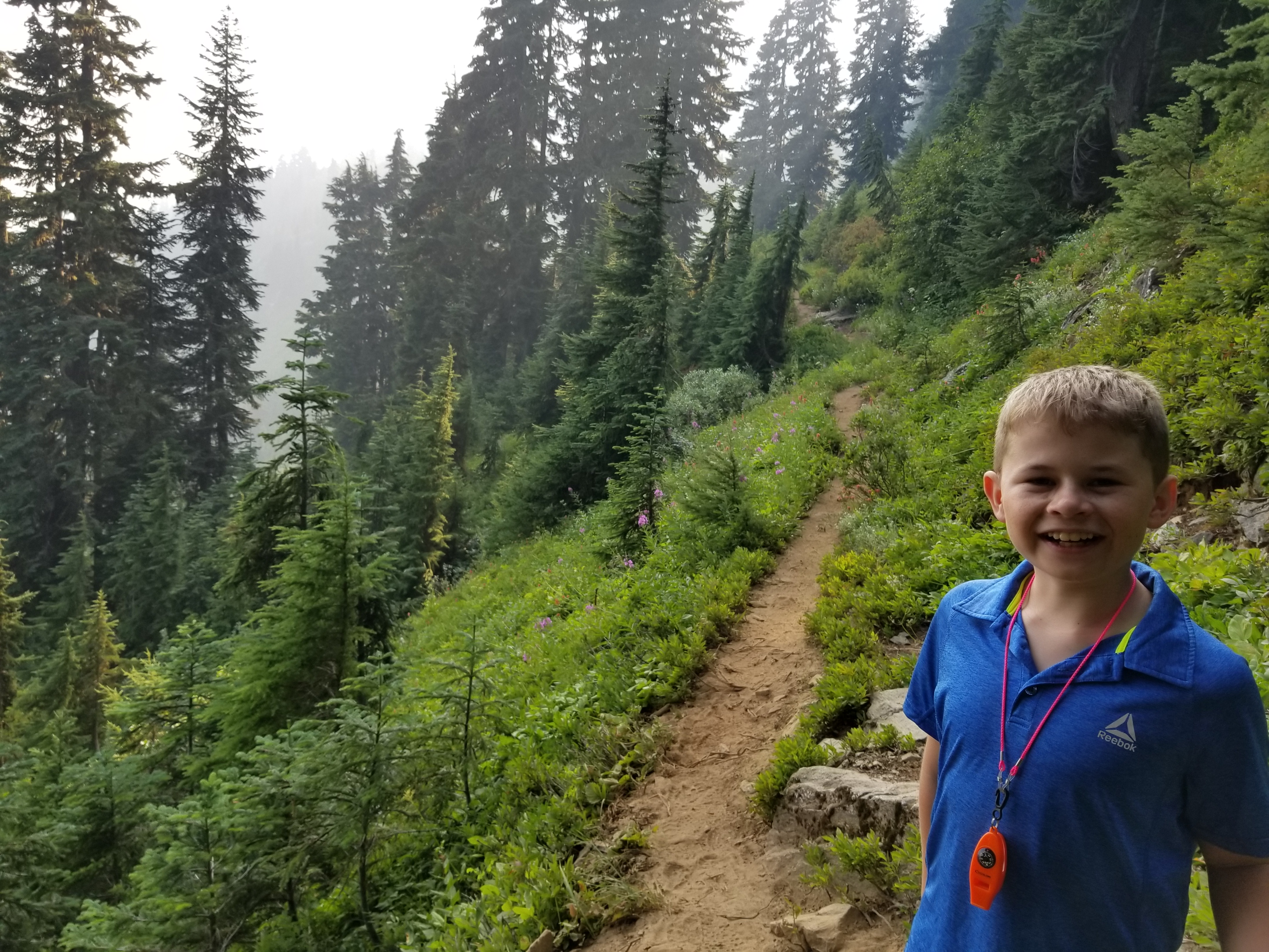
 Pretty trail. |
 |
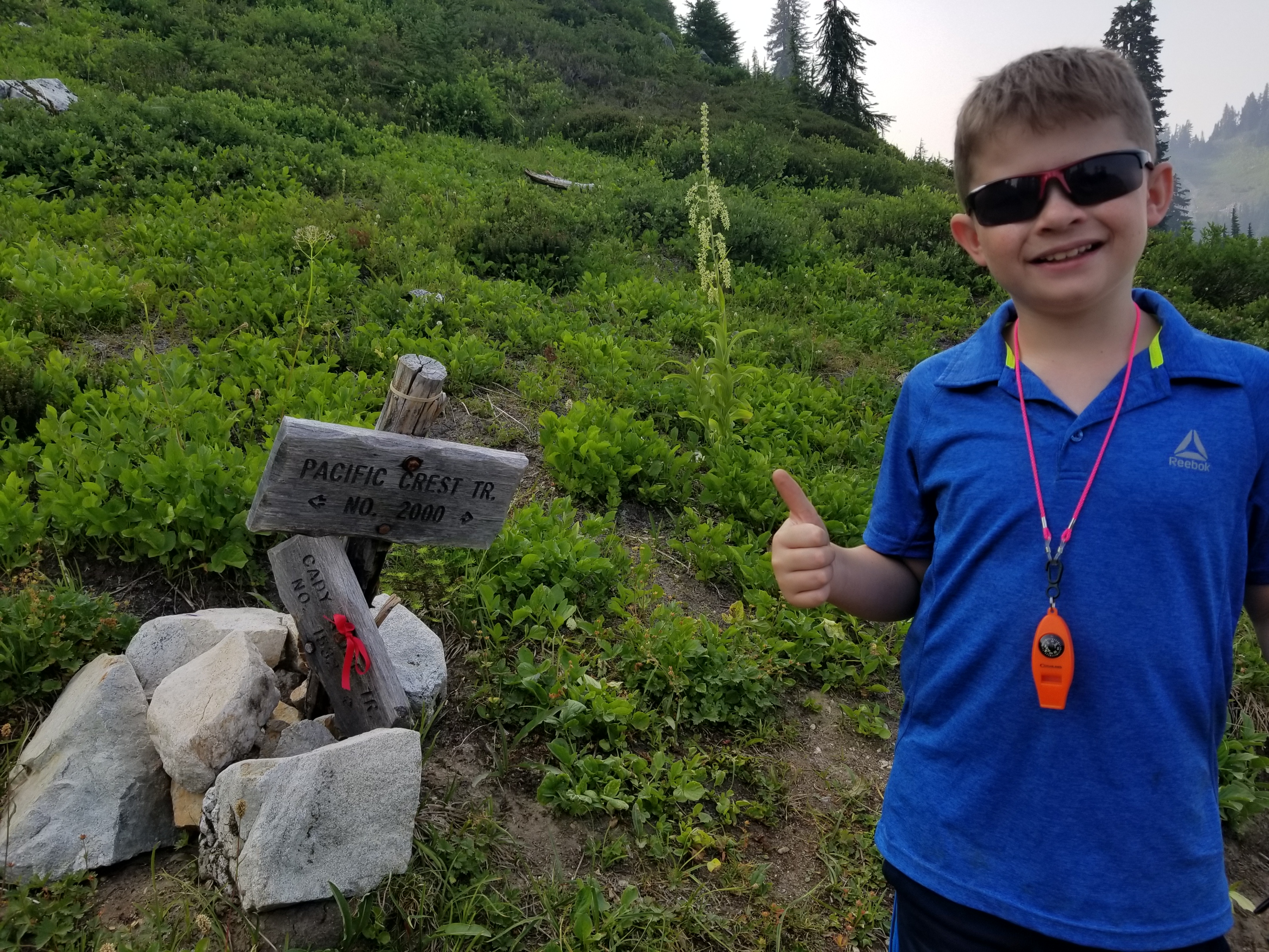 Made it to the Pacific Crest Trail! |
 PCT up to Jane Lake. |
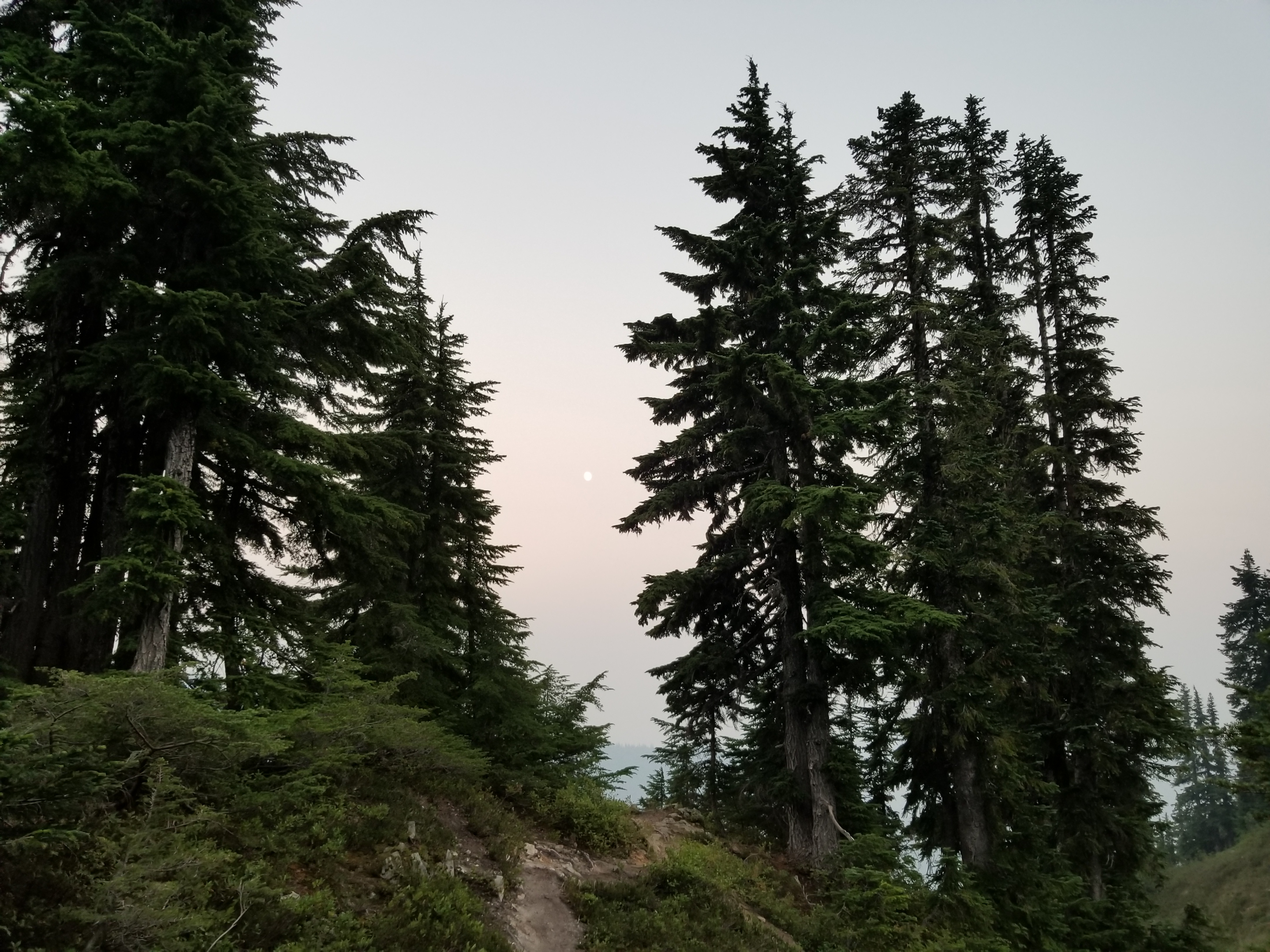 Sun through the smoke. |
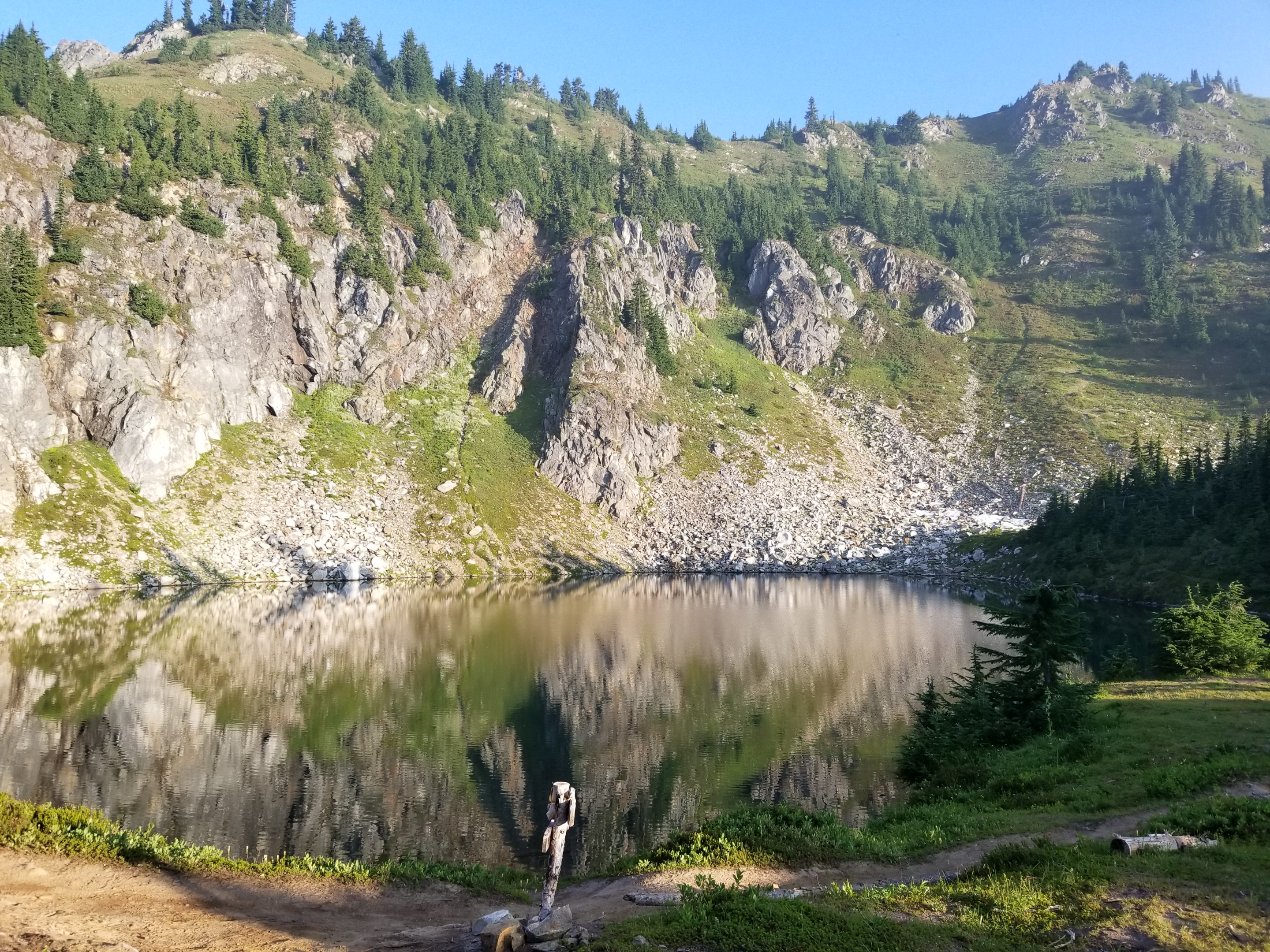 Jane lake in the morning. |
 |
|
|
 Camp with view of lake. |
 View from Coffee Rock. |
|
 Day hike north on the PCT toward Glacier Peak. |
 Glacier Peak through the smoke. |
 Nice meadows along the way. |
 Even snow! |
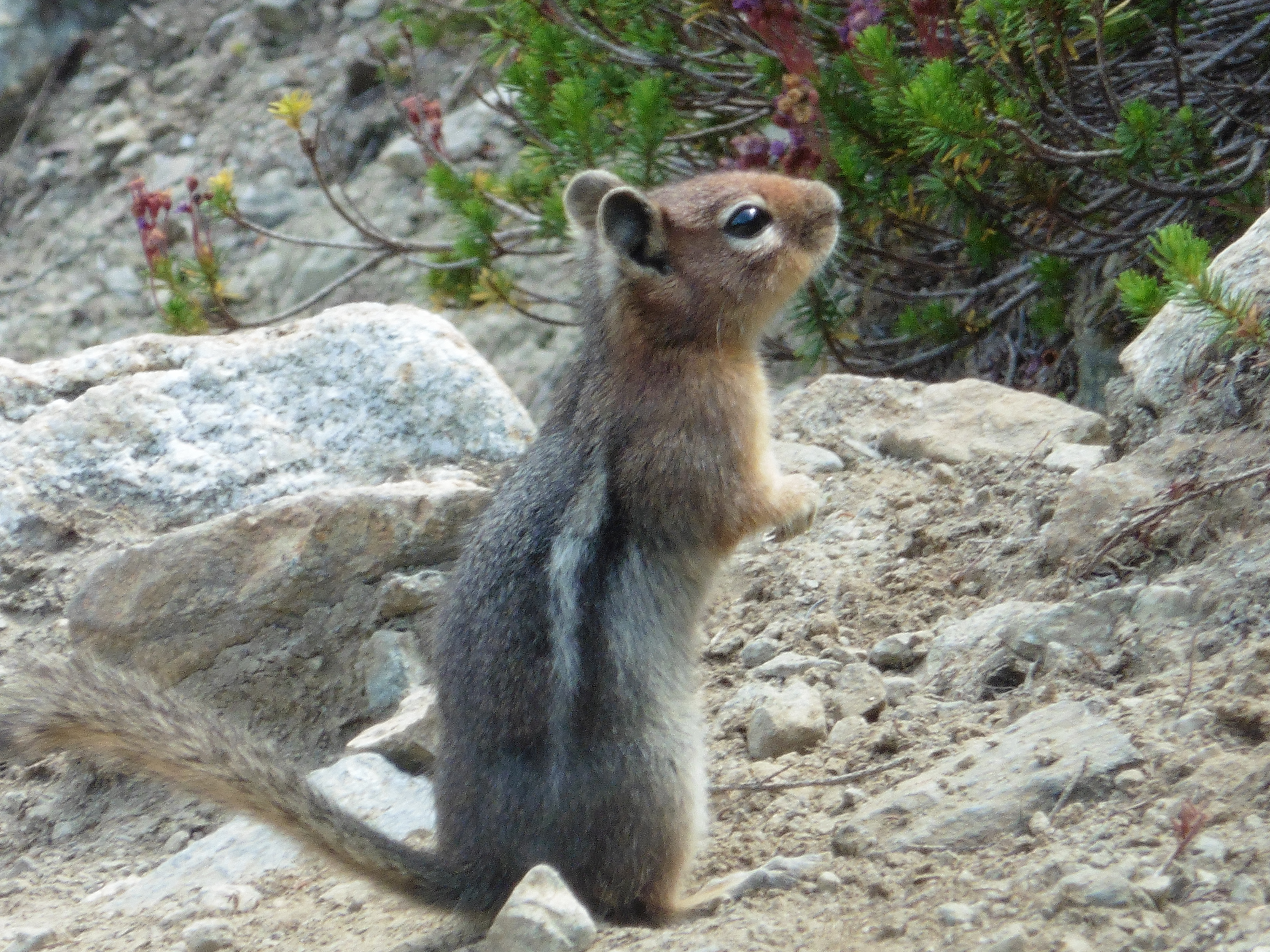 Golden Manteled Ground Squirrel... |
 ... entertained us on the trail. |
 Marmots hanging out below the trail. |
 Stream outlet from the lake. |
 Afternoon at the lake. |
 |
 Playing cribbage by the lake. |
 Squirrel chirping at us from his tree. |
 |
 Mist in the morning. |
 A little chilly! |
 Breakfast on Coffee Rock. |
 Meadow across the valley from the lake. |
 Hiking on the side of the hill. |
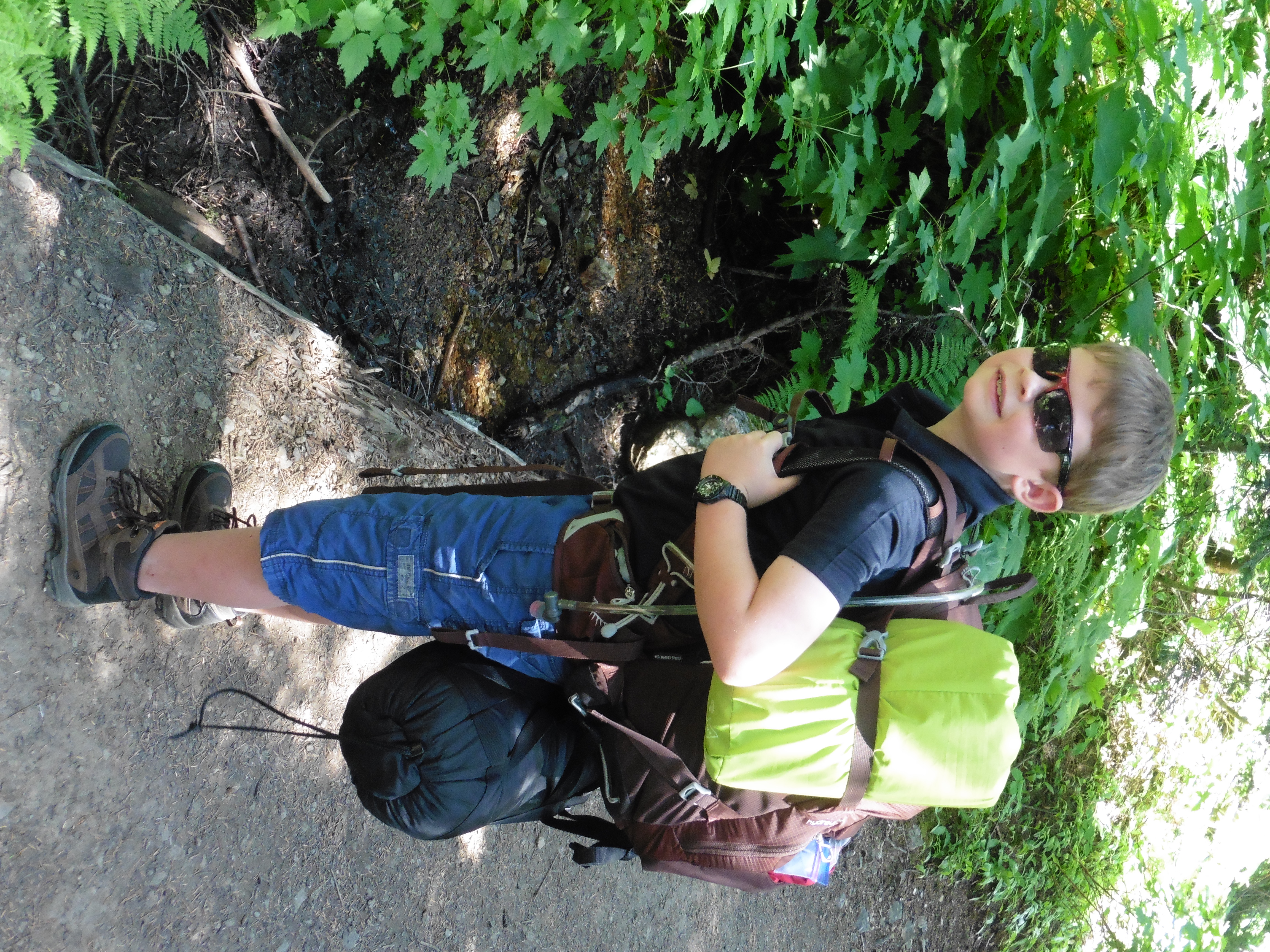
 Leaving the PCT, I am gonna carry my pack the whole way. |
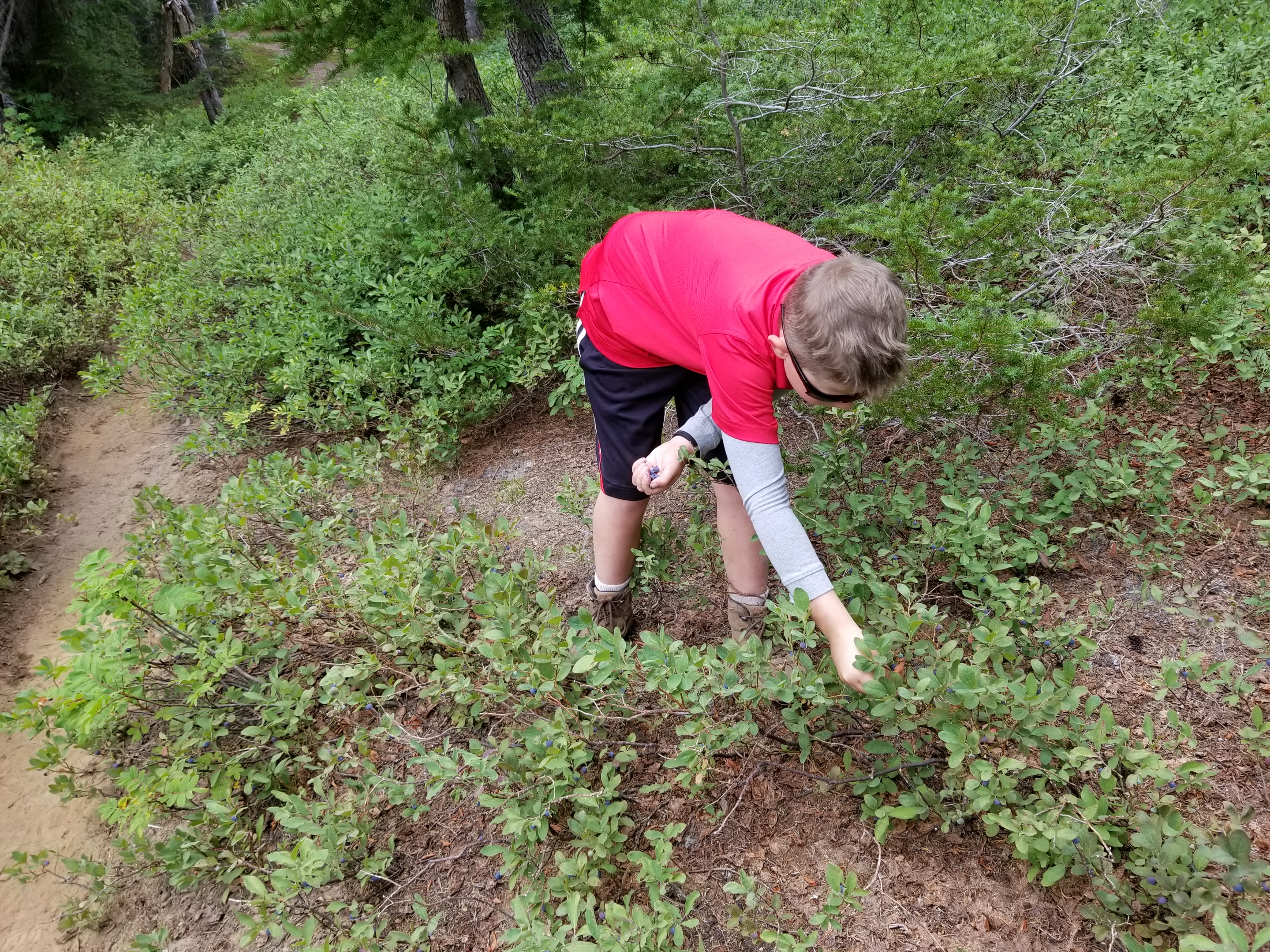 Picking some blueberries. |
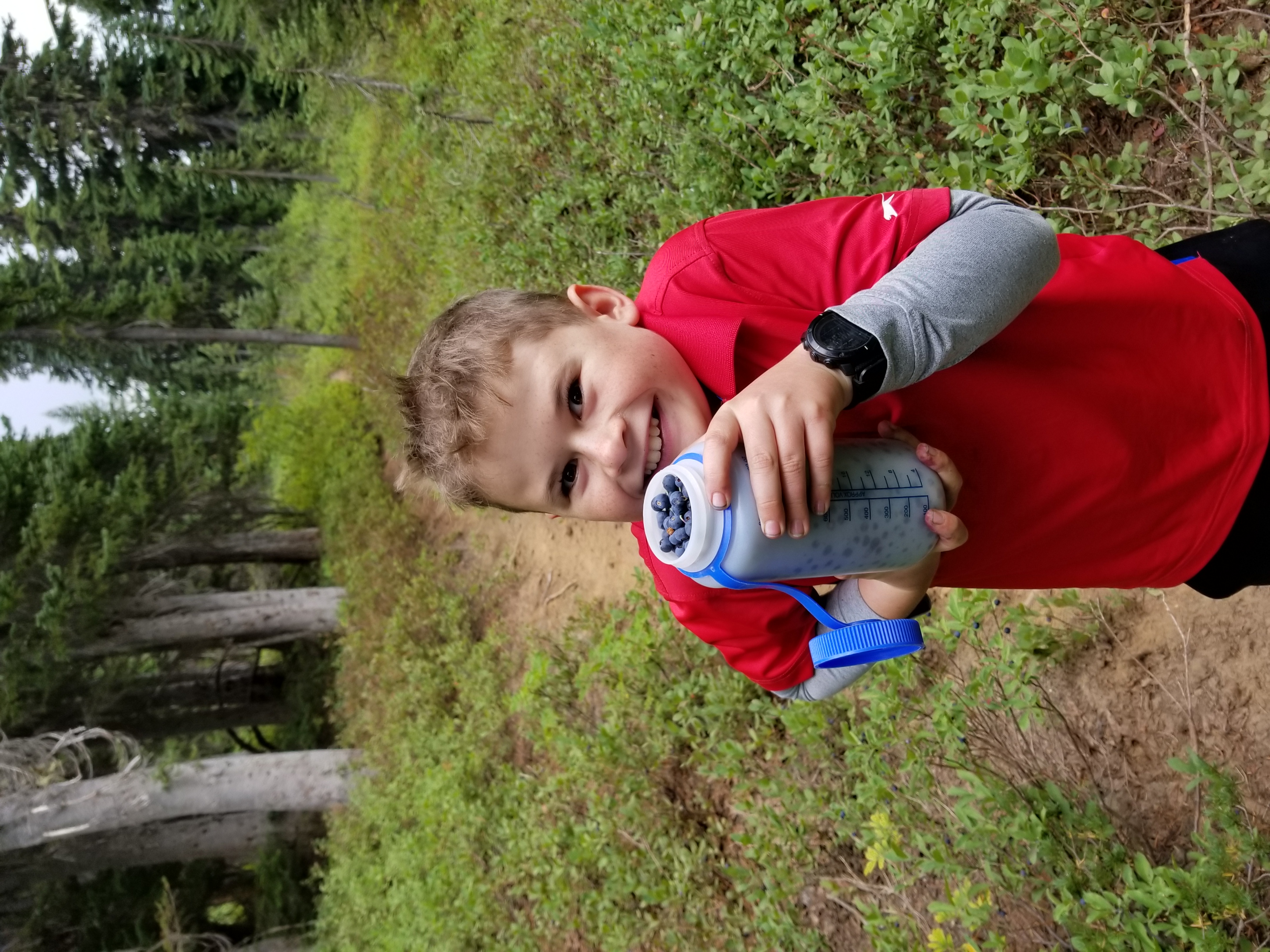 We got some berries, bwahaha! |
 |
 Back down in to the trees. |
 Beautiful creek at the end of the hike. |
 |
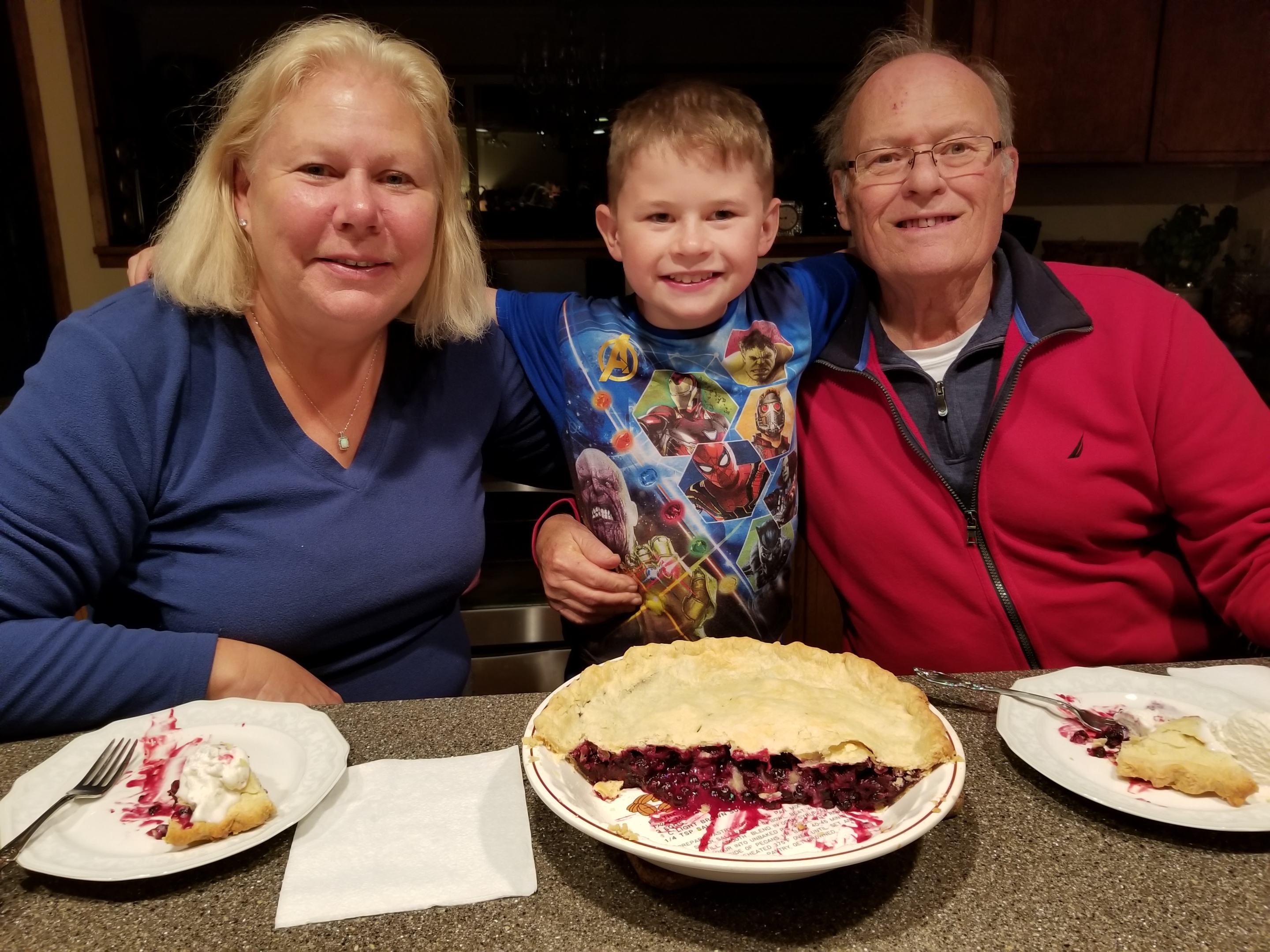 Wild blueberry pie with Grandma and Grandpa |
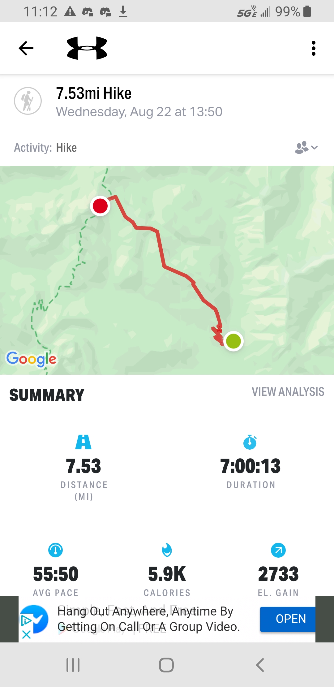 Stats for one way on the hike |
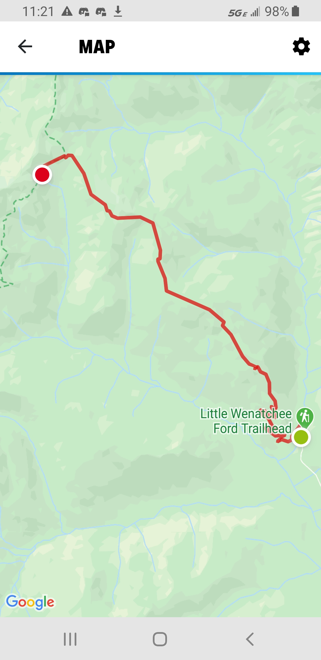 Map of hike. |
|
|
|
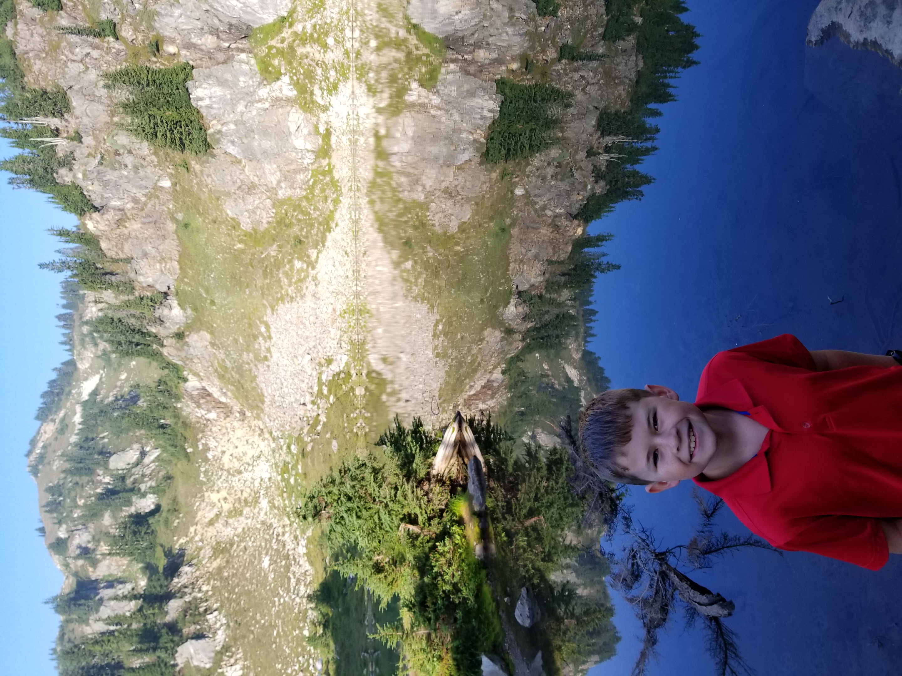
We drove up in to the Lost Lake area of Snoqualamie Pass to get to the Mirror Lake Trailhead. I was a little nervous for my first backpack, but
excited, too. We had already done much hiking this summer, including a 14er in Colorado. I was ready. I didn't really have a good backpack yet,
so I was loaded with 17 lbs, as much as my little pack could carry. The hike climbed up through a nice forest, with some really big trees. There
were a few salmon berries along the trail. We also saw some frogs in the marshy spots. We passed Cottonwood lake, then started to go up the hill.
The pack felt heavy, but the hike was not very long, just over 2 miles, so it was not too bad. We hiked around to the far side of the lake to find
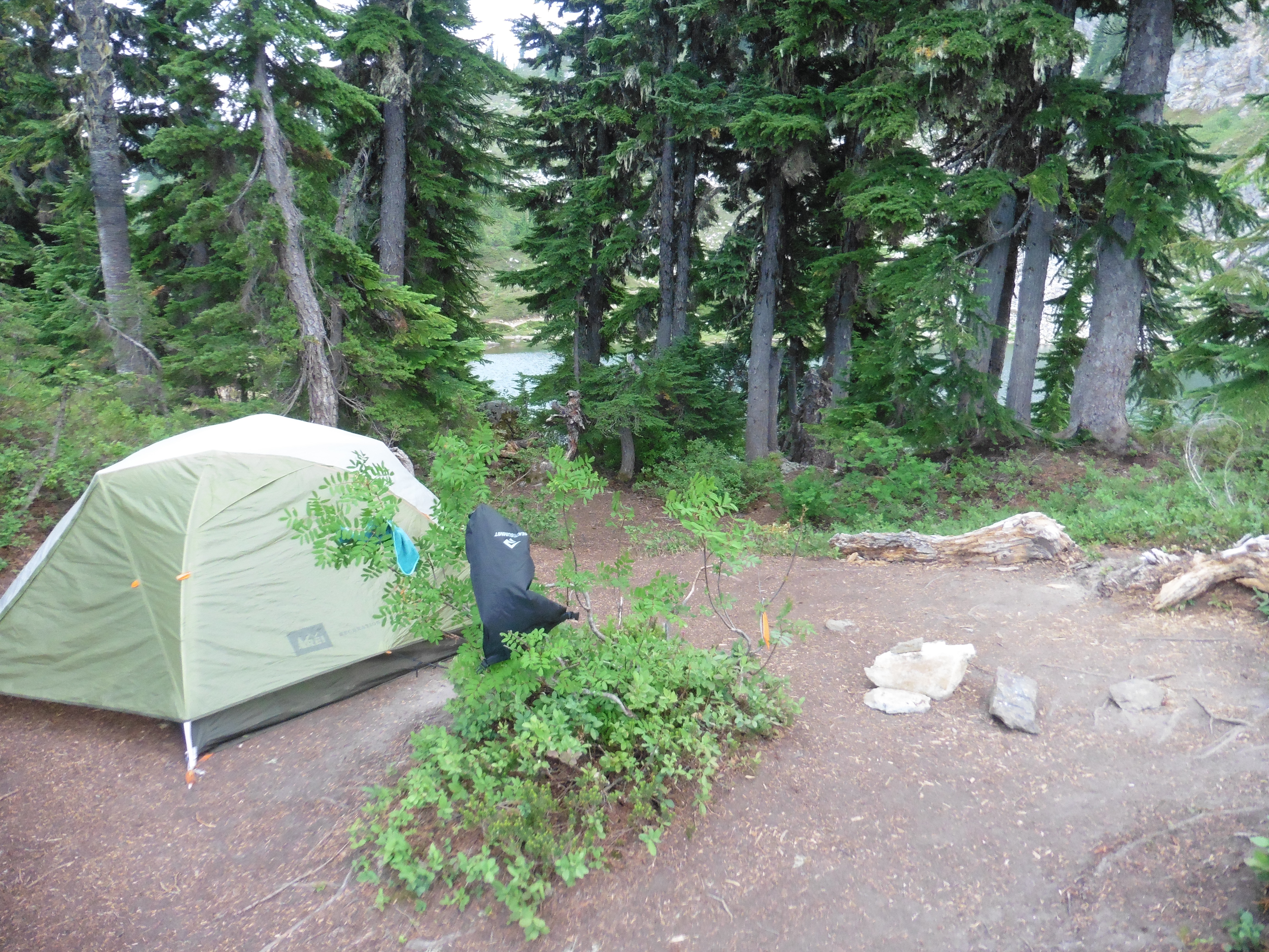
a camping spot. We found a nice spot to put the tent, with a little cooking area. We could see the lake from the site. After setting up camp, Papa
showed me how to find a good place for a latrine and prepared a hole. I had been curious and a little concerned about how that worked in the woods.
It turned out that it was a good idea to set that up, because not too much longer and I had a real need to go #2 for my first time in the woods! We
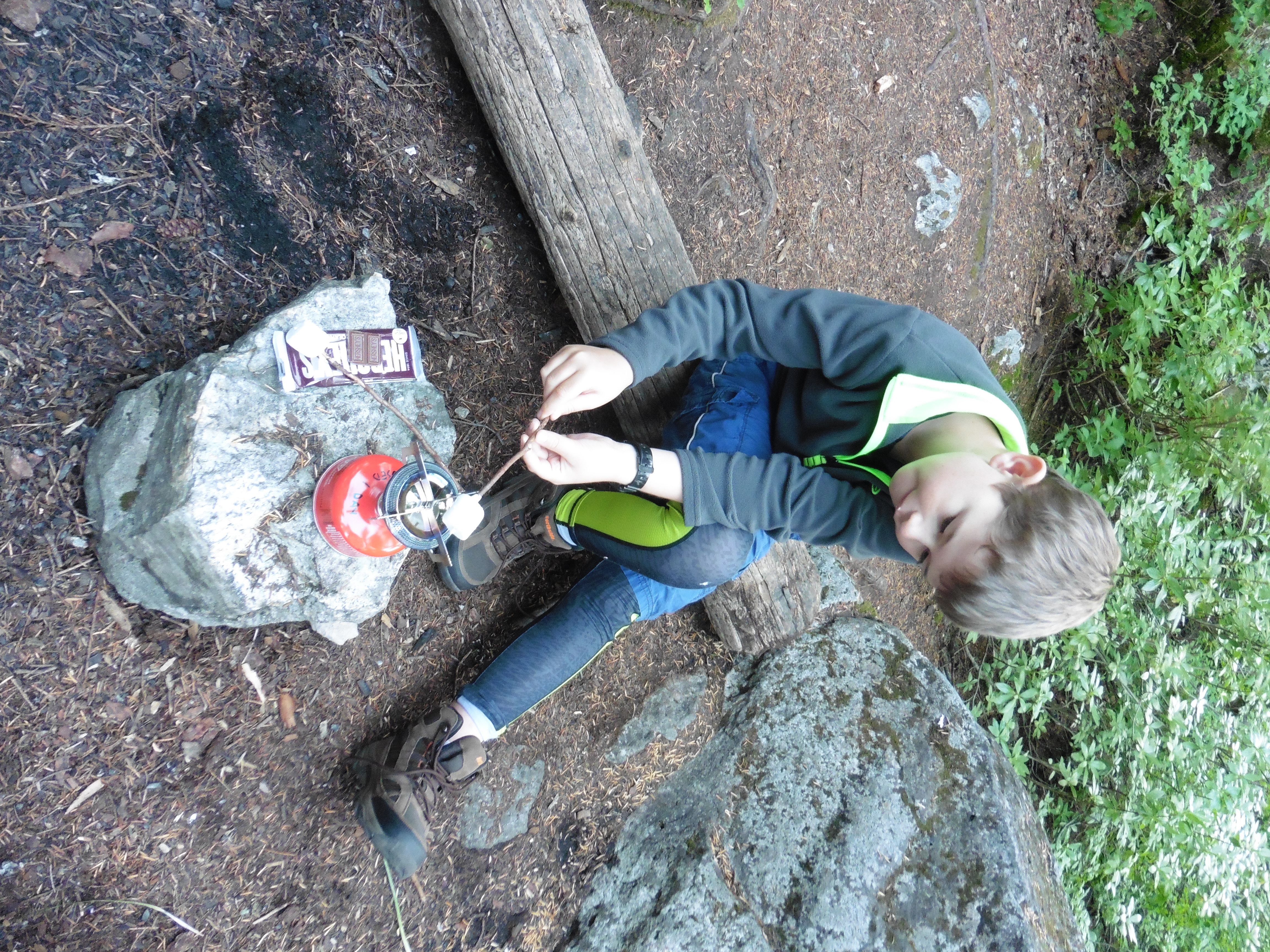
explored around the lake and tried to take a swim, but the water was a little cold. I whittled some wood to make a cribbage game. We made dinner, which was cup-o-noodles and canned chicken.
We found a nice rock at the edge of the lake, and ate there while admiring the view. I read some Garfield book on the rock, then we made dessert.
Papa even brought s'mores to make the first backpack special. Papa showed me how to hang a bear bag by hanging our food high in a tree.
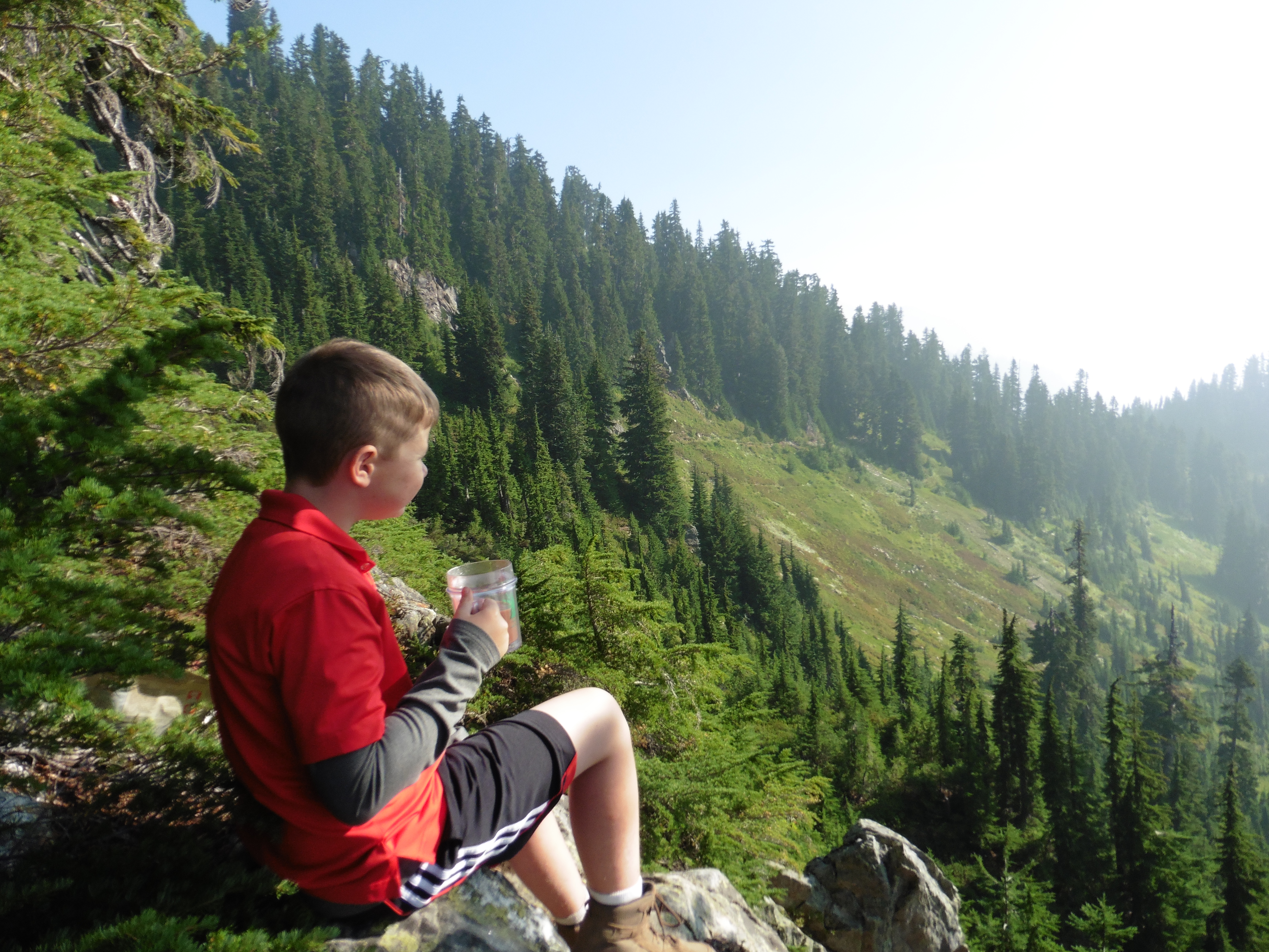
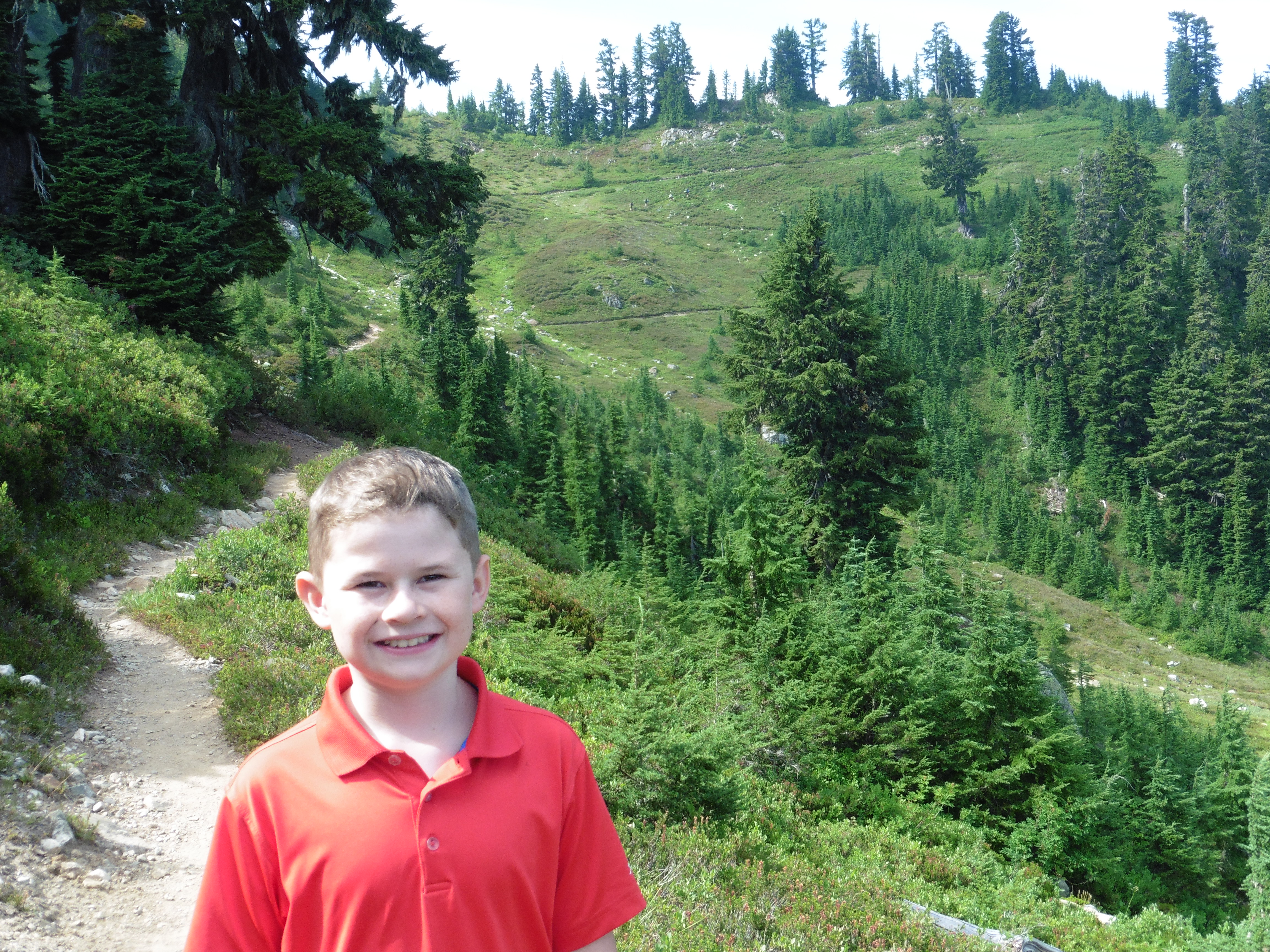
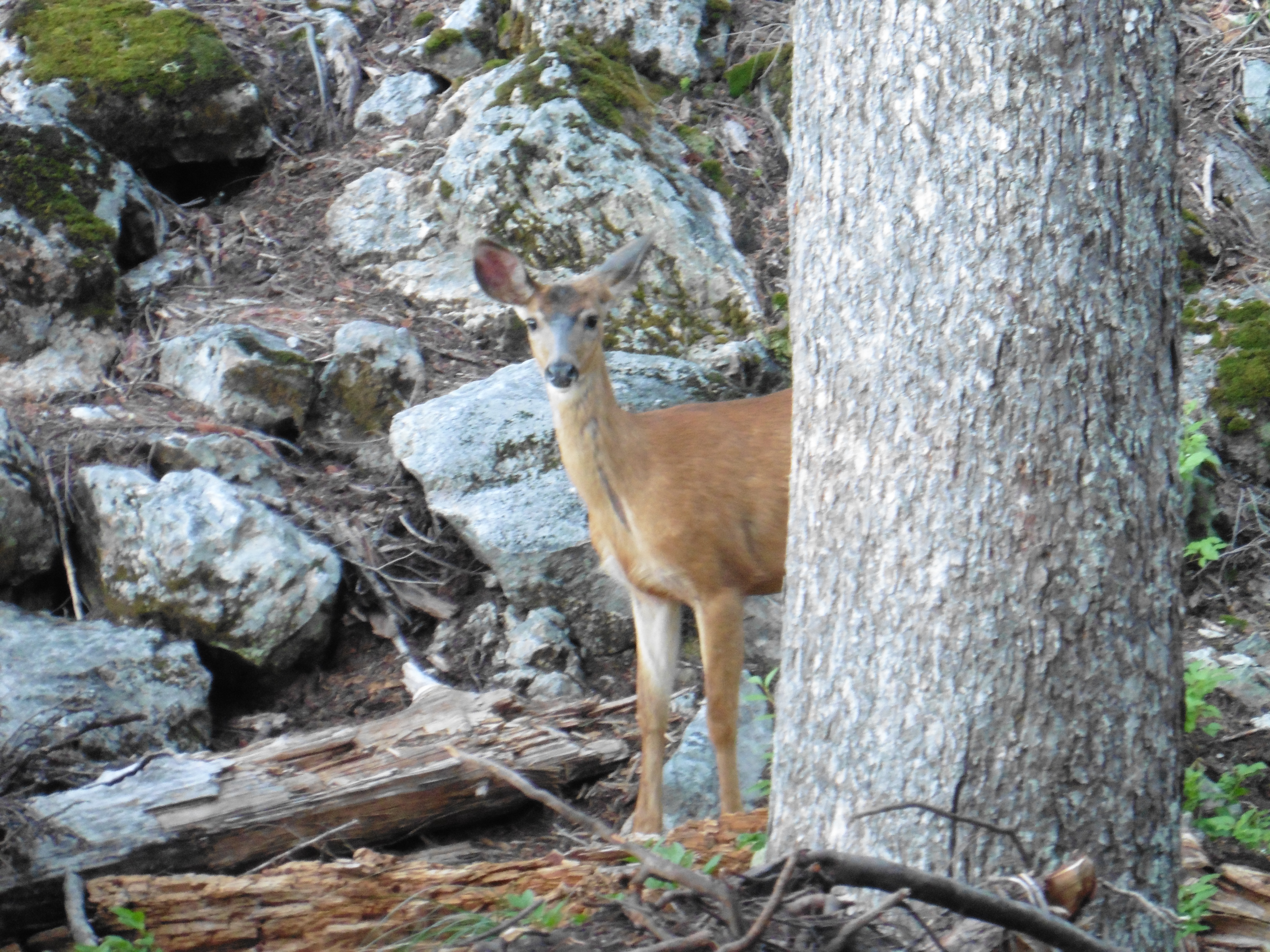
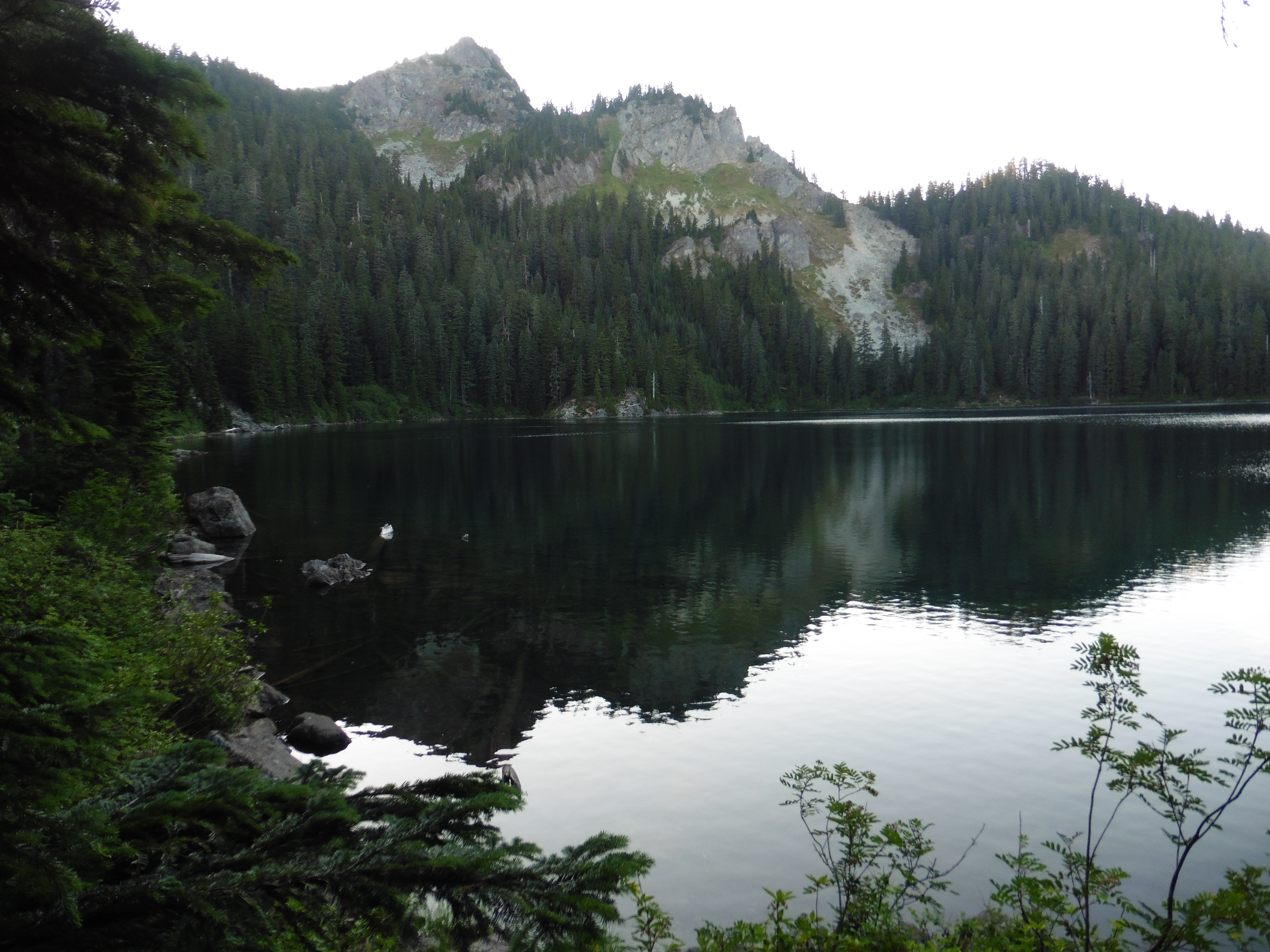
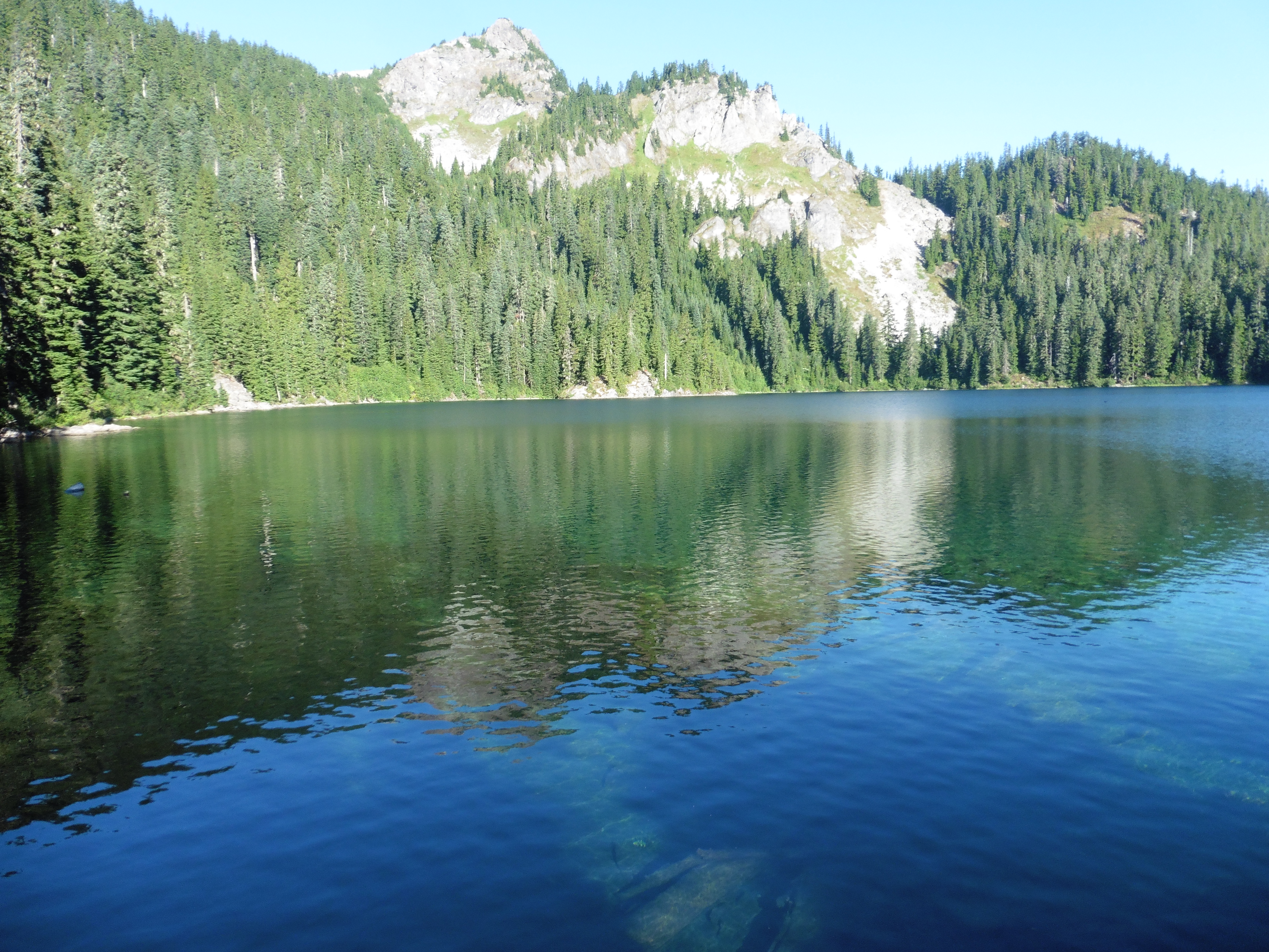
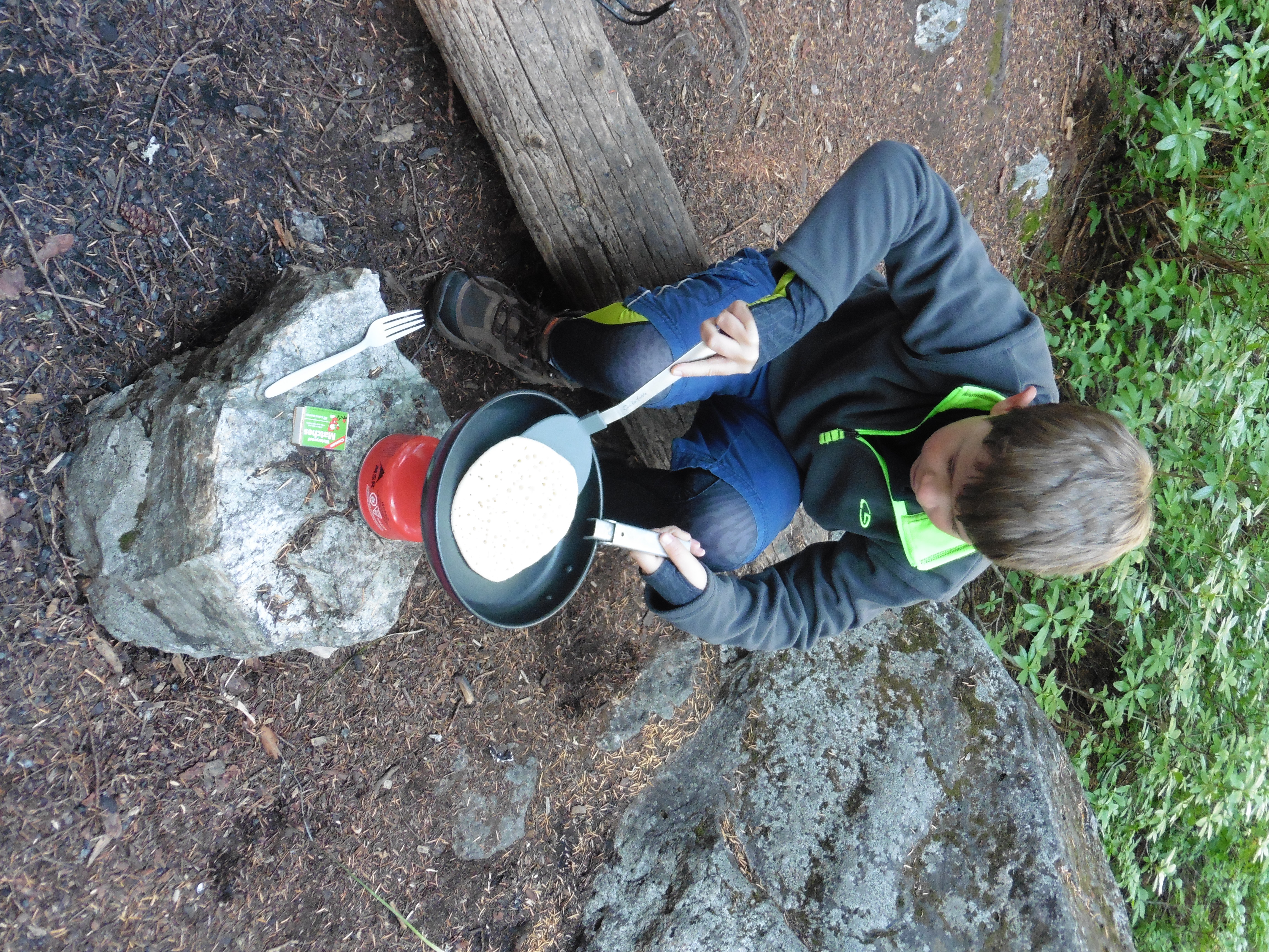
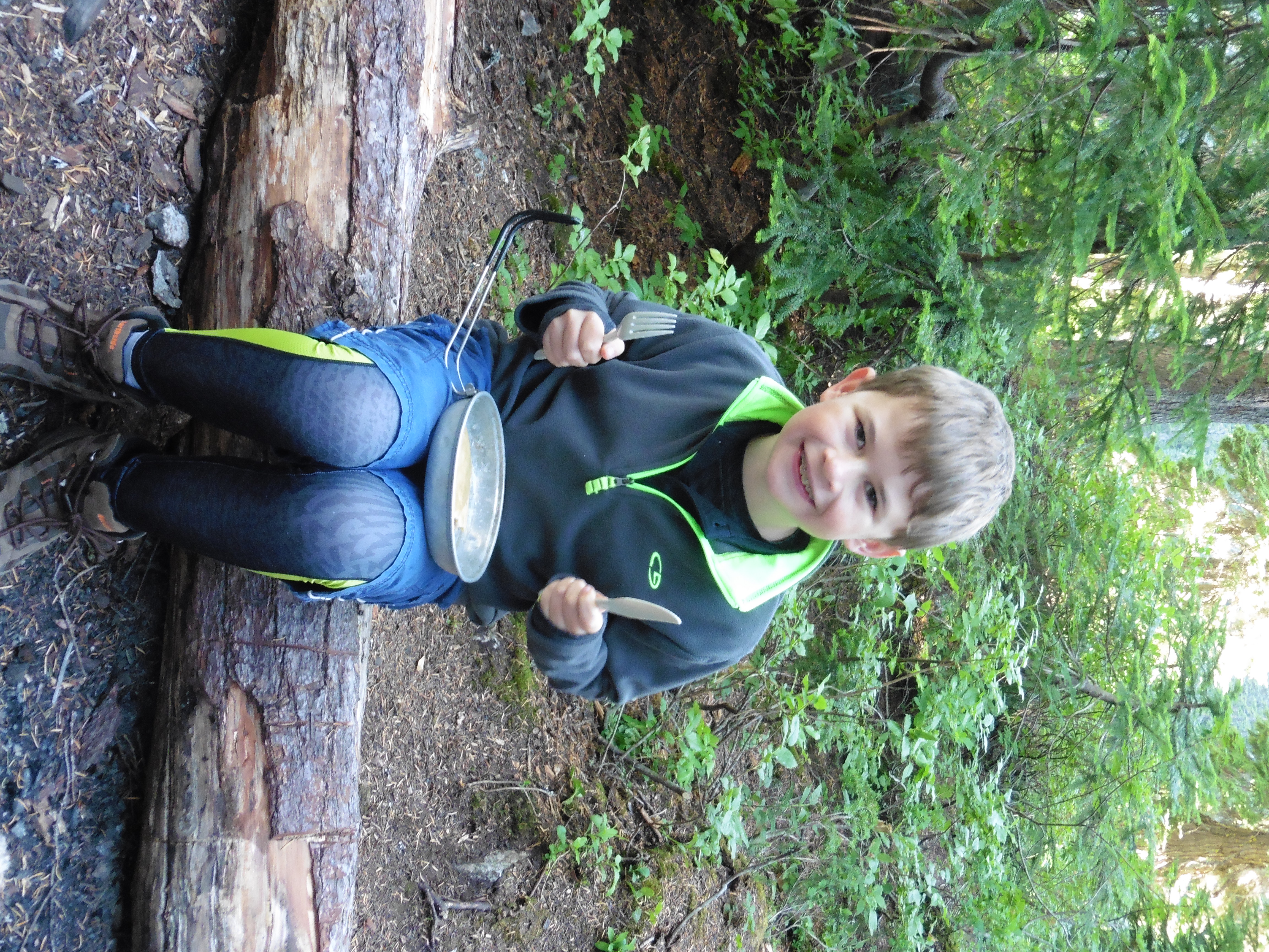
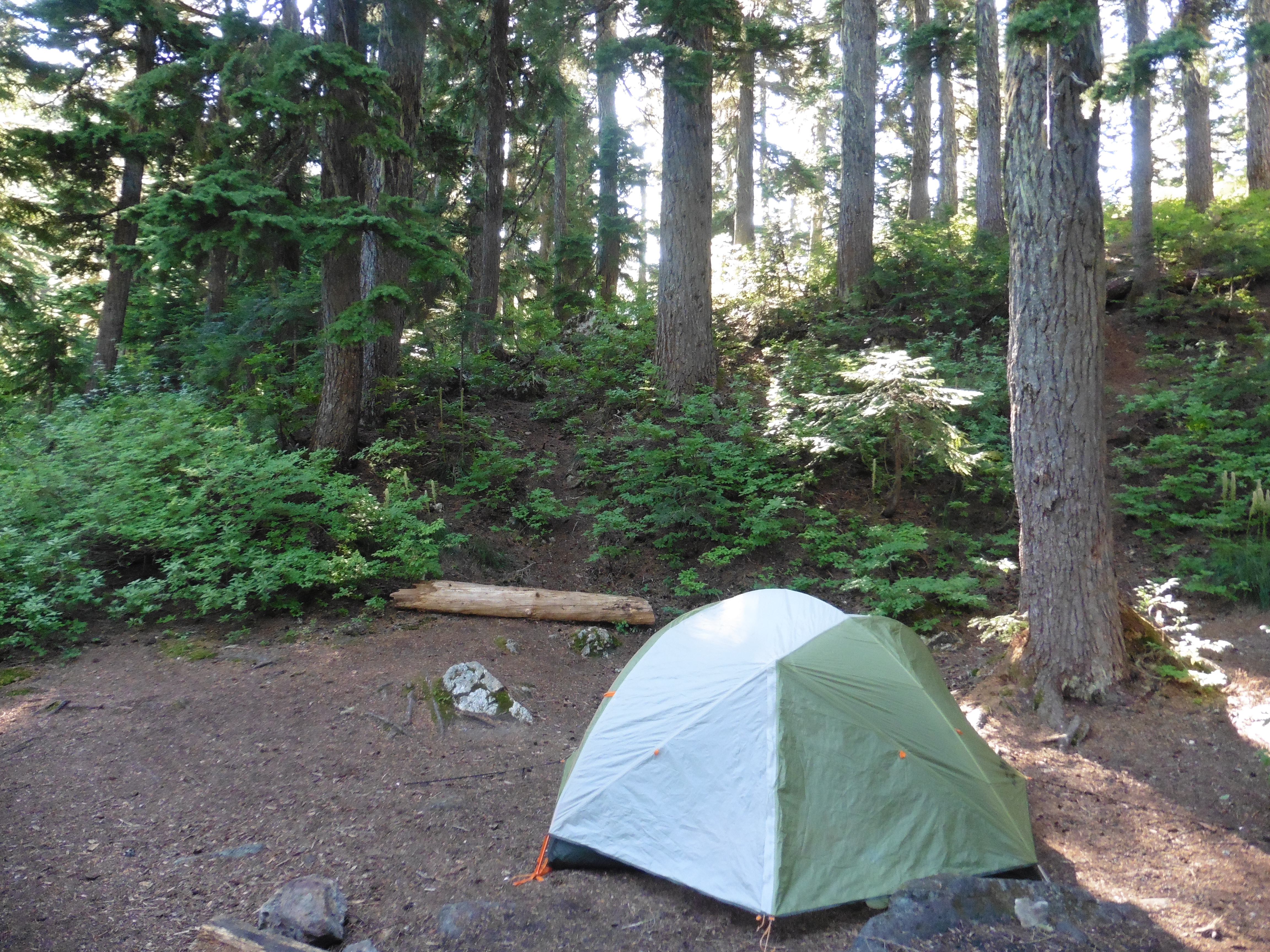
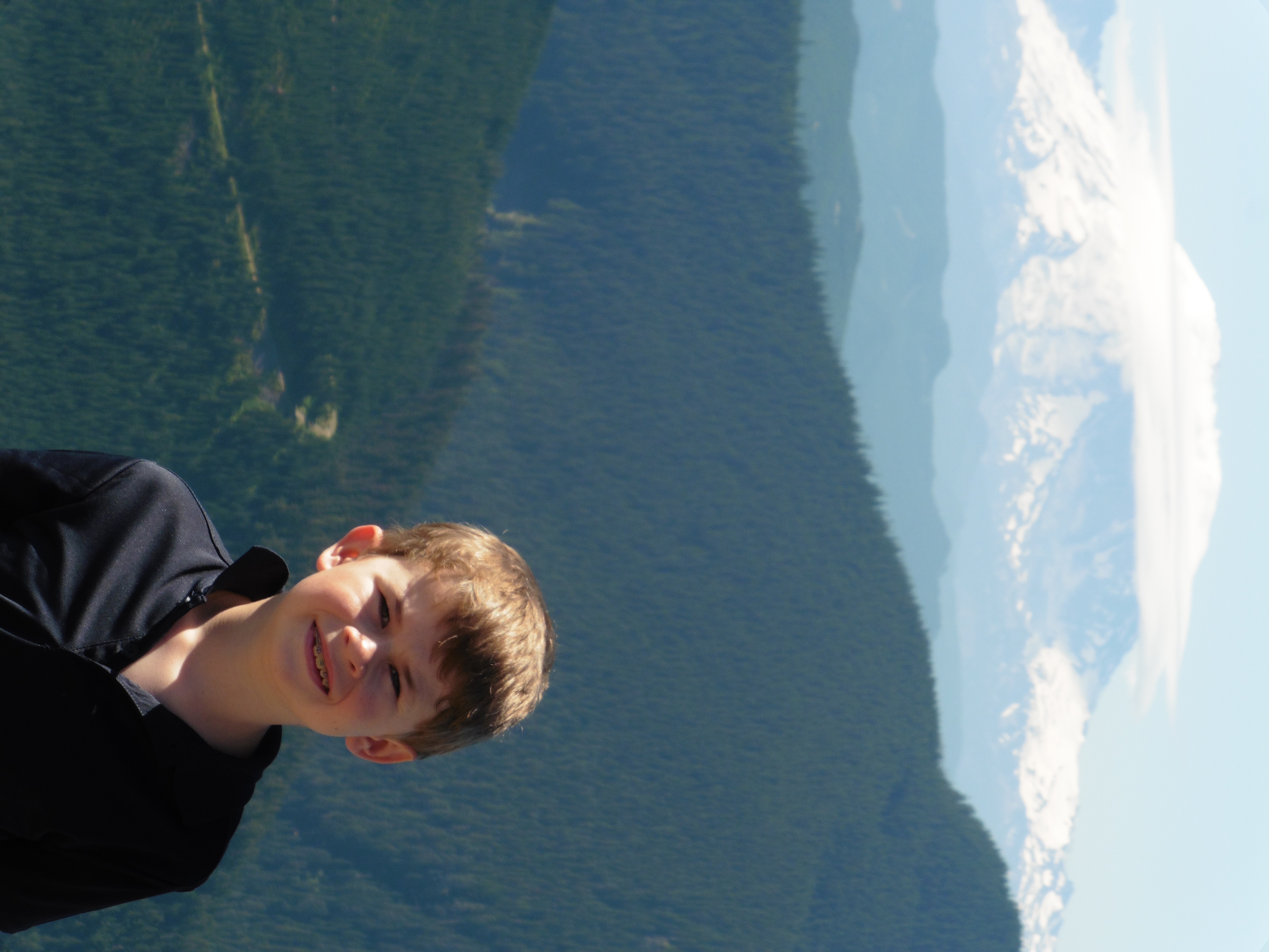
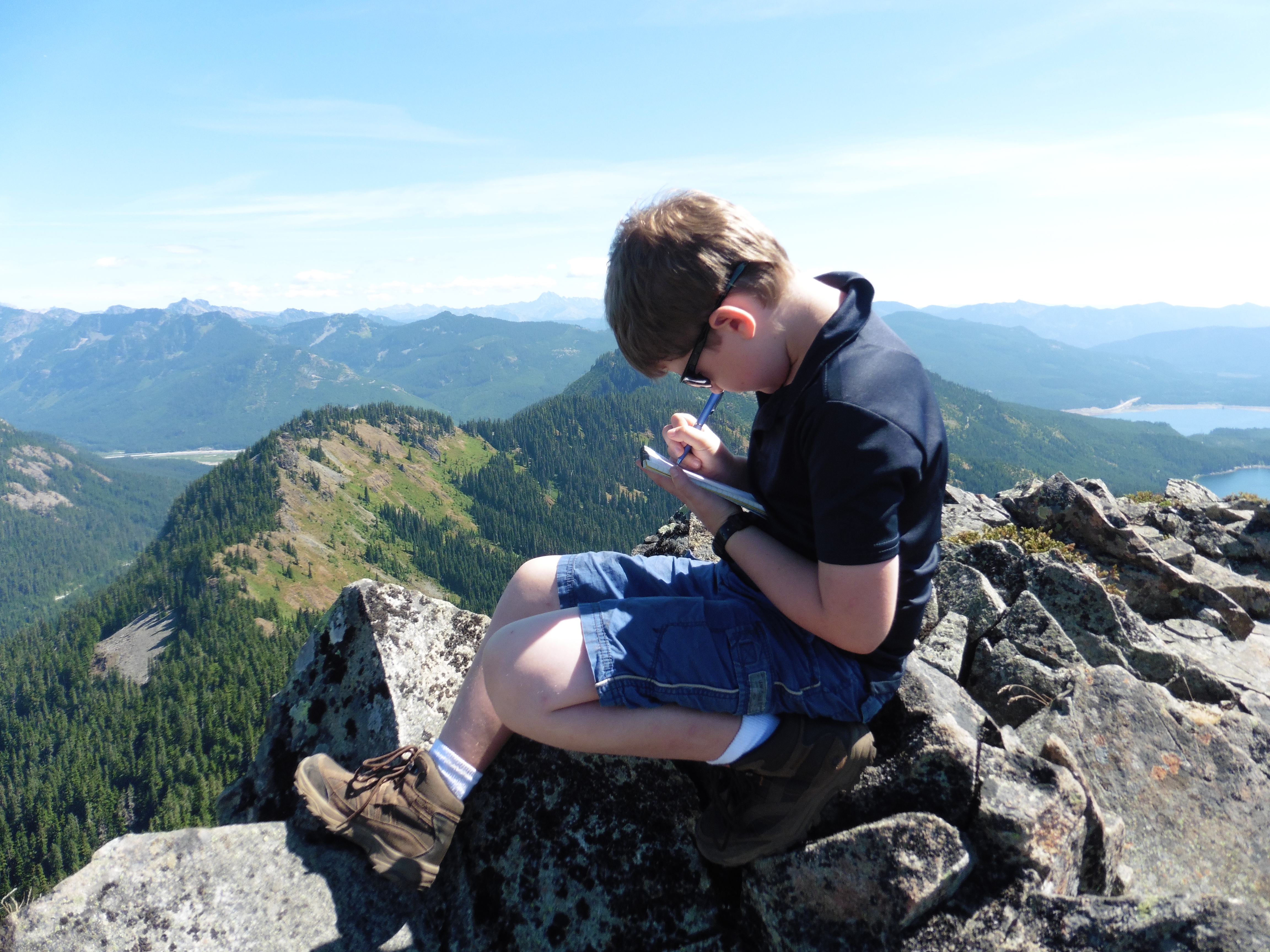
We went in to the tent early, and played cribbage with the pieces that I had made. The next morning, we made pancakes! Papa made this trip extra special. We enjoyed our breakfast, which also included sausage and oatmeal, coffee, and hot chocolate on the rock by the lake, which we called "Coffee Rock." There was a continuous buzzing sound from all of the bees carefully inspecting the bushes around the lake. They did not bother us too much. We prepared for a day hike. We went up Tinkham peak, which left right from our campsite, scrambling up and up the hill. As we got higher, we had a nice view of Mirror Lake, Lost Lake and beyond. We reached a rocky scree area, and Papa kept telling me to stay in a more solid area, farther from the cliff edge. Finally, we made it to the top. The views of Mt. Rainier, and the rest of the Cascades was amazing! I signed the log book at the top. Down below the peak, we could see Midnight Lakes, that Papa used to go to with his friends in school. We made a loop of the hike and went down the other side of the peak. As we went down, it was steep and rocky for a bit. We found a cool flat rock with lichen on it. As we went down, we had to stay close to the cliff edge because there was the boundary to the Cedar River Watershed, which is Seattle's water source. I had a bad urge to go #2, and since I still don't plan ahead very much, I really had to go, right now! Fortunately, Papa plans ahead, and had the shovel and TP, so I was able to go with no big deal. We hiked the rest of the way down and found the off trail route to Midnight Lakes. On the way there, we scared a Marmot, who ran away but then turned to look at us. The lakes were cool. One was surrounded by rock, and rocky on the bottom, there was even snow on the far side. The other had trees around it. There were some good places to camp there. We played around the lakes for a while. There were a lot of bugs. We hiked back down to the trail, which turned out to be the Pacific Crest Trail, as the PCT crosses near Mirror Lake on the way to Snoqualamie Pass. When we got back to Mirror Lake, there were a few more campers setting up. One set of girls were hiking the Washington portion of the PCT, on their way to Snoqualamie pass for a break. One was a park ranger, but not on duty. For lunch, we had had peanut butter and graham crackers. That was another staple of Papa's legacy backpacking meal plan, as was all of the things we ate, except for the pancakes of course. Papa took a bath near the lake, but was careful not to get campsuds in the lake. He made me wash off, too. We found a full bar of normal soap by the lake. Papa said that was bad as it would hurt the lake, so he picked it up and packed it out with our trash. While papa was in the lake, someone yelled, and we thought it was someone making fun of him. But, later, a man came down the trail from Tinkham Peak and was a little rattled. He said he had slipped on the scree area and almost went over the cliff! That was his scream we heard. Back in camp I read some more on Coffee Rock and we enjoyed the beautiful late afternoon. For dinner, we had mac-n-cheese cups with canned chicken. Enjoying those on the rock with another round of s'mores. At around sunset, we went over to a saddle near camp. We startled a deer that was there and we all screamed. The sunset was nice. We went in the tent on the early side again and played some more cribbage. Papa read for a while, he was reading 'Wild' by the lady that hiked the PCT. Papa said a hiker came in late and camped nearby. He must have been a PCT thru hiker. In the morning, there was a cool mist coming in over the mountains. We had breakfast of oatmeal. The pancakes were much better! After enjoying more time on Coffee Rock, we packed up camp to head out. The hike out was pretty easy, with lighter packs and down hill. I really enjoyed my first backpack, and I was ready for more next year! One lesson we learned was that Papa's legacy food plan of cup-o-noodles, cup-o-mac, canned chicken, oatmeal, peanutbutter and graham crackers did not provide enough calories for him and wasn't really sustainable due to pack weight and volume. We would have to go with a more modern plan next time! |
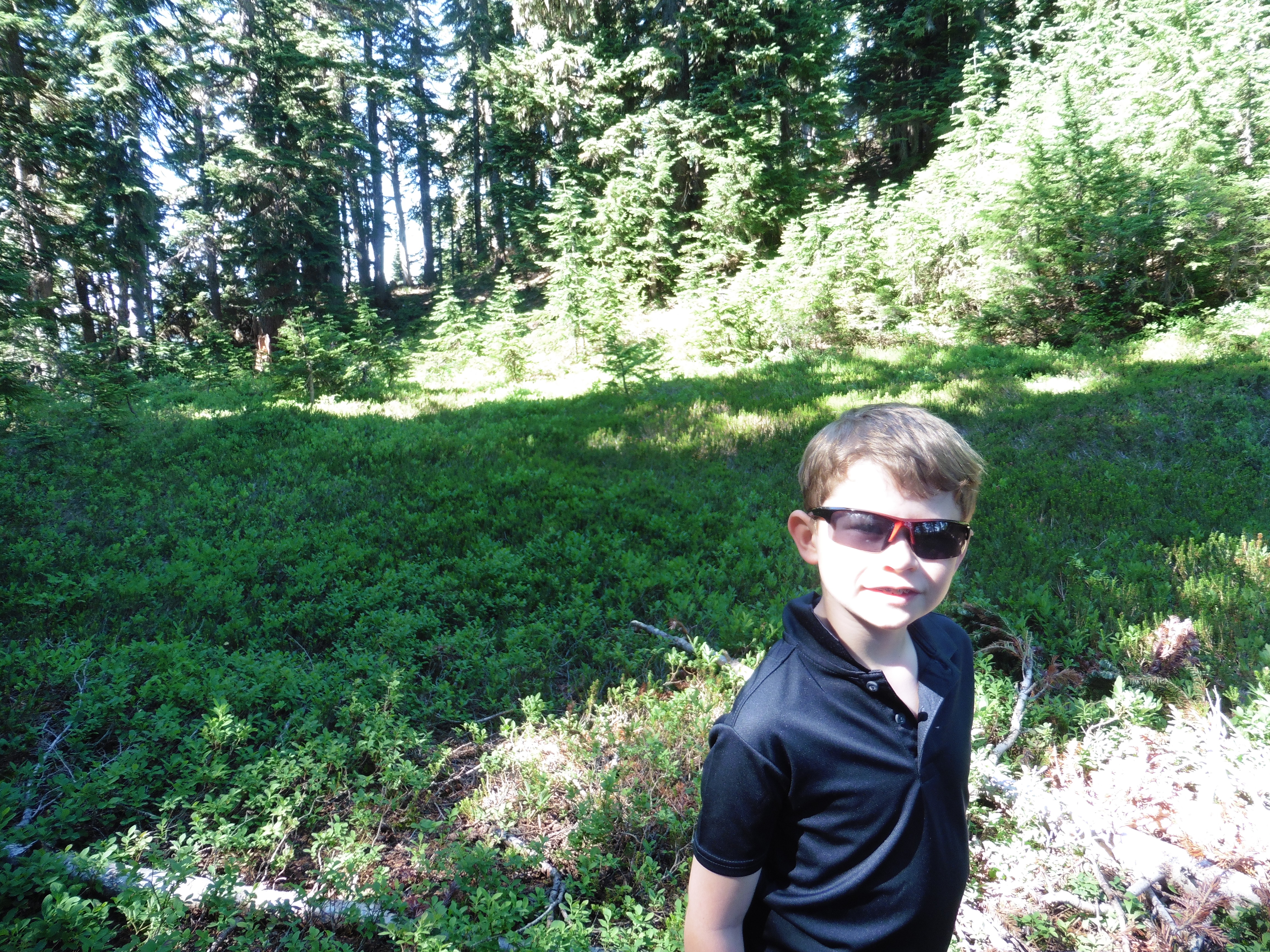
 Me and my pack, ready to go! |
 Almost to Mirror Lake! |
 Nice bridge through marshy meadow section. |
 Beautiful lake! |
 Whittling pieces for cribbage. |
 Our camp. |
 Reading Garfield on Coffee Rock. |
 View from the Tent. |
 Sunset from the saddle. |
 The deer we scared. |
 Evening on the lake. |
 Backpacking S'mores (fire ban in effect). |
 Morning view from Coffee Rock. |
 Backpacking Pancakes! |
 Pancakes with syrup, so yummy! |
 Camp in the trees. |
 Somewhat well executed bear bag hanging. |
 Part way up Tinkham peak. |
 Meadow on the way up the mountain. |
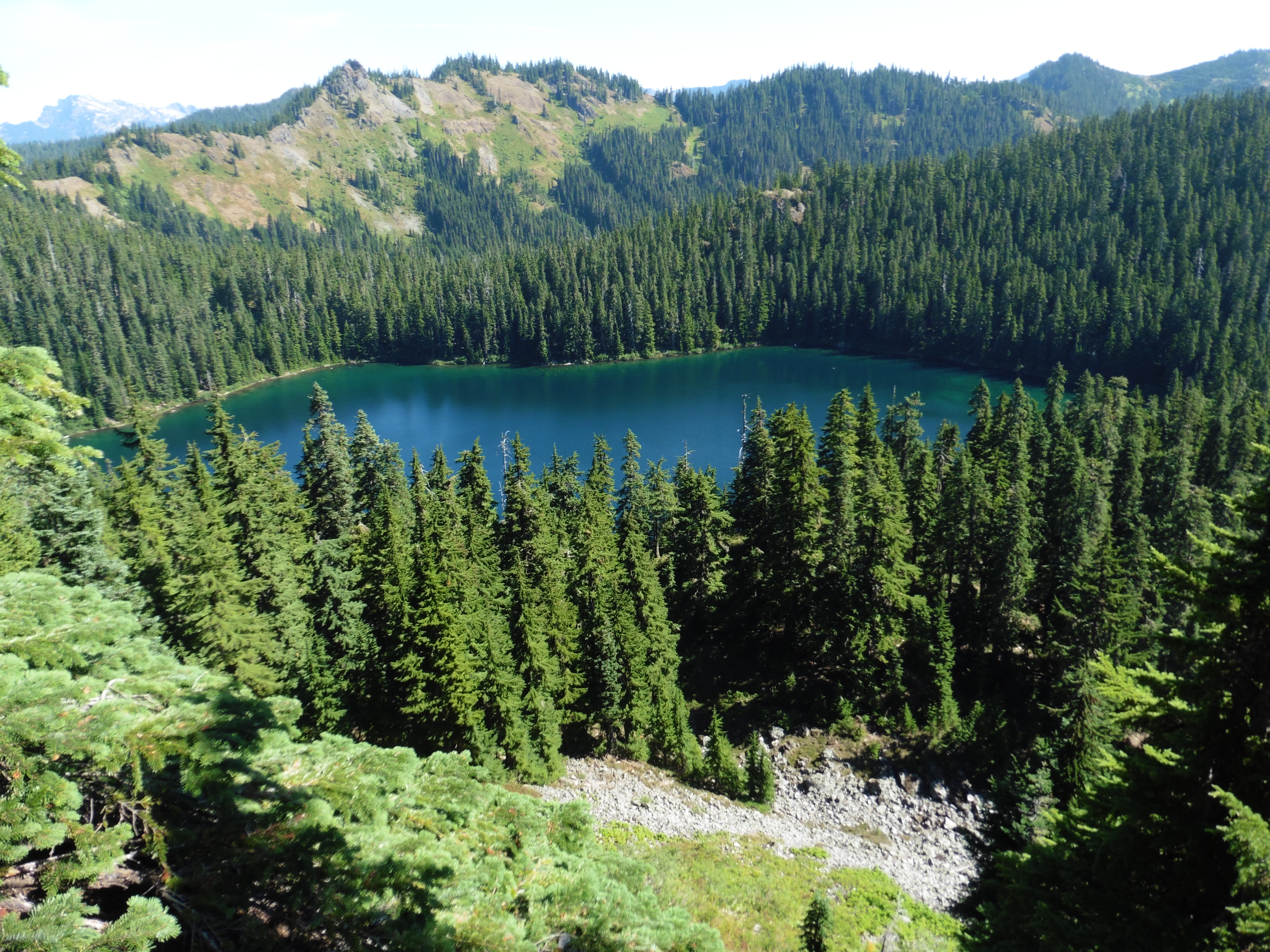
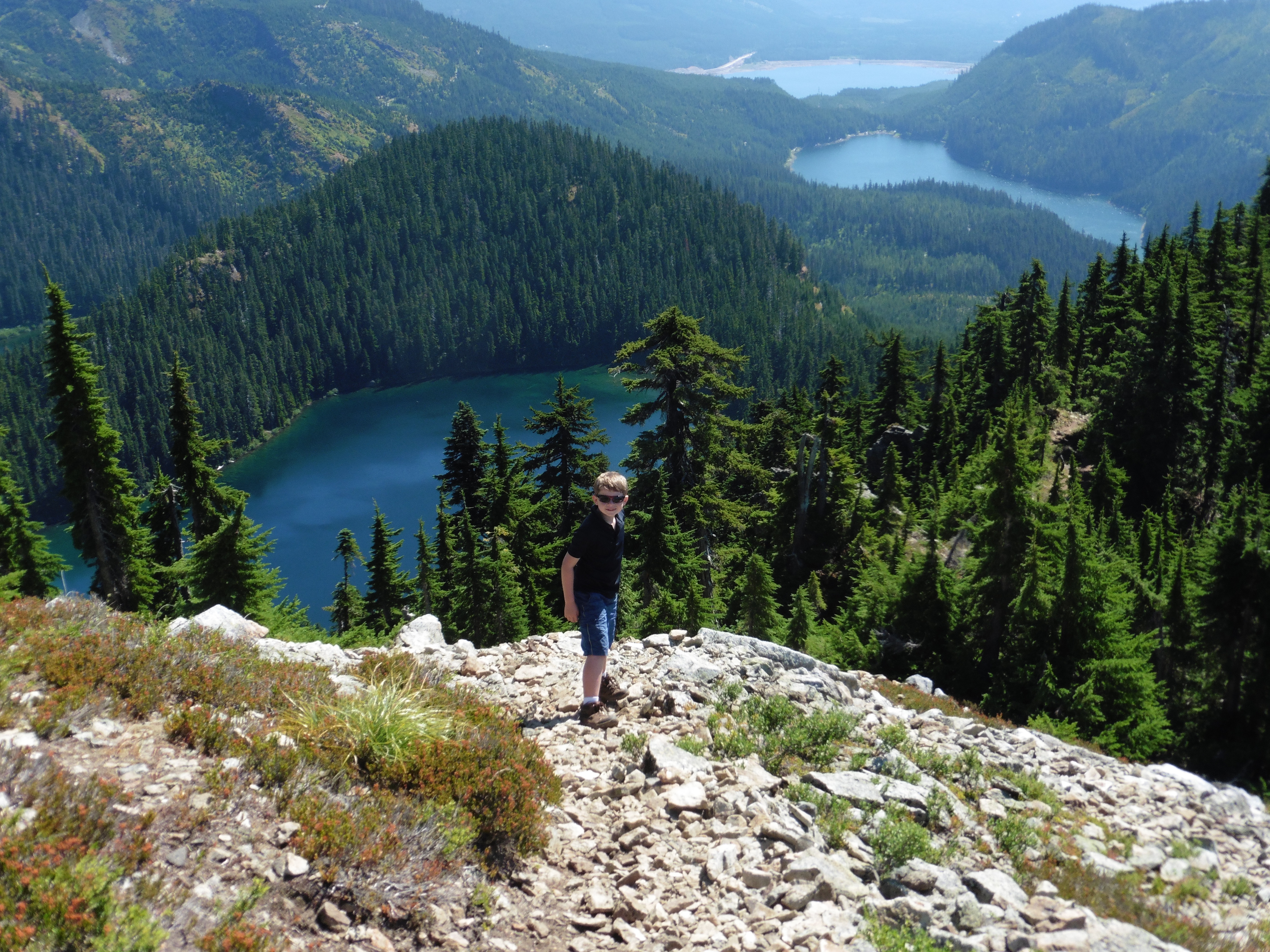 View of Mirror Lake with Lost Lake in the background. |
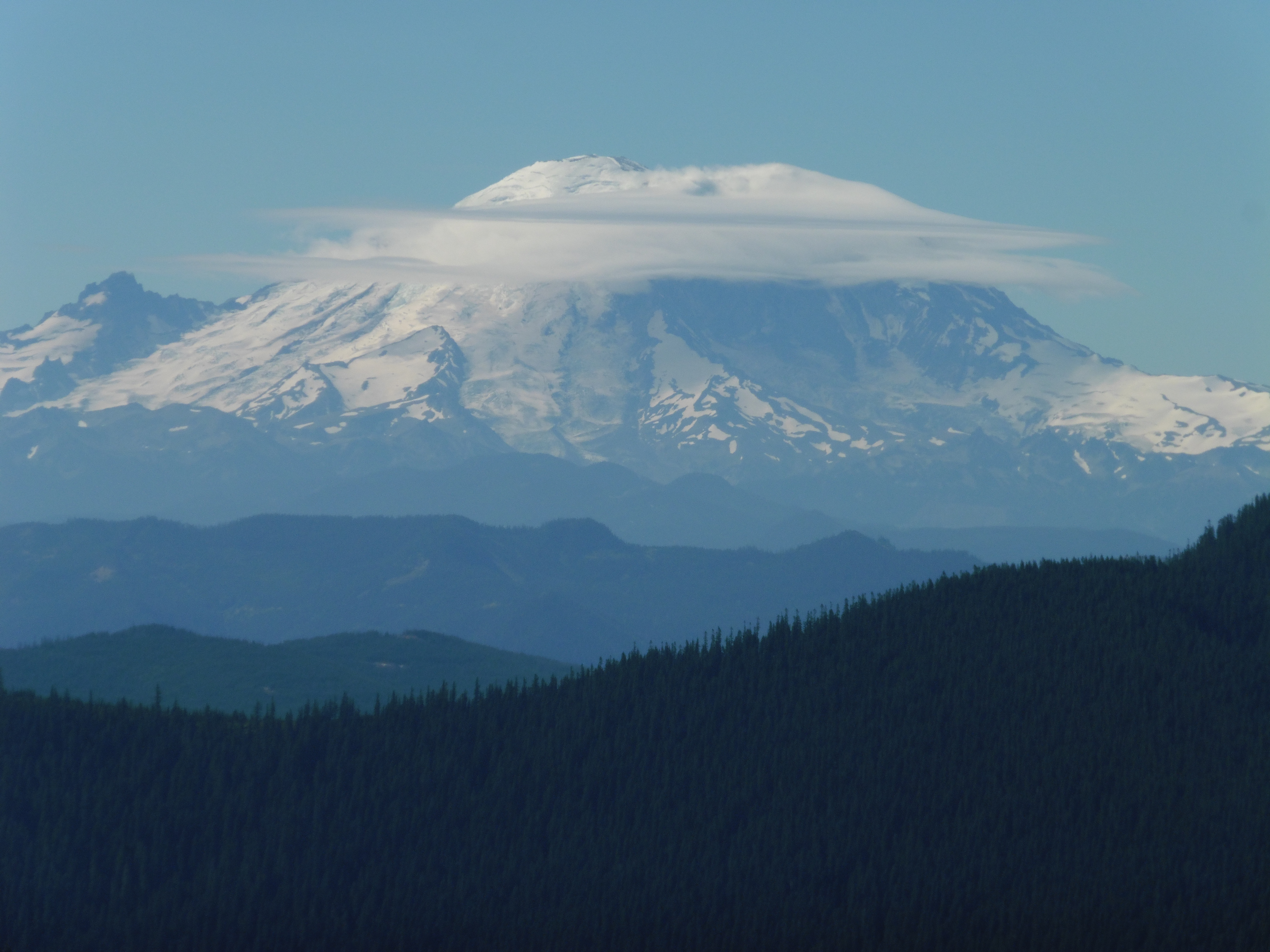 Mt. Rainier. |
 Nice view. |
 Signing the log on top of Tinkam Peak. |
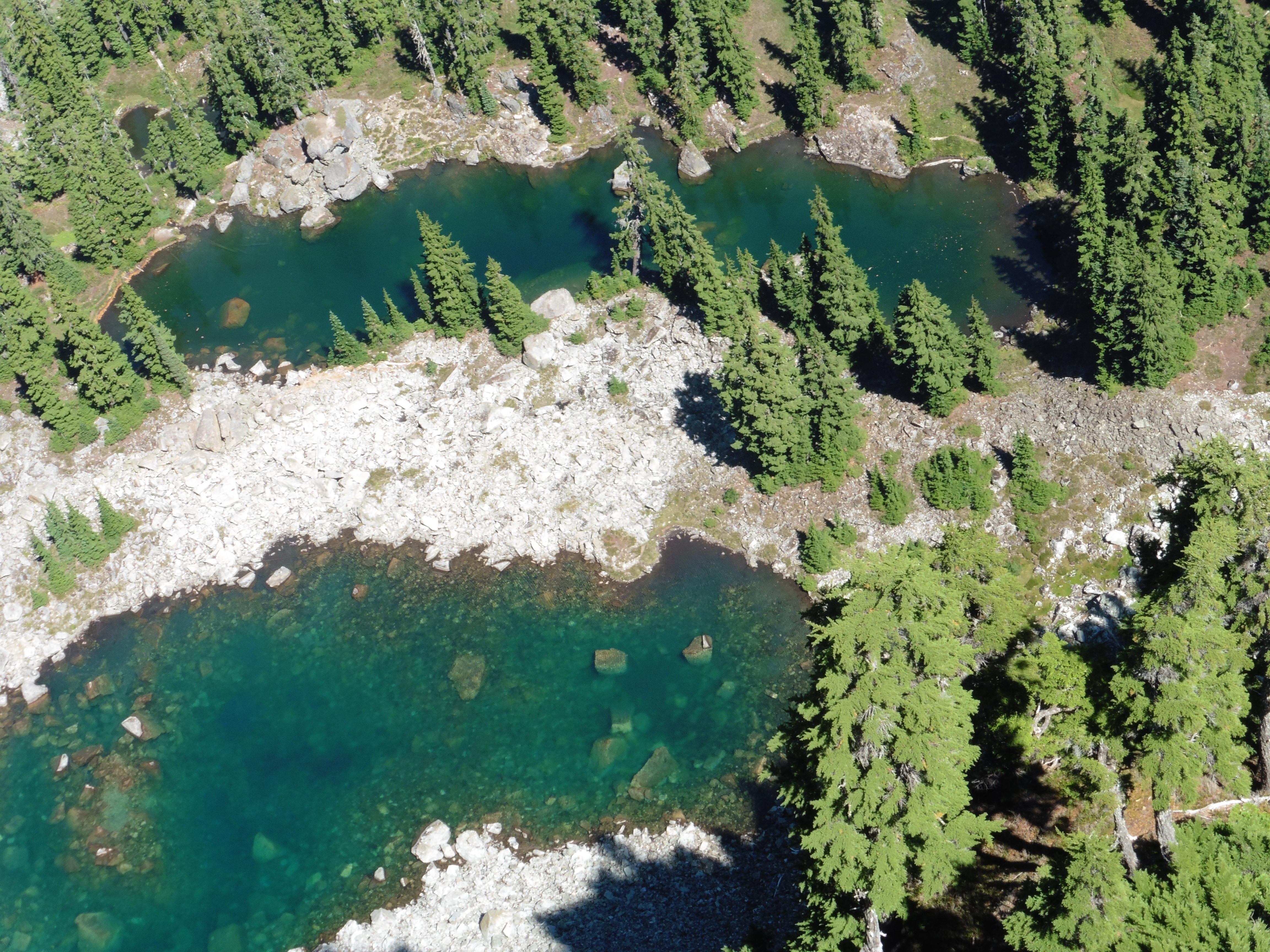 Midnight Lakes. |
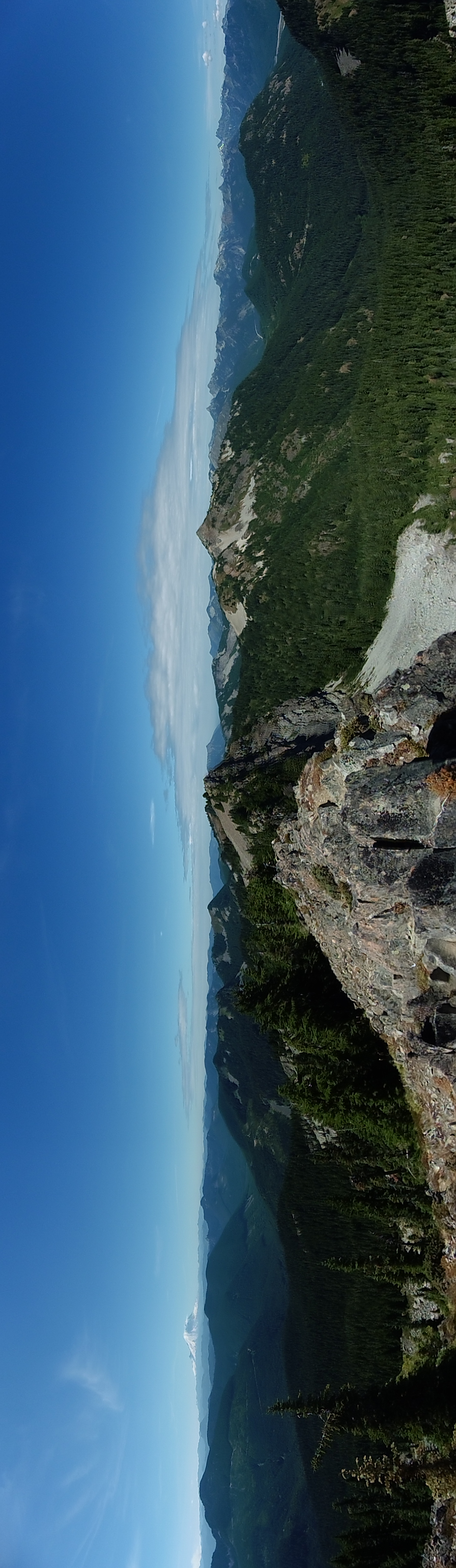 Panorama of the Cascades (around to the West). |
 Made it to the top! |
|
|
|
 Midnight Lakes. |
 Climbing down from the peak. |
 Meadow at the base of the peak. |
 Marmot! |
 Midnight Lake. |
 Playing around. |
 Midnight Lake. |
 More S'mores! |
 Camp. |
 Mist in the trees. |
 Morning on the lake. |
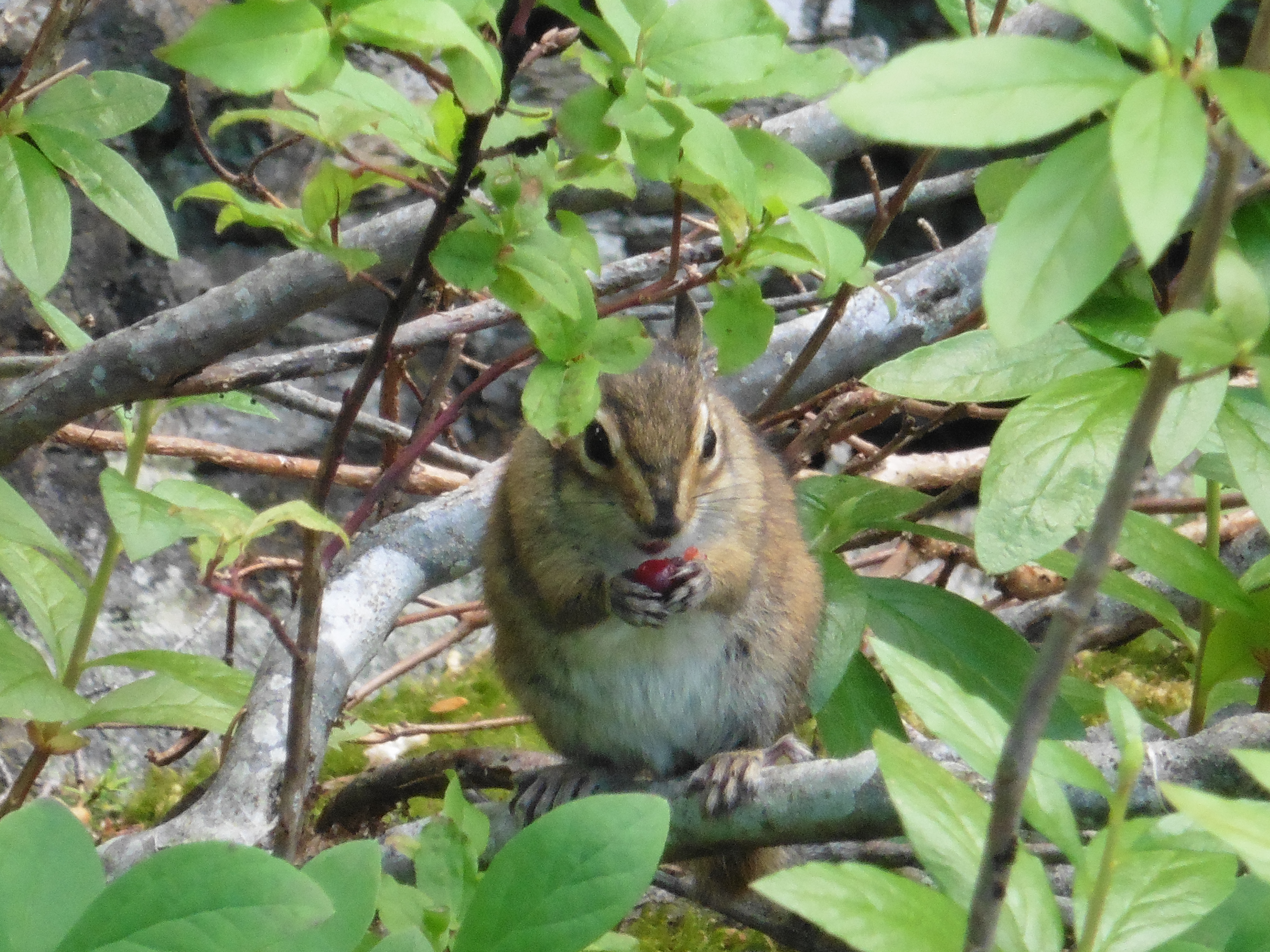 Chipmunk eating a berry in a bush near Coffee Rock. |
 Tree broken by a storm. |
 These trees are pretty big... |
 Fire weed shows that summer is almost over. |
 We made it back! |